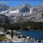
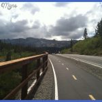
In Mammoth you can take a historic walk, the Lower Terrace walk (both described below), or other short trails for hiking or biking. 0 Behind and to the north of the hotel is the start of the Old Gardiner Road or High Road (about 4 mi/6 km long), which can only be traveled from south to north by cars (from Mammoth to Gardiner). You can bicycle either way, but you’ll avoid the long uphill grade if you start at Mammoth. Beaver Ponds You can start the Beaver Ponds Loop Trail at the same point as the Old Gardiner Road. A slightly steeper way to begin the loop is at Clematis Creek (it’s named for a flowering vine and pronounced KLEM-a-tus or klem-A-tus). Clematis Creek is located between Liberty Cap and the U.S. Commissioner’s stone house. Although billed by the Park Service and several hiking books as a 5-mile (8 km) trail, to complete a loop from any point in Mammoth to Beaver Ponds requires a walk of at least 6 miles (9.5 km). The long-range views, birds, wildflowers, and the ponds themselves are delightfully worth the effort, as are the contrasts that you pass between the high desert and the moist forest microclimates.
Beaver (Castor canadensis) are most active from dusk to dawn, so you’re unlikely to see them in daytime, but you can see a dam they’ve built between the ponds. Incidentally, a 1996 parkwide aerial survey found about 50 active beaver lodges in the entire park. Another trail reached from Clematis Creek is the Howard Eaton Trail to the upper terraces and beyond, accessed by crossing the creek before the Beaver Ponds Trail becomes steep. This trail segment leads you to Narrow Gauge Terrace (described on 270). A recommended part of this trail is described on 276.
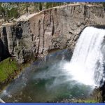
Hiking and biking around Mammoth Photo Gallery
Maybe You Like Them Too
- The Best Cities To Visit in The World
- World’s 10 Best Places To Visit
- Coolest Countries in the World to Visit
- Travel to Santorini, Greece
- Map of Barbados – Holiday in Barbados

