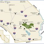
JOSHUA TREE NATIONAL MONUMENT MAP CALIFORNIA
558,000 acres. Located east of San Bernardino National
Forest in southern California’s Mojave and Colorado deserts, this large National Monument includes rugged mountains almost 6,000 feet high, canyons, rock formations, and massive boulders.
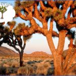
Some 467,000 acres consist of designated wilderness. There are many stands of Joshua trees in the Monument, along with cactus and other desert vegetation, plus palms at several oases. Bighorn sheep, coyote, and bobcat are among the wildlife.
Activities: Over 50 miles of trails are available for hiking, backpacking, and horseback riding, including 35 miles of the California Riding and Hiking Trail.
Cross-country travel is also possible, although horses must stay on trails or in washes. Rock climbing is a popular activity here. Mountain bike use is limited to roads. Hunting is prohibited.
Camping Regulations: Camping is allowed throughout a large portion of the National Monument, but it’s not permitted in several sizable day use areas. Before entering it’s necessary to register at one of 12 backcountry boards at entry points.
Campsites must be at least 500 feet from trails, one-quarter mile from water sources, and one mile from roads. Washes (dry streams or river beds) should be avoided for camping. Fires are prohibited, so a stove should be brought if one wishes to cook.
Water must be carried in. Since summer heat can be intense, fall through spring are the best times to visit this National Monument. Pets are not permitted in the backcountry.
For Further Information: Joshua Tree National Monument, 74485 National Monument Drive, Twentynine Palms, CA 92277; (619)367-7511.
JOSHUA TREE NATIONAL MONUMENT MAP CALIFORNIA Photo Gallery
Maybe You Like Them Too
- Explore Les Accates, France with this Detailed Map
- Explore Góra Kalwaria, Poland with this detailed map
- Explore Gumdag, Turkmenistan with this detailed map
- Explore Telfes im Stubai, Austria with this detailed map
- Explore Langenselbold, Germany with this detailed map

