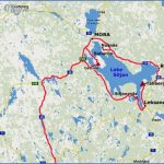
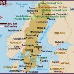
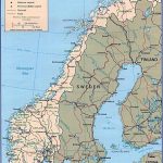
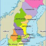
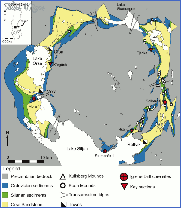
Lake Siljan, enclosed by gently rising hills with large areas of forest, lies in the heart of Dalarna (Dalecar-lia), with the Osterdalalv flowing in one end and out the other. 36 km (22 miles) long and 25 km (15 miles)
Mora girls in traditional costume wide, it has an area of 290 sq. km (110 sq. miles) and a greatest depth of 120 m (390 ft). In the NW part of the lake is the island of Solleron. The maximum depth of 120 m (390 ft) is reached in a curious channel which runs from Mora to Leksand; the rest of the lake has an average depth of only 60 m (195 ft). Lake Siljan, which has been artificially regulated since 1926, is renowned for its scenic beauty, which attracts large numbers of visitors (excursions, cruises and excellent boating on the lake). Mora (Mora Hotell, 120 Siljan, 100 b.), where the Osterdalalv flows into the NWend ofthe lake, is a small market town which attracts visitors in both summerand winter. The 1 3th c. church has a separate tower (1672); it is the distinguishing landmark of Mora. The town has associations with two very different characters
Gustavus Vasa and the artist, Anders Zorn. Gustavus Vasa, founder of the Swedish state, sought refuge in the town in 1520 and called upon the men of Dalarna to rise against Danish rule. He is commemorated by the Vasa Run, the longest cross-country ski race in the world, which is held on the first Sunday in March every year and ends at Mora. On the hill of Kiocksgropsbacken is a statue of Gustavus Vasa by Anders Zorn (1860-1920), Mora’s most famous son. The Zorn Collections, presented to the town by Anders and Emma Zorn, comprise the Zorn Museum, ZorngSrden, Zorns GammelgSrd and Gopsmor, the painter’s studio (open July and August). The Zorn Museum contains a selection of Zorn’s own work (watercolours, oils, sculpture, graphic’ art). In the same grounds is Zorn’s own house, ZorngSrden, furnished in the style of the turn of the 19th c. Zorns GammelgSrd, on the outskirts of the town, gives a comprehensive view of the old popular culture of Mora and the surrounding district: it is an open-air museum of 40 old farmhouses and cottages through which the development of the local style of timber architecture can be seen.
An attractive trip, within easy reach of Mora, is to the top of the Gesunda Berg (501 m (1 644 ft); cableway, superb panoramic views). While in the hills, it is well worthwhile to visit some ofthe old summer farmsteads (though many of these are no longer used as such but have become vacation homes). An unusual museum is the Siljanfors Forest Museum, on the road to Malung (1 7 km 1 0 miles). Other places of interest are Vamhus, where the old craft of basketwork is demonstrated; Oxberg, with a picturesque wooden chapel; an old water-mill on the Axi; and Nusnas, where visitors can see the traditional little orange-red wooden horses (the symbol of Dalarna) being made. To the N of Mora is Lake Orsa (alt. 1 61 m (528 ft), greatest depth 97 m 320 ft), with the village of Orsa at the N end. 35 km (22 miles) NE of Orsa, on Lake Skattung, is the little tourist resort of Furudal (Strandudden Hotel, 28 b.), frequented in summer by anglers and in winter by skiers (ski-tow). The church (c. 1870) contains medieval wood-carving. At Norboda, 15 km (10 miles) SE of Furudal, are more than 30 old log houses.
Rattvik (LustigsgSrden Hotel, 41 Lerdalshojden, 130 Nya Hotel Pers-borg, 72 b.), on the NE shore of the lake between Leksand and Mora, is the chief town in a commune to which Vikarbyn, Boda, Furudal and Bingsbo also belong. A tourist resort, it offers year-round attractions. On a promontory, reaching out into the lake, is the 13th c. church (rebuilt in 1 8th c.). Around the church are some 90 huts, some of them dating from the 17th they provided overnight accommodation for members of the congregation, and for their horses, coming from far away. On the S side of the church is the Vasa Stone, erected in 1 893 to commemorate Gustavus Vasa’s first address to the men of Dalarna in 1 520 on the precinct wall of the church. Located in a park (which also includes a vacation village and a heated swimming pool), is Rattviks Gammelgcird, with a display of old tools and implements, household goods and costumes. In Gudmunds Slojd visitors can see the little horses of Dalarna being made, particularly the grey horses which are a specialty of Rattvik.
The making of pottery can be watched in the Nittsjo factory. In the church school is a natural history museum (local geology, plant and animal life). From the Tolvasberg and the Vidablick lookout tower (325 m 1066 ft), there are magnificent views of Lake Siljan.
Leksand (Tre Kullor Hotell, 70 Tap-pan, 70 MasesgSrden, 38 b.), on the Osterdalaiv, is the main town of the commune of that name, to which more than 90small villages and hamlets belong. The church dates from the early 1 3th its onion-domed tower was added in the 18th c. The interior is predominantly Baroque (fine 14th c. crucifix). The Hembygsgcird is a local museum, with a varied collection. The Tinghus contains a collection of pictures by local artists. Every year, during the first week in July, groups of fiddlers in traditional costume can be seen all over Leksand, and indeed, throughout the commune, during the Lake Siljan musical festival, Musik vid Siljan.
Sammilsdal is the hub of the local midsummer celebrations, and in the second half of July a mystery play similar to Everyman, the Himlaspel, is performed here. In winter, large numbers of winter sports enthusiasts come to Leksand, which has an ice-rink and a cableway up the Asledsberg (437 m 1390 ft).
Matsg&rden, in Ostbjorga, and Skraddar-garden, in Stumsnas, are well-preserved wooden farmhouses with collections of the folk paintings for which the area is famous (Dalmalingar). The main event in the summer is the Lake Siljan musical festival, Musik vid Siljan (July), which proves the old saying that when two Rattvik men meet, three of them play the fiddle. Another sight worth seeing is the church boats, in which the local people, often wearing
Lake Siljan, near Rattvik traditional costume, row to church for high mass between midsummer and August.
SE of Lake Siljan is the hilly mining and smelting region of Bergslagen. The local mines yield iron ore and some copper (Falun), the largest output of the Grangesberg Exportfalt. In the vicinity of the Bergslagen mines are a series of ironworks at Borlange, Fagersta, Domnarvet, Avesta, Uddeholm, Degerfors, etc.
Lake Siljan Sweden Map Photo Gallery
Maybe You Like Them Too
- The Best Cities To Visit in The World
- World’s 10 Best Places To Visit
- Coolest Countries in the World to Visit
- Travel to Santorini, Greece
- Map of Barbados – Holiday in Barbados

