Governor’s beach
Pentakomo, comprised five settlements (pente=five, komi=village) which, at one time merged or disappeared to form the Pentakomo of today. The Pentakomo coastline, from the monastery of Agios Georgios Alamanos to Governor’s Beach, is unspoilt, while the coasts themselves have been subjected to such erosion that curious but interesting features have arisen, such as caves, arches, stacks and islands. One such remnant, known by the name “Karavopetra”, has been identified with the Arab incursions on the island. According to tradition, it was here that the corsairs moored their ships before looting and ransacking the land. On a narrow coastal area, to the west of the village of Mari, stretches a picturesque beach, which is known by the name of Governor’s Beach. This rocky and sandy beach, stretching for about one kilometre, has become, particularly after the Turkish invasion of 1974, a popular spot for bathers, campers and summer vacations. Following a decision by the Council of Ministers in 1989, an organised and planned camping site was established and set into operation at Governor’s Beach. Today, the area features all necessary amenities and comforts. The area covers about 13 ha of land and, in 1991, an athletics field, a tourist beach and other amenities began operation. A biological waste processing plant was also established. There are 358 camping lots, 111 for caravans and the remaining 247 for tents. Provisions also include parking spaces, public utilities, lavatories and washbasins, refreshment stands, a grocery, children’s play areas, open-air showers, garbage disposal units, paved pathways and benches. At a distance of about a kilometre west of Governor’s Beach, the force of the waves has broken the rocks, especially at weak points, and has led to the creation of various geomorphologic features.
LOWLANDS WEST OF LIMASSOL
a) Following the Limassol-Pafos highway and the old Limassol-Pafos road.
Route: Pano Polemidia, Ypsonas, Kolossi castle, The chapel of
Agios Efstathios, Erimi
What one can see at Pano Polemidia today is the dam, of 4 million cubic metres capacity, close to the old British military camp. The military camp acted as a concentration camp and as a training camp for volunteer soldiers during the second world war. One can also see the impressive four-storeyed building of the hospital of Limassol. The monastery of the Carmelites, of the 14th century, does not exist any more, though the church of the Order is there to receive a great number of visitors. It is a single-aisled rectangular church without frescoes. The holy well is close by, while the shrubs that surround it are covered with fragments of clothing, draped there, particularly by those who come to be cured of diseases. The church of Agia Anastasia, between Pano and Kato Polemidia is a beautiful Byzantine building of the 14th century with two domes in a cruciform design. Originally the church was covered with frescoes, though currently the best is that of the Deposition with a person standing at the foot of the cross, trying with a pair of pincers to pull out the nails which hold the Lord’s feet to the cross.
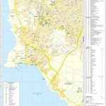
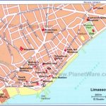
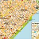
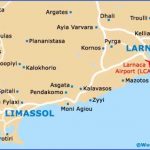
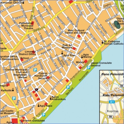
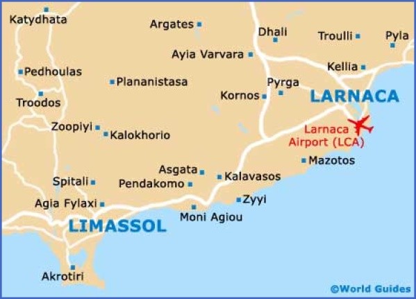
Road Map of Limassol (in english)
Church of Carmelites, Pano Polemidia
Very often Ypsonas is called a colony of Lofou, a vine-growing village in the hilly area of Limassol. The farmers of Lofou, exercising transhumance, used to move to Ypsonas during the winter months in order to sow their fields, while in summer time they stayed at Lofou to look after the vineyards. The Kolossi Castle, in the middle of the fertile Limassol plain, where sugar-cane and cotton were cultivated in medieval times, stands next to a gigantic cypress-tree and a native to Cyprus tree, known as machaerium. The walls of the castle, built with hewn limestone blocks, have a three-metre thickness, while the few windows, the coat of arms, the doors, the skylights, the balcony and the battlements form the exterior appearance of the building. Internally the castle is divided into three storeys. The lowest floor with the arched roofs was used for storage purposes. The well-cistern was also here. The first floor consists of two large rooms, used as kitchen and dining room. The entrance was defended by a drawbridge. To the right of this door is a large painting of the Crucifixion. The second floor also consists of two large rooms with two fire-places, both of them, decorated with the badge of Louis de Magnac. In these rooms lived the Grand Master of the castle. Next to the windows of this storey as well as of the first storey there are window seats. A circular staircase leads to the roof from where an extensive view can be enjoyed. Surrounding the castle were the houses of other noblemen as well as the vaulted barn of the knights. Close by are traces of the sugar mill where sugar cane was ground, while the aqueduct which supplied water for the working of the mill is still present, east of the castle. Most probably the castle was erected in the 14th century, though the middle of the 15th century is also mentioned as a probable date. What is certain is that the Knights of St. John arrived in Cyprus soon after the Latin occupation of Cyprus and in 1210 they were given the feud of Kolossi by King Hugh I. The Order, known as a Grand Commandery, owned vast properties in Cyprus, with Kolossi as the headquarters. The well known sweet wine of Cyprus (commandaria) got its name from the Grand Commandery of the Knights. It is also said that it is the knights who introduced beccoficos, the little birds caught on lime twigs and packed in jars filled with vinegar. Most probably the export of these birds commenced in those years. At the beginning of the 16th century, with the consent of the Order, the area of Kolossi was transferred to the family of Cornaro, though with the conquest of Cyprus by the Turks the family lost its rights on this vast property. Needless to say that Louis de Magnac was succeeded as Grand Commander by an Englishman, John Langstrother, before Kolossi passed into the possession of the Cornaro family.
Kolossi tower
Kolossi stores
Close to the imposing castle of Kolossi, and only a few metres away from the aqueduct, stands the Chapel of Agios Efstathios. The three-aisled chapel, of the 15th century, has some preserved frescoes, though the majority have been worn out. On the old iconostasis stand four portable icons, one of which portrays the Madonna, dating back to 1864. Most probably the chapel with its Byzantine architecture, dominant in the 15th century, served the knights, as the coat of arms of Louis de Magnac is still visible. The present-day as well as the prehistoric settlement of Erimi are closely associated with the river Kouris. In the Middle Ages Erimi, according to Mas Latrie, belonged to the Grand Commandery. Besides, the two churches, namely those of Panagia and Agios Georgios, are medieval, irrespective of the fact that the latter had been totally destroyed and recently restored. The church of Panagia is a fifteenth century building of cruciform style with worn out frescoes. The interior was once completely covered with mural paintings. The Chalcolithic settlement of Erimi, between the Stone and the Bronze Age, constitutes a landmark in Cypriot archaeology. The visitor cannot observe the circular huts, as they are covered with soil. In a tomb, close to the settlement, a bronze chisel has been found for first time, an indication of the revolutionary period inaugurated with the Bronze Age period. The Chalcolithic period is, however, significant as far as the decoration of pottery is concerned. Some findings, like pottery and steatite idols, are superior to those unearthed in the true neolithic settlements.
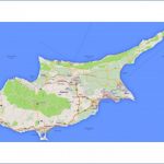
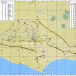
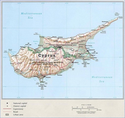
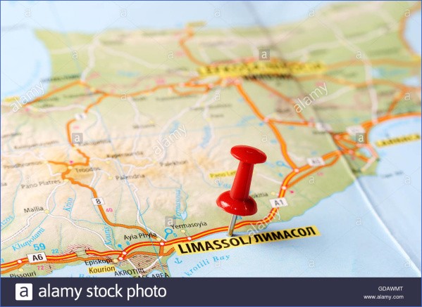
Limassol Road Map – Detailed Road Map of Limassol Photo Gallery
b) Exploring the peninsula of Limassol
Route: Tserkezoi, Trachoni, Asomatos, Akrotiri, Akrotiri lake,
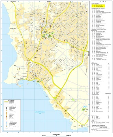
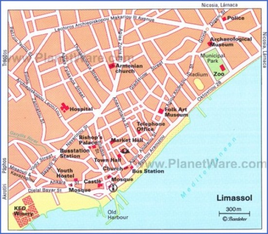
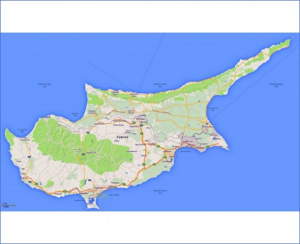
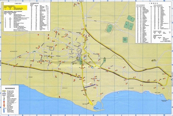
Large Limassol Maps for Free Download and Print
Agios Nikolaos of the Cats Monastery
Travelling under the arches of cypress trees in Tserkezoi village is always pleasant and rewarding. The village obtained its name from Cherkesy or Circassians who settled in the village in 1864, when Cyprus was occupied by the Turks. Probably the only trace of the passage of Circassians from this village is the cemetery close to the Lanitis farm. Trachoni belonged originally (13th century) to the Knights Templar, while a century later it belonged to the Knights of St. John of Jerusalem. The medieval chapel of Panagia (B.V.M.) and the church of Agios Mamas, a building of 1792, have been restored. The visitor to Asomatos travels under the arches of the cypress-trees. Fasouri, a well-known huge property west of Asomatos, falls partly within the administrative boundaries of the village. The Salt Lake of Limassol constitutes the southern boundary of Asomatos. About three packing and processing plants are installed in the village, dealing with fruit-juices and marmelades. A visit to Akrotiri could include the pebble beach, west of the village, the small forest, the Lake, the Lady’s Mile, the swampy area and the “merra” as well as the area where the British base lies. The salt lake of Akrotiri fills with sea water only in winter and spring months and constitutes a beautiful and almost unique wetland attracting migratory birds from North European countries. West of the lake extends a smaller wetland, close to the “merra” (communal grazing land) where the migratory birds are numerous. The forest, west and south of the settlement, close to salt-loving plants, though not dense, preserves its peculiarity. Furthermore, close by are the Monastery of Agios Nikolaos of the Cats, a modern fishery which uses sea-water and the archaeological sites of Akrotiri and “Aetokremmos”, where remnants of ancient fauna, mainly hippopotamus, have been found.
At Aetokremmos, on the coastal cliffs of the Akrotiri RAF base, pygmy hippos and pygmy elephants are found with bird and snake bones, numerous marine shells and, for the first time, manmade stone tools and stone and shell ornaments. Life in the site goes back to 8500 BC, that is 1000 years earlier than life in Choirokoitia and Kalavasos – Tenta. Thus, there is at Aetokremmos the oldest archaeological site on the island. The lake of Akrotiri presents a rare geomorphological phenomenon. Between the capes Zevgari and Gata there was a tiny isle, while the coast extended north of the present lake. From the mouths of Kouris, to the west, and Garyllis, in the east, pebbles and sands were deposited which gradually extended further south and joined the little isle. Gradually more deposits were carried by the rivers while the present lake remained a hollow, which fills with sea water in the winter months but dries up in summer because of evaporation. The present bed of the lake is 2,5m below sea-level. The phenomenon is known as tombolo or in the case of Akrotiri, as double tombolo. Studying the medieval maps, one can see a break east of the peninsula, in present-day Lady’s Mile, which is due to a small canal opened by the Venetians to establish a fishery in the area. The wetland of Akrotiri hosts a great number of birds, mainly ducks and flamingoes. Besides, a great number of cranes, grebes, herons and other migratory birds visit the wetland during winter months. About three km east of Akrotiri settlement lies the interesting Monastery of Agios Nikolaos of the Cats. Until a few years ago only the church was standing on the site surrounded by marble pillars and capitals, crosses and hewn limestone blocks, all relics of ancient monastery buildings. The restoration of the old monastery was undertaken by the Bishopric of Limassol. Perpendicular to the western edge of the arched church of Agios Nikolaos a series of cells, built in traditional style, has been added together with an impressive verandah. Above the eastern door of the church there are five coats of arms, four of which are in a very good condition. The walls of the church are very thick, while traces of frescoes are visible. The iconostasis is very simple with a very old portable icon of Agios Nikolaos. The sanctum is linked at its western end with an arched room. It is, however, the history, the thrill and the tradition of the monastery that fascinate. According to tradition, the monastery was built by Agia Eleni, mother of Agios Konstantinos. Even wood from the True Cross was left at the monastery as thanksgiving to God who saved the queen mother from serious sea storms. Machairas mentions that Cyprus experienced a severe drought for 30 years, as a result of which all wells dried up, with the population leaving the island. Snakes multiplied and life in Cyprus, particularly at Akrotiri peninsula, was unbearable. Kalokeros, the commissioner of Cyprus, in the 4th century A.D., secured as many as a thousand cats which were entrusted with the duty of exterminating the snakes. Currently, there are no more cats and snakes, though the cape, southeast of the monastery, has already been immortalised with the name “Cape Gata” (Cape of Cats). The monastery was restored by Bishop Makarios (1750-1776) and was staffed by monks. However, it is not well known when it was again abandoned. At the moment a very small number of nuns look after the monastery.
Under the arches of cypress-trees, Tserkezoi
c) Kourio and the surrounding archaeological areas
Route: Episkopi, Kourio, Kourio beach, the Stadium of Kourio, the Sanctuary of Apollo
Episkopi, the successor settlement of ancient Kourio, stands on a rise with a fertile plain stretching to the south. The land of Episkopi changed uses in the last few centuries, growing sugar-cane which was later replaced by cotton, while currently the fertile soils produce citrus, vegetables, table-grapes and cereals. Mas Latrie and other travellers, like
Kapolitista, mention the sugar-cane of Episkopi. In Episkopi there is a number of historical and archaeological sites: The settlement of Faneromeni, to the south-east, belongs to the Middle Bronze Age, while the necropolis of Faneromeni, to the southeast, dates back to the end of the Early Bronze Age. The walled settlement depended upon agriculture and animal raising, often reinforced by hunting and limited fishing. Pamboula settlement on the top and the slopes of the rise to the east, belonged to the Early Bronze Age. A few of the findings are exhibited in the Archaeological Museum at Episkopi.
The necropolis of Kaloriziki is the largest unearthed necropolis in the area of Kourio so far. In a tomb, dating back to the 12th century B.C., the well-known Mycenean golden sceptre of Kourio was found. The necropolis of Agios Ermogenis, to the south-west, hosts a great number of tombs. In the chapel lies the tomb of Saint Ermogenis, Recent excavations near the chapel brought to light a burial monument which probably was a royal tomb. Serai or Seragia is the site south of Episkopi where relics of a medieval built-up complex lie. Two arched rooms, the relics of a church and a store house have been preserved. Most probably the church dates back to the 7th c. A.D. In the large store house hundreds of clay conical pots were found, used mainly for the processing of sugar. Samples of these pots can be seen in the nearby museum. In 1992, a cistern has been found with plastered walls inside, used mainly for the distillation of sugar. Ditches, through which water was transported, have also been unearthed. Furthermore, the clay conical pots and other pots with flat bases have been found. The Museum of Kourio, at Episkopi, housed in a traditional two-storeyed building with a paved courtyard, originally destined as a private house of archaeologist McFadden, consists of two rooms. In the first room marble statues, tombstones, terra cottas, amphorae, decorated pottery, etc are exhibited. Most of the findings from Kourio, Kaloriziki and Agios Ermogenis, date back to the Cypro-geometric period up to the Roman era and the first Christian centuries. In the second room findings from Faneromeni, Pamboula, the Sanctuary of Apollo and the tombs of present day Episkopi are exhibited. The visitor can see in the room pots and golden jewels of the Mycenean era, red-polished pots of the Bronze Age and a large number of offerings from the Sanctuary of Apollo.
From all ancient kingdoms of Cyprus, Kourio is probably situated on the most conspicuous topographic position. It is built on a rise, about 60m high, with three steep, almost vertical, sides. The area around Kourio must have been inhabited quite early. Close by is the neolithic settlement of Sotira, while by the river Kouris, dwellings of the Early Bronze age have been unearthed. Herodotus refers to the tradition that Kourio was founded by Greeks from Argos, in Peloponnisos. It appears that during the Hellenistic and Roman periods Kourio was still an important center, while during the 4th century A.D. it was destroyed by earthquakes. It was also seriously affected by the Arab raids of the 7th century A.D. After all these raids the bishopric of Kourio was transferred to Episkopi. The excavations of the last decades help us to understand, to a certain extent, the functions of the ancient city of Kourio. Bearing in mind the new entrance to the site of Kourio at the south-eastern end of the Kourio cliff, the following tour is recommended to the visitor.
Maybe You Like Them Too
- Top 10 Islands You Can Buy
- Top 10 Underrated Asian Cities 2023
- Top 10 Reasons Upsizing Will Be a Huge Travel Trend
- Top 10 Scuba Diving Destinations
- World’s 10 Best Places To Visit

