To drive to Yellowstone Park from Livingston, take U.S. Highway 89 from the center of Livingston or from Interstate 90 just south of town. In about 3 miles (5 km), you pass through Rock Canyon, which has been cut by the Yellowstone River and is sometimes called Gate of the Mountains. At the southern end of the canyon, look to the northwest to see cliffs with numerous layers of sedimentary rocks that tilt rather sharply. These roughly 400-million-year-old rocks are tilted because of deformation in this area at about the time of the major uplift that produced the Beartooth Range; the roadside exposures only hint at how complicated the deformation is. Soon after the completion of a road rebuilding project in the 1960s, blocks of this hillside slipped in a massive landslide that covered the road.
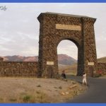
Nineteenth-century explorers dubbed this the First Canyon of the Yellowstone River. Farther upstream, explorers found three other canyons cut by the Yellowstone, each more spectacular than the one before. Second Canyon, located about 15 miles (24 km) north of the North Entrance, is now called Yankee Jim Canyon. Inside the park boundaries are Third, or Black Canyon, east of Gardiner (reached only by trail) and Fourth Canyon, the Grand Canyon of the Yellowstone. Paradise Valley, so called since at least the 1880s, spreads out before you just as you emerge from the canyon. On your left (to the east) is a part of the Beartooth Range that’s sometimes called the Snowy Mountains. The highest peak visible from the valley is Emigrant Peak (10,921 ft/3329 m). To the west is the more rounded eastern edge of the Gallatin Range. Irrigation now helps Approach to the North Entrance overcome the low annual rainfall, making the valley hospitable to farming. Ten or twelve miles (16-19 km) from Livingston, near Mill Creek, you begin to see effects of glaciers during the last ice age (the Pinedale), which was at its height about 25,000 years ago. Some areas are covered with large boulders dragged there by the glaciers, and a long terminal moraine appears to the east of the highway just south of Emigrant.
This terminal moraine, the endpoint of a major Yellowstone glacier in Paradise Valley, is a mound of unsorted rocks and soil left when the glacier dropped them, much as a conveyor belt would do. The small settlement of Emigrant is about 23 miles (37 km) south of Livingston; at the stoplight a road leads eastward to the tiny town of Pray and to Chico Hot Springs. Chico, settled beginning in 1864, has a resort hotel established in 1900 that was sometimes used as a clinic in its first 50 years. You might enjoy a plunge in one of Chico’s two public pools supplied with natural hot spring water or a meal in their gourmet restaurant. Near Chico, at the mouth of Emigrant Gulch, the optimistically named Yellowstone City had 300 settlers in 1864 and could claim the title of easternmost town in Montana Territory. The settlers had all come as gold seekers, but the gold strike here petered out, and most of the men moved on. It may seem strange that Yellowstone City could have been the easternmost town, but Montana Territory was settled from west to east, unlike most parts of the U.S. The mining prospectors, who were the first white settlers, could most easily reach Montana’s mineral-rich mountains from the southwest. Mentioned frequently in histories of Yellowstone was the ranch settled in 1868 by the Bottler brothers and located about 3 miles (5 km) south of the present site of Emigrant. Sometimes travelers wrote of its cabin, built so poorly that the wind blew through it. Yet many others found it to be a welcome way station for food and company. England’s Earl of Dunraven came through in 1874 and reported from his camping spot: evening was drawing on apace, and the scenery was being glorified with sunset effects.
The level rays of the sun lit up most brilliantly the Eastern Mountains, striking full upon the sharp angular masses of limestone, bringing out in bold relief against the sky background the cruel jaggedness of their forms, which contrasted strongly with the smooth softness of the plain beneath, penetrating and searching into the deep rifts and gorges, and defining in detail all the savage grandeur of the range. Emigrant Peak is a prominent landmark in Paradise Valley. About 7 miles (11 km) south of Emigrant, near a wide spot in the river, you’ll find a welcome picnic and rest area. The long mesa to the east, Hepburn Mesa, is made up mostly of sediments, but it has a lava cap that has slowed erosion of the sediments below. As you continue south, jagged formations to the west, called Point of Rocks, appear. You can take a century-old, rough dirt road from here southwest into the Tom Miner Basin, named for an early prospector and poacher. This scenic basin has ranches, a forest service campground, and trails into the Gallatin Range.
Map Livingston to the North Entrance Photo Gallery
Maybe You Like Them Too
- The Best Cities To Visit in The World
- World’s 10 Best Places To Visit
- Coolest Countries in the World to Visit
- Travel to Santorini, Greece
- Map of Barbados – Holiday in Barbados

