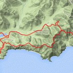
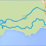
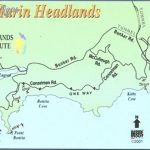
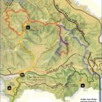
What’s Best: The ingredients for a full day: Open highlands with grand Pacific views, a big beach, a placid lagoon, and nonprofit centers featuring art, history and conservation. The kicker is an amazing walk to Point Bonita Lighthouse.
MARIN HEADLANDS MAP SAN FRANCISCO Photo Gallery
Parking:From 101 north, take the last exit, toward Sausalito after coming down the grade from the tunnel. Turn right at first stop sign on Alexander Ave. and follow road around under freeway. Turn left on Bunker Rd, go through light-metered tunnel and continue about 3 ml, veering right as you approach the coast. Park at Rodeo Beach, next to Fort Cronkhite. From 101 South, take the Alexander exit toward Sausalito just after crossing the Golden Gate Bridge and follow directions above. Agency: Golden Gate National Recreation Area
View from Conzelman Road
Hike: Rodeo Beach (up to 1 ml.); Rodeo Lagoon loop (1 ml.); Battery Townsley loop (1.25 ml.); Wolf Ridge loop (5 ml.); Point Bonita Lighthouse (1mi.)
Rodeo Beach is a .5-mile long, wide swath of sand, set between the bluffs of Tennessee Point on the north and Bird Island, just offshore, to the south. A valley spreads inland, beginning with a large lagoon. Be Aware: Unsafe to swim due to riptides.
A trail encircles Rodeo Lagoon. Some of the lagoon’s many shorebirds are endangered species. From the Rodeo Beach parking, head toward the lagoon and go left, away from the beach. You’ll cross the bridge and then head toward the beach on the south side of the lagoon, below the visitors center; you can also access this trail from the center. Half of the trail is near the road and the other half contours above water. More Stuff: Another option for this hike is to begin at Battery Alexander, which is just up the hill from the visitors center on Field Road. A trail with great views leads down to the least-peopled part of the lagoon. From Battery Alexander you will also find the South Rodeo Beach Trail, a short walk to the cove just south of the main beach.
The Battery Townsley loop takes you for a bird’s-eye view of the Headlands and a good look at the Farallones offshore. Begin at the parking at the far west end of Bunker Road, near Fort Cronkhite. Starting as pavement, the Coastal Trail climbs about 200 feet to the old defense bunker. Either retrace your steps down, or come down Old Bunker Road, which drops down behind Fort Cronkhite.
Maybe You Like Them Too
- Arnold A Town with a Heart
- Map of New York City – New York City Guide And Statistics
- Map of San Francisco – San Francisco Map Free
- Coolest Countries in the World to Visit
- The 10 Best American National Parks to Visit


