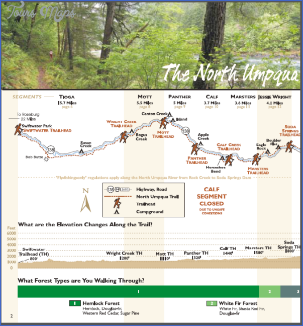
NORTH UMPQUA TRAIL MAP OREGON
This new trail, which is currently under construction, follows alongside or near the beautiful North Umpqua River in southwest Oregon. When completed it will be about 77 miles long. Much of the trail is now open.
It stays mainly within Umpqua National Forest, but there’s also a section on BLM lands. The trail traverses two designated wilderness areas, the Boulder Creek Wilderness and the Mount Thielsen Wilderness, and intersects with the Pacific Crest Trail.
It’s open to horseback riding, and mountain biking is allowed outside of the two wilderness areas. Difficulty is easy to moderate, and there are a couple of steep stretches of trail.
Camping Regulations: Camping is allowed along the trail, as are campfires, except where posted otherwise. Campers should set up well off the trail and away from the river, and avoid meadows.
For Further Information: Umpqua National Forest, P.O. Box 1008, Roseburg, OR 97470; (503)672-6601.
NORTH UMPQUA TRAIL MAP OREGON Photo Gallery
Maybe You Like Them Too
- Arnold A Town with a Heart
- The Best Cities To Visit in The World
- World’s 10 Best Places To Visit
- Map of New York City – New York City Guide And Statistics
- Map of San Francisco – San Francisco Map Free

