Province: Kalmar Ian.
Area: 1 346 sq. km (525 sq. miles).
Population: 23,000.
Postal code: S-380 … Telephone code: 0485.
Borgholms Turistbyra,
Box 115,
S-38070 Borgholm; tel. 1 23 40.
Boda Turistbyra,
S-38074 Lottorp; tel. 2 23 60 (June-August only).
Farjestadens Turistbyra,
S-38060 Farjestaden; tel. 3 02 60 and 3 01 75 (May-September only).
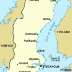
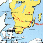
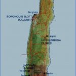
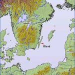
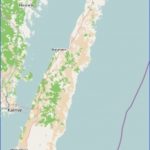
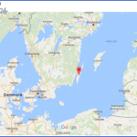
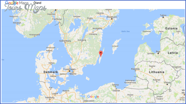
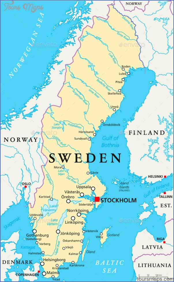
Oland, lying off the SE coast of Sweden and separated from it by the Kalmarsund, is Sweden’s second largest island, with two rural communes and one town, Borgholm. The scenery and vegetation of the island are very different from those of the adjoining mainland. Since the island is no more than 16 km (10 miles) across at its widest point, there is always a light sea-breeze blowing. The strangest part of Oland is the desolate Alvar steppe country, where the limestone rock is exposed or covered only by a thin layer of earth.
The Stora Alvar extends from Vickleby to Ottenby, covering an area 40 km (25 miles) long by 1 0 km (6 miles) wide a treeless limestone steppe made up of bare rock, karstic formations, grassy heathland and expanses of flat bog. This southern part of Oland, however, also contains the most fertile arable land on the island (e.g. around Morbylcinga). The landscape pattern of central Oland, between Borgholm and Farjestaden, is different, with deciduous and coniferous forest predominating along the Kalmarsund and a broad swath of hazel scrub and flower-spangled wooded meadowland in the interior. Northern Oland has a rocky W coast, a series of alternating promontories and low-lying inlets on the E coast; between are meadowland and some steppe country, with clumps of junipers; and on the higher ground in the Boda area, coniferous forest extends from coast to coast. Oland has a long history of human habitation. Among its most striking remains of the past are the cemeteries, most dating from the Iron Age, and the refuge forts constructed for the defence of the settled areas during the period of the great migrations. In the 1 2th and 1 3th c. the churches were fortified by the construction of defensive towers sometimes one at each end of the church. Although most ofthe present churches were built in the 19th c. there are still some surviving medieval churches. Other remnants of earlier days are the stone walls, the fishermen’s huts, the windmills and the villages with their houses dotting the main street. The windmills of Oland, numbering almost 400, have become the very symbol of the island. They are primarily small mills, built to serve the needs of each individual farm. All the windmills are now recorded historical monuments. The island’s main source of income is agriculture (stock-farming); it provides employment for 40% of the population.
Windmills, Oland
SIGHTS. In the N ofthe island, 2 km (1i miles) from the little fishing village of Byxelrok, are Neptuni Akrar (Neptune’s Fields), a curious beach formation of loose stones; they are covered with flowers at the height of summer. From here there is a view of the huge granite dome known as the Blue Malden (BIS Jungfrun). Above the beach is a cemetery of 35 graves, with a ship-setting of the Viking period. To the N, E and S extends the Krono Park, an area of some 6000 hectares (15,000 acres) with more than 50 species of trees. Within the park is Trollskogen, a wood of pine-trees twisted into bizarre shapes by the wind. To the S, on the W coast, is the Kalla Odekyrka, a 13th c. fortified church which has preserved its defensive aspect; dedicated to St Olof, it provided lodging for travellers and others coming from the nearby port of Kallahamn. In the interior ofthe island to the W, S of the new church of Kalla, lies the Vi Alvar cemetery, with Iron Age judgment rings and sacrificial stones. At Jordhamn, on the W coast, can be seen a skurverk, a wind-powered device for grinding limestone. Limestone is also worked at Sandvik, farther S, which has the largest Dutch windmill in Sweden. To the S is the Knisa Mosse nature reserve, with a rich variety of bird-life. At a road junction (SW to Borgholm, SE to Egby) stands Fora church, with a 12th c. defensive tower; outside the church is the 1 5th c. St Martin’s Cross. The road continues down the W coast via the resorts of Bruddestad and Aleklinta (cliffs) to Kopingsvik, with the overhanging limestone cliffs of Kopings Klint, on which there are burials and judgment rings. 300 m (300 yds) from the church is a runic stone 3 m (1 0 ft) high. 4 km (2J miles) W is Borgholm.
Borgholm (pop. 6500; Strand Hotell, 284 SB; Halltorp Olands Gastgiveri, 1 8 Borgholm, 40 b.), the only town on the island and a popular holiday resort. 1 km (J mile) SW of the town, on higher ground, are the imposing ruins of Borg-holm Castle, begun in 1572, subsequently rebuilt and destroyed by fire in 1806. There are fine views of the island and the Kalmarsund from the ramparts. At 22 Tullgatan is the ForngSrd Historical Museum of Oland. In Strandgatan, by the harbour, the Archaeological Museum (Kronomagasinet) occupies a building dating from 1 81 9. 3 km (2 miles) S is Solliden, a mansion built in 1 903-6 for Queen Victoria, now a royal summer residence. In the beautiful park much ofthe original vegetation has been preserved, but there is also a Dutch rose-garden, as well as many deciduous trees not usually found in this area. The park is open to the public in summer from 12 noon to 2 p.m. daily. 12 km (7J miles) E of Borgholm stands Egby church, the smallest on the island. In spite of restoration and rebuilding in 181 8, when the tower was added, it has preserved its original Romanesque character. Notable features of the interior are the font and stone altar (12th c.); the Baroque pulpit and reredos date from about 1 750, 1 5 km (1 0 miles) SE of Borgholm is Oland’s best preserved medieval church, Gard-slosa Kyrka (Romanesque. 12th late 1 3th c. Gothic choir). It has wall paintings of Old Testament scenes and fragments of 14th c. frescoes. The pulpit (1666) and
The Oland Bridge over the Kalmarsund the beautiful Rococo altar (1 764) are also richly painted.
Himmelsberga, 23 km (1 5 miles) SE of Borgholm, is worth visiting for its open-air museum (typical Oland farmhouses with old furnishings and equipment). These are handsome old half-timbered buildings, mostly of oak. Norrgarden (1842) has almost the character of a manor-house, while Karls-Olsgarden is a late 18th c. turf-roofed cottage with wall paintings in the parlour. 27 km (17 miles) SE of Borgholm is Ismanstorpborg, the most striking of the refuge forts on Oland, probably dating from the time of the great migrations. 125 m (400 ft) in diameter, it has well-preserved ramparts, within which are 88 hut bases. Since it has nine entrances very unusual it is thought to have been primarily a cult site. 17 km (10 miles) S of Borgholm is Karums Alvar, a large Iron Age cemetery with a ship-setting 30 m (100 ft) long known as Noah’s Ark. Nearby are two limestone hills to which Odin is said to have tethered his horse, Sleipnir. Lerkaka, 25 km (1 5 miles) S of Borgholm, has a handsome row of five well-preserved windmills. There is also a large runic stone here.
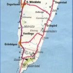
On the W coast of the island, opposite Kalmar, lies the little port of Farjestaden. From Mollstorp, to the N of the town, the Oland Bridge (6070 m (6600 yds) long, with 1 53 piers) crosses the sound to Svino (Kalmar). 500 m (500 yds) from the end ofthe bridge is the fine Oland Zoo (Olands Djurpark). 8 km (5 miles) N of Farjestaden we find the Gr&borg, the largest refuge fort on the island, probably constructed during the great migrations, and which continued in use into the Middle Ages. The ramparts, up to 6 m (20 ft) high, enclose an elliptical area 220 m (240 yds) long by 1 65 m (1 80 yds) wide. There are remains of an impressive vaulted gateway. Nearby is the ruined 1 3th c. St Knut’s Chapel. 4 km (2i miles) S of Farjestaden (signposted Runsten) is the Karlevisten, the oldest runic stone on Oland, with a long inscription explaining that it was set up at the end of the year 1000 by Sibbe the Wise, a Danish sea-king (probably without lands). 6 km (4 miles) NE of the little port of Morbylanga is the Romanesque church of Resmo (c. 1150), with frescoes of the same period in the choir. The upper part of the E tower was demolished in 1826, but part of the staircase and the S wall have been preserved. 5 km (3 miles) E of Morby-Icinga is Mysinge Hog, a Bronze Age burial mound. There is a magnificent view of the Stora Alvar from here. In this area there are also Neolithic chambered tombs, the only ones of their kind in eastern Sweden. The remains of 30 people were found in these 4000-year-old tombs, which were built from nine large blocks of granite.
Near the S end of the W coast is the little port of Degerhamn, 3 km (2 miles) N of which is the Gettlinge Gravfalt, a large Iron Age cemetery with two limestone mounds marking the graves of chieftains. Nearby are a ship-setting, a judgment ring and a number of burial places of different types. 9 km (5 miles) E of Degerhamn we find another Iron Age cemetery, the Seby Gravfalt, with the remains of limestone mounds still rising prominently. 1 km (f mile) away, by the roadside, a large runicstonehasan inscription recording that Ingjald, Naf and Sven set it up in honour of their father, Rodmar. 1 6 km (1 0 miles) SE of Degershamn is Eketorps Borg, a refuge fort with ramparts enclosing an almost perfectly circular area. The original fort, dating from the 4th cž was enlarged in the period of the great invasions. It developed into a sort of small fortified town, and habitation continued for several hundred years. Its population lived by farming and stock-rearing. In the western part of the fort, hut foundations have been exposed by excavation. At the end of the Viking period, the inhabitants built wooden houses; these remained in occupation well into the medieval period. Finds of material dating from this period show that the people who lived here had by then taken to trading and seafaring.
The S end of the island is occupied by the Stora Alvar, a great expanse of steppe-land which is aglow with colour when the heather and thyme are in bloom; in certain favoured spots, too, thousands of orchids flower in spring. A very common flower is the trailing tormentil; rare species such as the large sand-lily and the little blue globularia are also found. Many plants are protected by law (including the yellow pheasant’s-eye which grows on coastal grassland). Near the southernmost tip of the island is Ottenby, which in the 1 3th c. belonged to a monastery. It was taken over by Gustavus Vasa and remained Crown property thereafter. The manor-house of KungsgSrd dates from 1 804. To the N, visible from the road, is an Iron Age cemetery. 2 km (1 J miles) W are two high limestone mounds, the King’s Stones. The KungsgSrd estate is bounded on the N by a wall running from coast to coast, built in 1653 to protect the peasants’ fields to the N from the royal deer. On the promontory stands Sweden’s tallest lighthouse, Lange Jan (42 m (140 ft) high), built in 1785. Nearby are a bird-watching station and ornithological museum.
Oland Sweden Map Photo Gallery
Maybe You Like Them Too
- The Best Cities To Visit in The World
- World’s 10 Best Places To Visit
- Coolest Countries in the World to Visit
- Travel to Santorini, Greece
- Map of Barbados – Holiday in Barbados

