Norway (administrative district of Svalbard).
Area of archipelago: 61,723 sq. km (23,830 sq. miles).
TRAVEL. Boat services from Bergen viaTromsoand HonningsvSg to Spitzbergen (Longyearbyen and Ny Alesund); cruises. Air services from Tromso to Longyearbyen (2-3 times weekly in summer, once or twice weekly in winter).
Accommodation. Since there are no tourist hotels on Spitzbergen visitors must either find accommodation in private houses or stay at one of the two camp sites, the amenities of which are rather spartan. If unable to get private accommodation visitors must be equipped to look after themselves (tent, sleeping bag, etc.) and must also bring sufficient food. Visitors arriving inadequately equipped will be required to leave.
Conservation. In recent years, about 27,000 sq. km (10,500 sq. miles), 44% of the total area, have been given legal protection. There are three National Parks (S Spitzbergen, Forland, NW Spitzbergen), two nature reserves, two plant reserves and fifteen bird reserves.
As a result ofthe extreme climatic conditions, it takes many years for refuse to decay. In order to avoid disturbing the delicate ecological balance, visitors should dispose of their rubbish (garbage) properly.
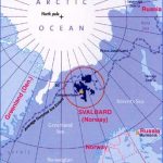
The Spitzbergen (Spitsbergen in Norwegian) archipelago, since 1925 part of the Norwegian administrative district of Svalbard (which
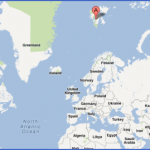
Warning. There is always the possibility, even during the summer, of encountering polar bears. Since they are usually of an aggressive nature and liable to attack without warning, extreme caution should be observed. includes the islands lying between long. 10° and 35° E and lat, 74° and 81° N), lies between lat. 76°28′ and 80°48′ N, some 700 km (450 miles) from Hammerfest and 1000 km (625 miles) from the North Pole. It has a total area of 61,723 sq. km (23,830 sq. miles).
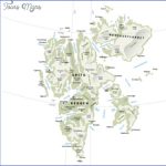
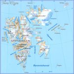
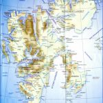
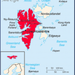
The main island, West Spitzbergen (Vest-spitsbergen) is broken up by deeply indented fjords. Off the W coast is the small island of Prins Karls Forland (Prince Charles Foreland). To the NE, separated from the main island by the Hinlopen Strait, is Nordaustlandet (North-East Land), almost completely covered with ice. To the SE are Barentsoya (Barents
Island) and Edgeoya (Edge Island), and beyond these, the narrow little island of Hopen.
Spitzbergen has rich coal deposits from the Tertiary era, occasionally used in the past by visiting ships to supplement their supplies and now mined both by Norwegians (about 1000, at Longyearbyen) and Russians (about 2000, at Barents-burg and Pyramiden), The mines are on West Spitzbergen, mainly on the S side of the Isfjord (Longyearbyen, Barents-burg, Pyramiden, etc.). The coal can be shipped only during the few ice-free summer months. Since 1 960, there have been test drillings for oil at various places in Spitzbergen.
Warm rainproof and washable clothing, and sturdy footwear are essential for a visit to Spitzbergen. Great caution should be exercised in venturing on to glaciers.
HISTORY. Spitzbergen is believed to have been discovered as early as 1194 by Norwegians, who named it Svalbard (the cold land). In 1596 it was again discovered by the Dutch navigator Willem Barents, during his quest for the North-East Passage to China. Under the Treaty of Sevres (1 920), Norway was granted sovereignty over Spitzbergen, and Russia was given the rightto workthreecoal-mines. In 1 925, the territory was incorporated into Norway under the old name of Svalbard. The islands are ruled by a governor (sysselmann). Many of the islands and their natural features are named after seamen, fishermen, hunters, scientists and statesmen of different nationalities, recalling the history of their discovery and exploration. Apart from a few mining settlements on the W coast, the islands are unin-habitated.
Geologically, Spitzbergen belongs to the European continental shelf and shows a history of development from the Pre-Cambrian rocks to the Tertiary era. The huge glaciers reaching down to the sea and the pointed summits ofthe mountains create an impression of an Alpine world which has sunk under the ocean. The highest peak is Newtontoppen (1717 m-5633 ft), NE of Isfjord. About four-fifths of the land surface is covered by perpetual ice. As a result of the warm Gulf Stream which washes the W coast, the drift ice retreats farther here in summer than anywhere else in the Arctic regions at the same latitude. Seals, polar bears, reindeer, Arctic foxes and some 30 species of birds inhabit the region. Plant life, which grows during the brief summer, consists of small blossoming plants, ferns, mosses and lichens. The climate varies, with frequent mist, and the temperature rises above freezing point only during the short summer months. The midnight sun is visible from about 19 April to 24 August, while from 27 October to 15 February, the sun remains continually below the horizon.
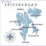
The tourist ships dock only on the W side of the archipelago. After passing the South Cape ((Sorkapp) of West Spitzbergen (lat. 76°26′ N) the ships sail past the 15 km (9 mile) wide Hornsund, the southernmost inlet on the W coast, with the towering Hornsundstind (1431 m 4695 ft), and then past the Torell glacier and the Bell Sund. It then comes to the lsfjord, the largest fjord on the W coast, cutting 100 km (60 miles) into the land with a width of up to 25 km (1 5 miles) and with a number of arms branching off. The landscape on the N side is of Alpine type, while on the S side, with the mining settlements, the fjord is edged with steepsided tabular hills. In the Adventfjord is Longyearbyen (named after the 19th c. American mining engineer, J. M. Longyear), the largest settlement on the island. It is a very serious offence (punishable by imprisonment) to pick any of the tiny flowers that grow here in the summer.
The scenery is even finer and grander farther up the coast. The ship sails along the W side ofthe long island of Prins Karl Forland with its jagged glaciated peaks (Mt Monaco, 1084 m 3557 ft) and after rounding the northern tip of the island, comes into sight of the wide Kongsfjord (King’s Fjord), with the pyramidal peaks of the Tre Kroner (Three Crowns, 1 225 m – 4020 ft) rising above the 14 km (9 mile) wide King’s Glacier, the largest glacier on the W coast. On the S side of the fjord is the former mining settlement of lly Alesund (mining abandoned after an accident in 1962). Here is the most northerly post office in the world (special postmark) and a radar and satellite tracking station (pop. about 30: scientific research on ionosphere). Near here is a monument commemorating Amundsen’s flight in the airship Norge (1926). The Kongsfjord was the starting-point of a number of Polar flights. Amundsen’s attempt to reach the Pole with two aircraft in 1925 was unsuccessful, but in the following year he flew over the Pole in the Norge, two days after the Americans Byrd and Bennett, and landed Spitzbergen cruise ship in the Kongsfjord. at Teller in Alaska. In 1928, the Italian, Nobile, set out from here in hisairship, but was lost on the return flight. To the N of the Kongsfjord are the Krossfjord and the Mollerfjord, with Mollerhavn (Lloyd Hotel” hut, with visitors’ book). 30 km (20 miles) N of the Kongsfjord is a 30 km (20 mile) wide expanse of glaciers, with seven huge rivers of ice reaching down to the sea between steep and jagged peaks. Still farther N is the 9 km (5 mile) long ‘Magdalenefjord, at the head of which is the Waggonway glacier (named for the deep rifts in the ice like cart-ruts), 2 km (1i miles) wide, with a cliff-like front up to 100 m (330 ft) high; to the left is the Miethe glacier. On the S side of the fjord are the Adams and Gully glaciers, in the N E corner the pyramidal Rotgesberg (802 m 2631 ft). To the N is the island of Danskoya, from which a Swede named Andre set out to fly to the Pole in a balloon but perished, along with his companions, in the attempt. Beyond this island is Amsterdamoya (also known as Smeerenburg, from smeer, ”blubber”), the base of the 17th and 18th c. Dutch whalers. In earlier days, whaling was such a source of wealth that the little summer settlement of Smeerenburg for a time ranked equal with Batavia on Java. The cauldrons in which the whale oil was melted down used to stand on the low flat hills above the shore.
Spitzbergen Svalbard Map Photo Gallery
Maybe You Like Them Too
- The Best Cities To Visit in The World
- World’s 10 Best Places To Visit
- Coolest Countries in the World to Visit
- Travel to Santorini, Greece
- Map of Barbados – Holiday in Barbados

