HOTEL. Kaupunginhotelli, Itaranta 4,1 50 bž SP,
EVENTS. Rapids shooting contest and White Fish Festival on Kukkolankoski rapids, 1 8 km (11 miles) N (last Sunday in July); Tornio Valley Summer, with a variety of events (throughout July).
RECREATION and SPORT. Tennis, riding, fishing, swimming; boat trips to skerries (rocky islets).
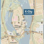
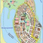
The Finnish frontier town of Tornio (Swedish TorneS), lies on the Gulf of Bothnia, at the mouth of the Tornionjoki (Tornealv), which forms the boundary with Sweden here. It is divided into three parts, the westernmost of which is on the former island of Suensaari, now joined to the mainland on the Swedish W bank of the river.
The town first appears in the records in the 14th c. when Archbishop Hemming was baptising Finns and Lapps in this area. It received its municipal charter in 1 621.
SIGHTS. The wooden church (1864), with a separate tower, has a patterned shingle roof; inside, the ceiling is partly painted; fine 17th c. brass chandelier. In Torikatu, near the crossing into Sweden, is the Tornio Valley Museum. To the N of the church is a sports field, and still farther N is a water-tower with a lookout platform; nearby are tennis courts.
SURROUNDINGS.-9 km (5 miles) S is the island of Roytta, the port of Tornio (boat trips to skerries).
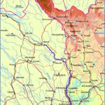
A drive up the Tornio valley to the N is recommended. In 17 km (10 miles) a detour brings one to the Kukkolankoski rapids, which have a fall of 13-8 m (45 ft) over a distance of 3-5 km (2 miles). Fishing; restaurant, with good fish dishes. 26 km (16 miles) beyond the turning for Kukkolankoski is another side road leading to the Matkakoski rapids. The next place is Ylitornio, which has a modern stone church with an old wooden belfry beside it. 10 km (6 miles) N of the church, Road 930 turns off on the right to Rovaniemi. A short distance along this road, a narrow side road leads to a camp site and car park on the hill of Aavasaksa (222 m 730 ft), with the Tengelidnjoki flowing round the foot of the hill. From here, a footpath (350 m 400 yds) leads to the top, where the midnight sun can be seen on Midsummer Day, although the hill is actually S of the Arctic Circle. Accommodation is available in both summer and winter in comfortable vacation chalets. Ski-lift (length 605 m-1985 ft).
Haparanda (Finnish Haparanta), Tornio’s Swedish neighbour and counterpart, lies on the W bank ofthe Tornealv (Finnish Tornionjoki). The town was founded in 1809, after Tornio had passed to Russia together with the rest of Finland. The frontier rampart at the sports field to the N of the town is a reminder of this earlier period of confrontation. The frontier between Sweden and Finland is now regarded by joth sides as the most peaceful frontier in the world. Haparanda is Sweden’s easternmost town. It offers the same opportunities for excursions and recreation as Tornio.
During the First World War, Russia and the Central Powers exchanged prisoners unfit for further service through Haparanda. In the churchyard of Nedertornea church, on the western outskirts of the town, is a stone commemorating the 205 Austrians, 11 Germans and 2 Turks who died on the journey and were buried here.
Tornio Tornea Finland Map Photo Gallery
Maybe You Like Them Too
- The Best Cities To Visit in The World
- World’s 10 Best Places To Visit
- Coolest Countries in the World to Visit
- Travel to Santorini, Greece
- Map of Barbados – Holiday in Barbados

