Altitude: 412m/1352ft. Area: 861sq.km/332sq. miles Population: 2,280,000 (conurbation 3,010,000)
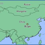
Xi’an is situated in central China, between the Weihe river in the north and the Qinling Mountains in the south, at 108°55’E and 34°16’N.
The city lies on a major rail route which runs from Lianyungang on the Yellow Sea via Orumqi in the Autonomous Region of Xinjiang and on to Kazakhstan. There are direct rail links with Beijing and Shanghai, and flights to most large Chinese cities as well as to Hong Kong.
Xi’an is one of north-west China’s chief textile centres, where cotton grown in the artificially irrigated paddy-fields in the neighbouring countryside is treated and processed. Other major branches of industry are chemicals and engineering.
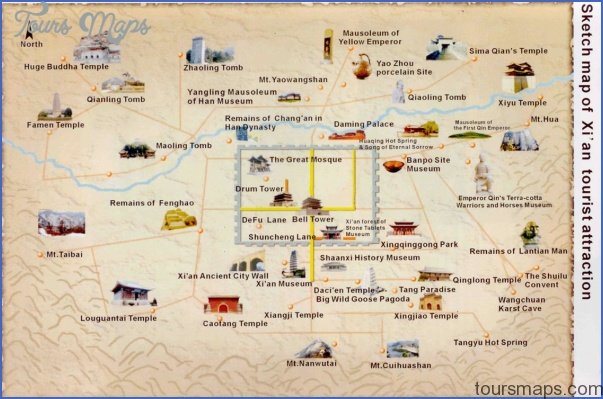
It probably possesses more items of archaeological interest than any other town or city in China, the most important, of course, being the world-famous Terracotta Warriors, which attracted 1,700,000 domestic and foreign visitors in 1992.
Xi’an is one of China’s six historic capital cities. From 1027 B.C. onwards eleven dynasties chose it as their seat of government. In fact, however, its history probably goes back 6000 years. In Banpo, a village 6km/4 miles to the east, archaeologists have excavated a settlement once inhabited by over 500 people which dates back to the 4th c. B.C.
The Emperor of the Western Zhou dynasty (1066-771 b.c.) elected to reside in Feng, near present-day Xi’an. The capital city during the Qin era in the 3rd c. b.c. wasXianyang (also nearwhere Xi’an lies today), with 500,000 to 600,000 inhabitants, or a third of the total population of China at that time. Under the Western Han (206-8 b.c.) the capital, sited north-west of where Xi’an now lies, was called Chang’an (Long-lasting Peace) and covered an area of 35sq.km/13’/!sq. miles. Here was the beginning of the famous Silk Road, which wound its way through Central Asia and the Middle East as far as the Mediterranean and thus linked Xi’an with such cities as Istanbul, Rome and Venice. From then until the 14th c. a.d. the Silk Road was an extremely important route along which spread the world’s oldest cultures, those of China, Persia, Egypt, Turkey, Greece and Italy.
Under the Sui dynasty (581-618) the town developed even further and its name was changed to Daxing (Great Prosperity). In the Tang era (618-907), named Chang’an once more, it enjoyed a further halcyon period; its area increased to 84sq.km/32sq. miles, making it the largest city in the world at that time. Chang’an was a busy trading centre and the setting-out point for journeys to Central Asia, Russia, India, the Mediterranean and Africa as well as a place where all kinds of ethnic groups came together. Almost all the buildings of that period were destroyed in the countless wars which devastated the country during the Late Tang period, but two which survived were the Pagoda of the Great Wild Goose (Dayan Ta) and that of the Small Wild Goose (Xiaoyan Ta). When the Tang dynasty fell Chang’an became less important. At the beginning of the Ming dynasty (1368-1644) a number of changes were made to the town and it was finally given the name it still holds today, Xi’an (Westerly Peace). However, it was only one-sixth of the size that Chang’an had been during the Tang period. The
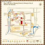
Provincial Museum town has changed little in appearance in the last six hundred years. Although its boundaries have expanded considerably since the 1950s the historic town centre remains unaltered. The Tang dynasty built its capital Chang’an 7km/41/2 miles north-west of where Xi’an lies today. Its defensive walls, 22km/14 miles in length, formed an irregular quadrilateral with twelve gates, each with three entrances. The main gate was reserved for the use of the emperor. The north side of the wall is shaped rather like the Ursa Major constellation, and the south side like Ursa Minor. The town was served by eight main streets and 160 side streets together with large numbers of palaces (none of which survive) and an excellent drainage and sewerage system using pentagonal clay pipes. On the excavation site, in addition to the remains ofthe town walls to the south-west, the visitor can still see a large mound of earth which is all that is left of the Han imperial residence, the Palace of Weiyang, around which ^ countless legends have been woven. At one time the palace comprised more than 40 separate buildings, the main one being 183m/600ft long, 164ft wide and 12m/39ft high.
Xi’an Map Photo Gallery
Maybe You Like Them Too
- The Best Cities To Visit in The World
- World’s 10 Best Places To Visit
- Coolest Countries in the World to Visit
- Travel to Santorini, Greece
- Map of Barbados – Holiday in Barbados


