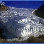
At about the same time that the plume started sending up magma in the Yellowstone region, a worldwide climate change brought colder temperatures and, in some places, glaciers. Vast ice sheets covered much of Canada and spread south to the Ohio River. Elsewhere, glaciers also formed at high elevations. The broad plateaus of the park average about 8000 feet (2400 m) above sea level and so developed glaciers. We know that worldwide there were about 20 glaciations or ice ages. Each glaciation lasted about 50,000 to 100,000 years, with shorter warm periods in between. The glaciers retreated about 10,000 years ago, resulting in the warm interglacial period we now enjoy. Glaciers had several major effects on Yellowstone, and the last two glaciations left evidence all around. Almost the entire park was covered with ice. Often the ice was about one-half mile (800 m) thick, so that animals and plants were essentially non-existent here. Although glaciers are solid ice, they flow slowly toward lower ground at rates of a few yards (meters) per year.
The glaciers were major agents that modified the landscape drastically by transporting some rocks, digging and scraping away at others, and interacting with the park’s thermal areas. Some examples of this activity follow. The glaciers’ ability to transport rocks is demonstrated in the area of the Yellowstone Canyon [GEO.13] and in the Lamar River valley [GEO.14]. In both places, you see boulders as large as 10 feet (3 m) across that are clearly out of place. We know where they originated, because they match the 2.7-billion-year-old gneisses common in the Beartooth Range. These boulders are called glacial erratics, because they are many miles from the nearest outcrops of similar rocks. Glaciers will often gouge out holes in the ground when moving over soil or soft sediment. Look for these kettle ponds, or kettle holes, mostly on the north side of the Northeast Entrance Road [GEO.15]. The glaciers carried huge amounts of rock and soil along and dumped it at their downhill edges where they melted. These deposits (or moraines) can be seen in Paradise Valley along the Yellowstone River north of the park. Streams formed from the meltwater of the glacier also carried away much of the debris and then deposited it further downstream as outwash sediments. The hot rocks underlying parts of Yellowstone had some unusual interactions with the glaciers. The glaciers dammed many streams by simply filling the stream valley with ice.
Sometimes the lake that was formed covered one of the many hot areas. Water Glacial erratics: The large boulders in this Lamar Valley photo were carried by the glacier from the Beartooth Range. Climate warming about 10,000 years ago melted the glacier, which dumped these boulders onto the land surface.
Glaciers reshape the landscape Yellowstone Photo Gallery
Maybe You Like Them Too
- The Best Cities To Visit in The World
- World’s 10 Best Places To Visit
- Coolest Countries in the World to Visit
- Travel to Santorini, Greece
- Map of Barbados – Holiday in Barbados

