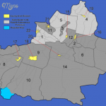
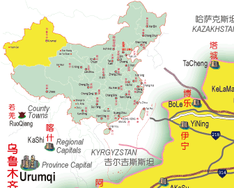
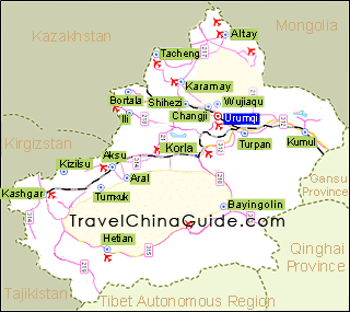
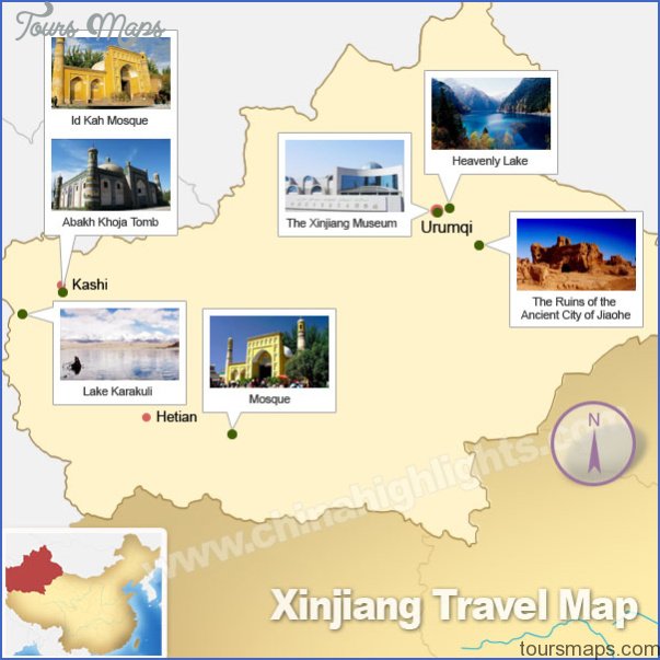
Area: 1,650,OOOsq.km/637,OOOsq. miles Population: 15,550,000. Capital: Urumqi
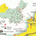
Xinjiang is the largest of China’s autonomous regions and provinces and covers one-sixth of the total area of the country. It lies between 73°41′ and 96°19’E and 34°29′ and 49°20’N, in the north-west of China, on the borders with India, Pakistan, Afghanistan, Tadzhikistan, Kirgiziya and Kazakhstan.
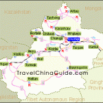
The main topographical features of Xinjiang are the Junggar Basin (Junggar Pendi) in the north and the Tarim Basin (Tarim Pendi), the great lake
Between these two areas of lowland the eastern Tienshan mountains, ranging from west to east, are 1500km/930 miles in length and 250-300km/150-185 miles wide; the peaks here are between 3000 and 5000m/10,000 and 17,000ft high, and in the west form two main chains separated one from the other by the Hi river. On the south-east flank of the range lie the Hami and Turpan Valleys – the latter is 154m/505ft below sea-level, making it the second lowest place on earth. In the south the predominant features are the Western (7282m/23,900ft) and Central Kunlunshan (7723m/25,347ft) ranges, as well as Mount Altunshan (6161 m/20,220ft). In the extreme north Xinjiang forms part of the Mongolian Altaj range.
The region’s remoteness and its great distance from the sea result in an extreme, continental-type, dry climate (more than one-fifth of Xinjiang is desert). In January the average temperatures are -15°C/5°F in the north and -70C/22-4°F in the Tarim Basin, while in July they are 21°C/70°F in the north and 32°C/90°F in the Turpan Valley.
Average rainfall is 100-500mm/4-20in. in the north and 25-100mm/1-4in. in the south.
There are a dozen or so different groups of people in the region, the most Population important being the Uigurs; at one time they formed 75% of the total, but this fell to 45% in 1973 as a result of the mass influx of Chinese after the building of the Lanzhou-Urumqi railway. Minority peoples include Kazakhs (Kazaks), Kirghiz, Tadzhiks, Uzbeks, Mongols, Tartars, Hui, Russians, Manchurians and Daurs. Most ofthe population are Moslem.
The southern part (East Turkestan) first came under Chinese control in 101 History b.c., and the region then became China’s major land link with west and south Asia and, in consequence, a matter of permanent dispute between China and its neighbours.
In the 9th c. the Uigurs settled here, followed by west Mongolian tribes after the Ming period (1368-1644). By the 17th c. the latter had grown in strength so as to constitute a threat to the Manchurian rulers, leading
Museum finally to the Junggar Wars (1696-1758). With the pacification of the Jung-gars and the taking of East Turkestan in 1758 the whole of Xinjiang was won and subsequently incorporated into the Chinese empire in the form of a protectorate. Much of it was lost following an uprising by the Islamic Turks in 1862-78, but the Chinese succeeded in re-taking most of it and then absorbed it into China as Xinjiang province. Betwen 1911 and 1941 the region was independent, but in 1949 it finally came under the aegis of the Central Government and in 1955 was designated an Autonomous Region.
There have been constant revolts against Chinese rule, and separatist movements have gained in strength since the collapse of the Soviet Union in the early 1990s.
The main industries are cotton and silk-processing and comestibles. Handicrafts, especially carpet-weaving, are well developed.
Xinjiang benefits from rich mineral resources, some of which are now being extracted, namely oil, coal, uranium and iron-ore.
Animal farming with cattle, sheep and horses is now the main industry in the Junggar Basin among the former nomads, mainly Kazakhs and Mongols, who now share in “collective” farms. The “oasis industry” plays an important role in the Tarim Basin; at the oases on the northern and southern edges of the mountain range wheat, maize, rice, cotton, sugar-beet, apricots, figs and melons are cultivated. The breeding of silkworms is also of importance.
Xinjiang Map Photo Gallery
Maybe You Like Them Too
- The Best Cities To Visit in The World
- World’s 10 Best Places To Visit
- Coolest Countries in the World to Visit
- Travel to Santorini, Greece
- Map of Barbados – Holiday in Barbados

