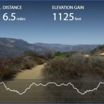
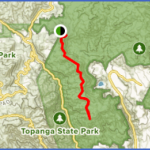
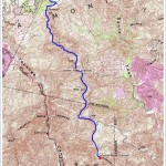
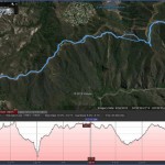
Hiking Distance: 6 Miles Round Trip Hiking Time: 3 Hours Configuration: Out-And-Back Elevation Gain: 800 Feet Difficulty: Moderate Exposure: Exposed Ridge Dogs: Not Allowed
Maps: U.S.G.S. Topanga Topanga State Park Map Tom Harrison Maps:
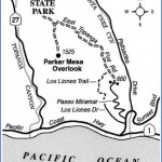
Parker Mesa Overlook (Also Referred To As The Topanga Overlook, Or Simply The Overlook) Is An Oceanfront Lookout Perched 1,525 Feet Above The Pacific Ocean. East Topanga Fire Road, The Access Route To The Overlook, Is A Restricted Road That Travels North And South Through Topanga State Park From Trippet Ranch (The Park’S Headquarters) To Paseo Miramar Off Sunset Boulevard.
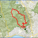
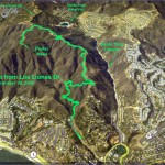
Parker Mesa Overlook Map Photo Gallery
Parker Mesa Overlook Can Be Accessed From Three Trailheads: From The North Via This Trailhead At Trippet Ranch And From The South Via The Los Liones Trailhead Or The Paseo Miramar Trailhead In Pacific Palisades (Hike 81). The Fire Road Follows The Ridge High Above Topanga Canyon And Santa Ynez Canyon, Passing Enormous Slabs Of Sandstone And Numerous Ravines That Drop Into The Canyons Along Both Sides Of The Ridge. Throughout The Hike Are Spectacular Vistas In Every Direction.
To The Trailhead
From Santa Monica, Drive 4 Miles Northbound On The Pacific Coast Highway/Highway 1 To Topanga Canyon Boulevard And Turn Right. Continue
4.6 Miles To Entrada Road On The Right And Turn Right Again. Drive 0.7 Miles And Turn Left, Following The Posted State Park Signs. Turn Left Again At 0.3 Miles Into The Topanga State Park Parking Lot.
Parker Mesa Overlook
From Trippet Ranch
From The Ventura Freeway/Highway 101 In Woodland Hills, Exit On Topanga Canyon Boulevard, And Drive 7.6 Miles South To Entrada Road. Turn Left And Follow The Posted State Park Signs To The Parking Lot.
The Hike
Head Southeast On The Signed Trail Towards Eagle Rock To A Fire Road. Bear Left Up The Road To A Junction At 0.2 Miles. The Left Fork Leads To Eagle Rock (Hike 79). Take The Right Fork On The East Topanga Fire Road Past A Grove Of Coastal Oaks. Continue Uphill To A Ridge And A Bench With Panoramic Views From Topanga Canyon To The Pacific Ocean. A Short Distance Ahead, The Trail Crosses A Narrow Ridge Overlooking Santa Ynez Canyon And Its Tilted Sandstone Slabs. Follow The Ridge South, With Alternating Views Of Both Canyons. At 2.5 Miles Is A Junction With A Trail On The Right. The Main Trail On The Left (East) Leads To The Trailheads At Los Liones Drive And Paseo Miramar (Hike 81). Leave The Fire Road, And Take The Right Trail A Half Mile South To The Parker Mesa Overlook At The Trail’S End. After Enjoying The Fantastic Views, Return To Trippet Ranch Along The Same Route.
Maybe You Like Them Too
- Top 10 Islands You Can Buy
- Top 10 Underrated Asian Cities 2023
- Top 10 Reasons Upsizing Will Be a Huge Travel Trend
- Top 10 Scuba Diving Destinations
- World’s 10 Best Places To Visit

