Category: Blog
22360 Devonshire Street Hiking Distance: 2.6 Miles Round Trip Hiking Time: 1.5 Hours Configuration: Out-And-Back Elevation Gain: 600 Feet Difficulty: Easy To Slightly Moderate Exposure: Exposed Hills Dogs: Allowed …
11000 Topanga Canyon Boulevard Hiking Distance: 0.7-Mile Outer Loop Hiking Time: 1 Hour (Allow Extra Time For Exploration) Configuration: Outer Loop With Several Exploratory Paths Elevation Gain: 100 Feet …
1 Black Canyon Road Hiking Distance: 2.6-Mile Loop Hiking Time: 1.3 Hours Configuration: Loop Elevation Gain: 300 Feet Difficulty: Easy Exposure: Mostly Exposed Dogs: Allowed Maps: U.S.G.S. Calabasas Santa …
Cheeseboro/Palo Comado Canyons Hiking Distance: 8.6 Miles Round Trip Hiking Time: 4 Hours Configuration: Out-And-Back With Small Loop Elevation Gain: 600 Feet Difficulty: Moderate To Strenuous Exposure: A Mix …
Hiking Distance: 4-Mile Loop Hiking Time: 2 Hours Configuration: Loop Elevation Gain: 1,000 Feet Difficulty: Moderate To Somewhat Strenuous Exposure: Mostly Exposed Dogs: Allowed Maps: U.S.G.S. Thousand Oaks N.P.S. …
Point Mugu State Park Lies At The West End Of The Santa Monica Mountains In Ventura County, Adjacent To The Pacific Ocean To The South, Newbury Park To The …
Carlisle Canyon-Backbone Trail Loop Circle X Ranch 12896 Yerba Buena Road Hiking Distance: 6-Mile Loop (With Optional 1.4-Mile Loop At West End) Hiking Time: 3-4 Hours Configuration: Loop Elevation …
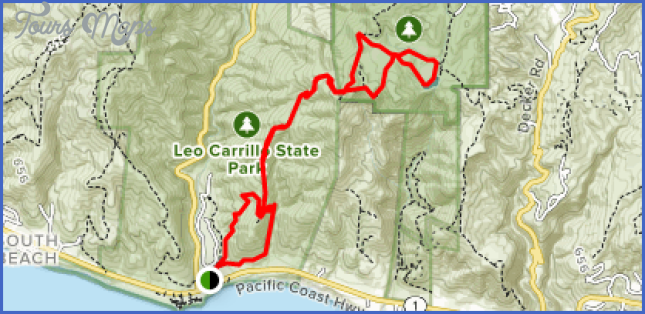
Leo Carrillo State Park Decker School Road Hiking Distance: 2.5-Mile Double Loop Hiking Time: 1.5 Hours Configuration: Double Loop Elevation Gain: 100 Feet Difficulty: Easy Exposure: A Mix Of …
35000 W. Pacific Coast Hwy Hiking Distance: 2.5-Mile Loop Hiking Time: 1.5 Hours Configuration: Loop With Spur Trail To Overlook Elevation Gain: 600 Feet Difficulty: Easy To Moderate Exposure: …
“The contemporary hymn, Let us build a house where love can dwell, includes the rousing chorus, all are welcome in this place. “As well as a cheery word of …
