22360 Devonshire Street
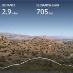
Hiking Distance: 2.6 Miles Round Trip Hiking Time: 1.5 Hours Configuration: Out-And-Back Elevation Gain: 600 Feet Difficulty: Easy To Slightly Moderate Exposure: Exposed Hills Dogs: Allowed
Maps: U.S.G.S. Simi Valley East And Oat Mountain
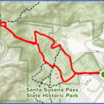
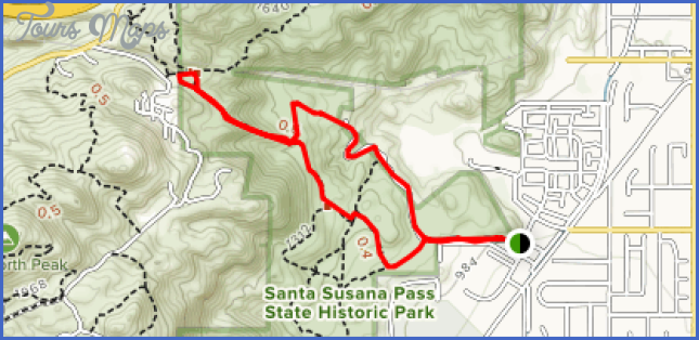
Old Stagecoach Trail Map Photo Gallery
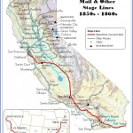
The Old Stagecoach Trail Begins In Chatsworth Park South And Climbs Through An Undeveloped Portion Of The Simi Hills. The Trail Follows A Segment Of The Historic Santa Susana Stage Road That Once Linked Los Angeles With San Francisco From 1859-1890. The Hike Utilizes The Old Route, Lined With Interesting Formations And Bedrock Worn Down By Stagecoach Wheels. A Web Of Unmarked, And Sometimes Confusing, Trails Weaves Through Rounded, Fractured Sedimentary Rock To Vistas Of The City Of Chatsworth, The San Fernando Valley, And The Santa Susana Mountains. Near The Ridge Is A Plaque Embedded Into The Sandstone Rock. The Marker Was Installed By The Native Daughters Of The Golden West In 1937, Designating The Old Santa Susana Stage Road.
To The Trailhead
From Highway 118/Ronald Reagan Freeway In Chatsworth, Take The Topanga Canyon Boulevard Exit. Drive 1.5 Miles South To Devonshire Street And Turn Right. Continue A Half Mile To The End Of Devonshire Street And Enter Chatsworth Park South. Curve Right And Drive 0.2 Miles To The Main Parking Lot.
From The Ventura Free Way/Highway 101 In Woodland Hills, Drive 5 Miles North On Topanga Canyon Boulevard To Devonshire Street And Turn Left. Continue A Half Mile To The End Of Devonshire Street And Enter Chatsworth Park South. Curve Right And Drive 0.2 Miles To The Main Parking Lot.
Stagecoach Trail Loop
Hiking Distance: 2-Mile Loop Hiking Time: 1 Hour Configuration: Loop Elevation Gain: 300 Feet Difficulty: Easy Exposure: Exposed Dogs: Allowed
Maps: U.S.G.S. Simi Valley East And Oat Mountain Rancho Simi Trail Blazers Stagecoach Trail Map
A Network Of Trails Runs Through The Northeast Corner Of The Simi Hills Near Chatsworth. The Area, Adjacent To The Santa Susana Mountains, Straddles The Ventura-Los Angeles County Line. This Loop Begins On The Stagecoach Trail Off Of Lilac Lane And Climbs Over A Chaparral-Covered Hill To Santa Susana Pass Road. Along The Way, The Trail Weaves Through Massive, Grey-Colored Sandstone Outcroppings Over 70 Million Years Old. This Hike Continues As A
Loop With The Upper (North) End Of The Old Stagecoach Trail, The Historic Route That Once Linked Los Angeles With Santa Barbara During The Last Half Of The 1800s. Throughout The Hike Are A Series Of Magnificent Overlooks Of The San Fernando Valley, The Santa Susana Mountains, The San Gabriel Mountains, And The Santa Monica Mountains. For A Longer Hike, The Trail Can Be Continued Along The Lower End Of The Old Stagecoach Trail Hike 147 Leading Down To Chatsworth Park South.
To The Trailhead
From Highway 118/Ronald Reagan Freeway In Simi Valley, Exit On Kuehner Drive. Drive 2.8 Miles South To Lilac Lane. (Kuehner Drive Becomes Santa Susana Pass Road As It Curves To The East.) Turn Right On Lilac Lane. Continue A Quarter Mile, And Turn Left Into The Dirt Parking Area.
The Hike
The Signed Trail, Located At The Back End Of The Parking Area, Is The Return Route. Begin The Loop At The Front Of The Parking Area On The Left (North). Traverse The Hillside Among Gorgeous Sandstone Boulders. Curve Right And Drop Into A Wide Gulch As The Homes Along Lilac Lane Disappear From View. Surrounded By A Jumble Of Weather-Sculpted Outcrops, The Path Leads To An Overlook Of Simi Valley, High Above The 118 Freeway. The Serpentine Path Curves Right To An Overlook Of Rocky Peak Park (Hike 150). Head East Through The Low-Growing Chaparral While Marveling At The Spectacular Landscape. Slowly Descend, Zigzagging Down The Hillside To Santa Susana Pass Road At A Half Mile, Located 120 Yards East Of The 118 Freeway Overpass.
Bear Right And Follow The Road 0.1 Mile To A Fire Road, Closed Off To Vehicles By Boulders. Bear Right, Passing The Boulders, And Gently Descend, Overlooking The Canyon On The Left To A Y-Fork. The Left Fork Continues Down The Canyon Towards Topanga Canyon Boulevard. (En Route, This Trail Passes Through The 500-Acre Spahn Ranch. The Area Was Used For Western Films, Including Bonanza And The Lone Ranger. However, It Is Best Known As The Site Where Serial Killer Charles Manson And His Infamous Cult Lived During Their 1969 Killing Spree. All The Ranch Structures Were Destroyed In A Wildfire One Year Later. The Land Is Currently Owned By The State.)
For This Hike, Veer Right And Head Up The Slope. Curve Right And Traverse The Hillside While Expansive Views Span Across The San Fernando Valley. One Hundred Yards Shy Of The Trailhead Parking Area Is An Unsigned Fork. Detour Left 0.2 Miles To An Overlook Atop A Knoll, Offering 360-Degree Vistas Across The Valley To The San Gabriel Mountains And Santa Monica Mountains. To Extend The Hike, The Trail Descends On The Old Stagecoach Road To Chatsworth Park South (Hike 147).
Maybe You Like Them Too
- Top 10 Islands You Can Buy
- Top 10 Underrated Asian Cities 2023
- Top 10 Reasons Upsizing Will Be a Huge Travel Trend
- Top 10 Scuba Diving Destinations
- World’s 10 Best Places To Visit

