Carlisle Canyon-Backbone Trail Loop Circle X Ranch
12896 Yerba Buena Road
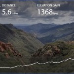
Hiking Distance: 6-Mile Loop (With Optional 1.4-Mile Loop At West End)
Hiking Time: 3-4 Hours
Configuration: Loop
Elevation Gain: 1,100-1,250 Feet
Difficulty: Moderate To Strenuous Exposure: Shaded Canyon And Exposed Hillside Dogs: Allowed
Maps: U.S.G.S. Triunfo Pass N.P.S. Circle X Ranch Map Tom Harrison Maps: Point Mugu State Park Trail Map
Sandstone Peak, Rising Along Boney Ridge, Stands As The Highest Point In The Santa Monica Mountains. Despite The Name, Sandstone Peak Is Actually A Mass Of Volcanic Rock. From The 3,111-Foot Summit Are Far-Reaching Vistas That Sprawl Out As Far As The Eye Can See, Including The Sweep Of The Mountain Range, The Oxnard Plain, The Topatopa Mountains At Ojai, And The Pacific Ocean, Which Dominates The Southern View. This Loop Through Circle X Ranch Is A Moderately Strenuous, Mid-Range Hike That Offers Amazing Scenery, Traveling From A Shady Canyon Bottom Up To The Summit Of Sandstone Peak.
Sandstone Peak Map Photo Gallery
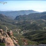
The Loop Begins On The Mishe Mokwa Trail, Dropping Into Carlisle Canyon Along Boney Mountain Past Weathered Red Volcanic Formations.
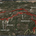
There Are Views Of The Sculpted Crevices Of Echo Cliffs And A Forested Streamside Picnic Area By A Huge, Split Boulder Known As Split Rock. The Trail Ascends Out Of The Shaded Canyon To Join With The Sandstone Peak Trail, A Segment Of The Backbone Trail. The Sandstone Peak Trail Climbs The East Slope Of Boney Mountain High Above Carlisle Canyon To Sandstone Peak. Inspiration Point Another Overlook Along The Spine Of The Mountain Lies A Short Distance To The West Of The Peak.
To The Trailhead
From Santa Monica, Drive 38 Miles Northbound On The Pacific Coast Highway/Highway 1 To Yerba Buena Road And Turn Right. (Yerba Buena Road Is 10.1 Miles Past Kanan Dume Road And 2 Miles Past Leo Carrillo State Beach.) Turn Right And Drive 5.3 Miles Up The Winding Road To The Circle X Ranger Station On The Right. From The Ranger Station, Continue 1 Mile To The Sandstone Peak Trailhead Parking Lot On The Left.
From The Pacific Coast Highway/Highway 1 And Las Posas Road In Southeast Oxnard, Drive 9 Miles Southbound To Yerba Buena Road And Turn Left. Continue Up Yerba Buena Road, Following The Directions Above.
From The Ventura Freeway/Highway 101 In Thousand Oaks, Exit On Westlake Boulevard (Highway 23). Drive 6.9 Miles South On Westlake Boulevard, Winding Up The Mountain Road To Mulholland Highway At A Stop Sign. Turn Right And Go 0.4 Miles To Little Sycamore Canyon Road. Turn Right And Drive 4.7 Miles To The Sandstone Peak Trailhead Parking Lot On The Right. (At The County Line, Little Sycamore Canyon Road Becomes Yerba Buena Road.)
The Hike
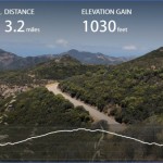
Pass The Trailhead Kiosk And Take The Sandstone Peak Trail, A Fire Road. At 0.3 Miles, Leave The Road And Begin The Loop, Taking The Signed Mishe Mokwa Connector Trail On The Right. Continue 0.2 Miles To A Junction With The Mishe Mokwa Trail And Take The Left Fork. Weave Along The Contour Of The Mountain, Following The Western Wall Of Carlisle Canyon. The Canyon Is Rich With Magnificent Red Rock Sandstone Formations. Echo Cliffs And Balanced Rock Can Be Seen On The Opposite Wall Of The Canyon. At 1.3 Miles, Descend Natural Rock Steps And Cross A Stream In A Rock Grotto. Descend Deeper Into Carlisle Canyon, Shaded By Oaks, Bay Laurel, And Sycamores. Cross Carlisle Creek To Split Rock And A Streamside Picnic Area Under Towering Oaks At 1.9 Miles. The Cabin Size Volcanic Boulder Is Split In Two With A Yard-Wide Access. Continue On The Main Trail Along The Floor Of Carlisle Canyon On The North Flank Of Sandstone Peak. Veer Left And Head West, Walking Parallel To The Stream Through The Shade Of Coast Live Oaks And Sycamores. Cross The Stream By Weather-Sculpted Volcanic Rocks. Gradually Ascend Out Of Carlisle Canyon Among A Continuing Display Of Outcroppings To A Signed Junction At 3.2 Miles. The Trail To The Right Leads To Tri-Peaks, While The Backbone Trail Continues West Into Big Sycamore Canyon. (See Below For The Optional Hike To Tri- Peaks.)
Instead, Bear Left On The Sandstone Peak Trail (Also The Backbone Trail), Zigzagging Up The Slope Towards Inspiration Peak. Pass A Non-Ending Display Of Weather-Carved Outcrops To A Junction. A Short Side Path On The Right Leads Up To The South-Facing Rocky Overlook Atop 2,800-Foot Inspiration Peak. On The Main Trail, Continue East About 0.7 Miles To Another Junction At A Spur Trail To Sandstone Peak. Detour To The Right 150 Yards To The 3,111-Foot Peak. The Side Path Climbs Steps And Rocks To The Multi-Colored Outcroppings Atop The Peak.
After Savoring The 360-Degree Views, Return To The Main Trail. Descend Over The Next 1.3 Miles On The Rock-Embedded Path While Enjoying The Spectacular Vistas And Losing 1,000 Feet In Elevation. Complete The Loop Back At The Mishe Mokwa Connector Trail. From The Junction, Return 0.3 Miles Back To The Trailhead On The Fire Road.
Optional Tri-Peaks Loop: Tri-Peaks Lies Directly West Of Sandstone Peak. An Optional 1.4-Mile Loop Leads To The Summit Of The Peak, Offering More Expansive Views Of The Landscape.
At The Far West End Of The Mishe Mokwa-Sandstone Peak Loop Is A Signed Junction. Take The Trail That Leads West And Walk 30 Yards To A Y-Fork. The Left Fork (The Backbone Trail) Descends To Big Sycamore Canyon In Point Mugu State Park. For This Hike, Go To The Right On The Tri-Peaks Trail. Climb Up The Narrow, Rocky Path To A Signed T-Junction. The Left Fork Is The Return Route.
For Now, Detour Right And Loop Around The Hill To The Rocky Southern Base Of The Massive Formation. An Unmaintained Path Weaves Among The Rocks (And Includes Some Rock-Scrambling) To The Three-Pointed Summit. The Commanding Views Range Across The Surrounding Mountains, The Conejo Valley, And Thousand Oaks To The Mountains Beyond. After Taking In The Views, Return To The Junction And Continue Straight Ahead At A Near-Level Grade. Then Drop Down On The Rocky Path To A T-Junction (The Chamberlain/Backbone Trail). Bear Left And Walk A Half Mile Down Canyon, Parallel To A Seasonal Drainage, To Complete The Loop.
Maybe You Like Them Too
- Top 10 Islands You Can Buy
- Top 10 Underrated Asian Cities 2023
- Top 10 Reasons Upsizing Will Be a Huge Travel Trend
- Top 10 Scuba Diving Destinations
- World’s 10 Best Places To Visit

