At first impression, this route hardly qualifies as a backroad. After all, Wilmington, which comprises a good portion of the route, is the state’s ninth-largest city and its metropolitan area is ranked twentieth in the nation in growth rate. And along the developed beaches of Pleasure Island, you can’t squeeze a playing card between the hotels and condominiums. But by taking roads that only the locals know about, we’re going to bypass most of the horrific congestion along the major routes through Wilmington and Pleasure Island. Also, if you make this trip in winter, you’ll still get to see most of the attractions without battling the typical tourist crowds. Regardless of when or how you take this route, do take it. The combination of historical sites, recreational opportunities, and scenic beauty is tough to beat for such a small area.
Start out at Cape Fear Memorial Bridge in Wilmington. Head south on Front Street (U.S. 421 Truck). Drive 1 mile, then turn right onto Burnett Boulevard. Drive 2 miles, turn right, then make a quick left onto River Road. Drive 12 miles, then turn right onto U.S. 421 south. Drive 1 mile, then turn right onto Dow Road. Go a quarter mile to Carolina Beach State Park. Visit the park, then backtrack to Dow Road and turn right. Drive 4 miles, then turn right onto U.S. 421 south. Drive 3 miles to the Southport-Fort Fisher Ferry. Take the ferry and proceed from the landing on NC 211. Drive 3 miles, then turn right onto NC 87. Drive 3 miles, then turn right onto NC 133 north. Drive 7 miles, then turn right onto Orton Road. Drive a quarter mile to Plantation Road. Orton Plantation is just across the road to the left. Brunswick Town is to the right, and then left on St. Phillips Road. To complete the loop, continue 12 miles on NC 133 to U.S. 17 and then 3 miles to Wilmington. (60 miles)
From the mid-nineteenth to the early twentieth century, Wilmington was North Carolina’s largest city and by far its most important port. Ideally situated at the confluence of the Cape Fear and Northeast Cape Fear rivers, some thirty miles from the ocean, the city has served a principal role in the commerce and history of North Carolina. Merchants exported great quantities of lumber, cotton, fertilizer, rice, and other cargo while importing the goods needed for a growing state. The port served as a crucial supply point for the Confederacy during the Civil War. Nearly a century earlier, British troops disembarked at its docks during the Revolutionary War. Wilmington remains important in North Carolina, one of only two significant seaports in the state (Morehead City being the other one). But ships no longer handle goods at the foot of Water Street. Today’s seaport is located downstream at a large industrial site that we will drive by. Water Street and Wilmington’s waterfront now play host to sightseers and history buffs.
sailor’s delight sunset lights the sky above the USSNorth Carolina in Wilmington.
Across the river from Wilmington’s waterfront is the USS Battleship North Carolina Memorial. The USS North Carolina represents the first in a new era of fast, powerful battleships. At her commissioning in 1941, she was regarded as the greatest sea weapon ever built. Seeing action during every major naval campaign of World War II, the USS North Carolina earned fifteen battle stars. When the navy decided to dismantle the ship for scrap in the late 1950s, a statewide grassroots effort (including schoolchildren donating coins) raised the money required to build a berth and display the ship. Even if war machines are not your thing, a tour of the venerable battleship is highly recommended.
We take the back way from Wilmington to the bridge over the Intracoastal Waterway at the head of Pleasure Island. The twelve miles of this route that follow River Road might surprise you. A few miles to the east is the congested and heavily developed U.S. Highway 421. Our route, however, passes through undeveloped woods along the eastern shore of the Cape Fear River. Just before we get back on U.S. 421, there is a county park on the right called Snows Cut Park. Snows Cut is the name of the canal that runs beside the park, dug to permit boat travel between the Cape Fear River and the Atlantic Ocean. Although this section of the Intracoastal Waterway is not natural, the island created to the south of it is known as Pleasure Island.
Shortly beyond the bridge over Snows Cut, our route turns off to the right and escapes the full-blown beach-resort mania of Carolina Beach. Carolina Beach State Park is next up. Occupying the southern shore of Snows Cut directly opposite Snows Cut Park, as well as along a portion of the Cape Fear River shoreline, the park features a campground, picnic area, hiking trails, a marina, and relative solitude from the masses back at Carolina Beach.
Continuing on the backroads behind Carolina Beach, Wilmington Beach, and Kure Beach, we rejoin U.S. 421 at a local landmark. The Kure Beach Fishing Pier is said to be the oldest continuously operating pier on the North Carolina coast. The first pier built at this location was in 1923. Storms and modernization have necessitated many rebuilds over the years, but the pier still maintains its fisherman motto: Man, you should have been here last week.
A couple of miles from the Kure Beach Fishing Pier we leave the condos behind us for good. Fort Fisher State Historic Site (river side) and Fort Fisher State Recreation Area (beach side) make it difficult to choose what to do first. Built by the Confederacy to protect the critical port of Wilmington, Fort Fisher fell to Union forces on January 15, 1865. Despite numerous efforts to preserve the historical site, Fort Fisher remained unprotected for nearly a century. During this time, the fort fell victim to treasure hunters, severe erosion, the U.S. government (the military built a base over part of the fort and constructed an airfield on it during World War II), and the construction of present-day U.S. 421, which bisects the ruins. Today, the state historic site designation protects what remains, although erosion from the sea remains a threat.
Built by the Confederacy to protect the critically important port of Wilmington, Fort Fisher fell to Union forces in 1865. In the second gun chamber of Shepherd’s Battery, we see a toppled Barbette gun carriage and an 8-Columbiad tube leaning against the parapet wall, stark reminders of the fierce battle. Timothy H. O’Sullivan, Library of Congress
If you choose the beach-side recreation area, park in the parking area across the street from the Fort Fisher visitor center and walk back up the beach to the condos, where you’ll discover a unique rock outcrop on the beach. Called Coquina Rocks, it is the only natural rock outcrop on the North Carolina coast. Down the road a little bit from Fort Fisher is one of three state aquariums: the North Carolina Aquarium at Fort Fisher.
Be extra careful if you drive in this area in the morning or evening. White-tailed deer are everywhere around here and they have the bad habit of jumping in front of vehicles.
A short distance beyond the aquarium is the Southport-Fort Fisher Ferry that we’re going to board. But before we do, let’s continue another quarter mile to the end of the road. That grass-covered pile of sand on the right is Battery Buchanan, which guarded the mouth of New Inlet and represented the first line of defense for Fort Fisher. Once an imposing structure, the bastion has suffered from 143 years of erosion. If not for the interpretive signs, the average visitor would think this pile of sand was just another sand dune.
Coquina Rocks at Fort Fisher State Recreation Area is the only natural rock outcrop along the North Carolina coast.
Morning twilight silhouettes the live oak trees at Fort Fisher State Historic Site.
To the left at the end of the road is a body of water called the Basin. It is extremely popular among fishers, boaters, kiteboarders, and windsurfers. The Basin exists as the result of one of the biggest engineering projects of the nineteenth century. Built in the 1880s, the Rocks is a breakwater extending about a mile to Zekes Island and, from there, another two miles to Bald Head Island. The first section stretches more than one hundred feet wide at the base and nearly forty feet thick. It doesn’t sound like such a big deal until you stand at the end of it and see it fade in the distance. Why did the government build such a massive structure? The plan was to block New Inlet, which had opened during a storm in the 1700s. The inlet caused water flow and depth problems in the Cape Fear River, the route used by ships heading to the port at Wilmington. The breakwater successfully corralled the inlet, and it remains largely intact today. You can walk across the Rocks at low tide, but be forewarned that algae makes the surface extremely slippery. Also, pay careful attention to the tides. At high tide, the Rocks can be covered by several feet of water, making it impossible to cross.
Let’s head back up the road now and board the ferry. Just before the ferry reaches the dock at Southport, it passes by Prices Creek Lighthouse. Built in 1849, the lighthouse is the only one remaining from a series of range lights located along the Cape Fear River from Oak Island to Wilmington. Range lights worked by allowing river pilots to line up the lights from two beacons, steering them in the correct direction through the channel. Prices Creek Lighthouse is owned by the Archer Daniels Midland Corporation, which has steadfastly refused public access to the lighthouse, even for maintenance and historical research. Enjoy the view from the ferry, because that’s all you’re going to get.
For many people, Southport is the quintessential coastal village, retaining all its charm from the late-nineteenth and early-twentieth centuries yet somehow managing to avoid the gaudiness of the typical beach resort. Stately live oaks line the streets, shading the large historic homes overlooking the Cape Fear River. Southport’s postcard-pretty waterfront wonderfully blends salty local fishermen plying their trade and businesses catering to the tourists who come to watch the fishermen at work.
From Southport we turn north and head back to Wilmington on a wide parallel of Cape Fear River’s western banks. Two sites along the way are worth exploring. First is Brunswick Town State Historic Site. Established in 1727, Brunswick Town was one of the colony’s earliest ports. It also had the distinction of being seat to two different counties: New Hanover and Brunswick. Brunswick County was created from a portion of New Hanover County in 1764. Surpassed in population by Wilmington, Brunswick’s prominence had diminished by the time of the American Revolution and fell into ruins in the early 1800s. During the Civil War, the Confederates built Fort Anderson over the town site. The fort joined Fort Fisher, Fort Johnston in Southport, Fort Caswell on Oak Island, and Fort Holmes on Bald Head Island as a seemingly formidable line of defense for the vital port of Wilmington. Fort Anderson fell to Union troops soon after the fall of Fort Fisher.
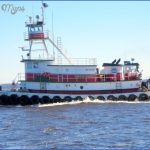
An abandoned tugboat slowly falls to pieces on the Cape Fear River at Wilmington.
Azaleas bloom in the gardens at Orton Plantation on the Cape Fear River.
In the 1720s, rice plantations began sprouting up along the Cape Fear River in the Wilmington region. Nearly thirty were established by the time the Civil War began. By the end of the nineteenth century, however, rice cultivation in North Carolina had been abandoned. Today, most of the old rice fields are unrecognizable and only one of the original plantation houses remains. Orton Plantation, adjacent to Brunswick Town, stands proudly on a sandy bluff overlooking the Cape Fear River. Originally constructed as a one-and-a-half-story structure around 1725, the home has undergone a number of changes, resulting in the magnificent Greek Revival mansion that exists today. The rice fields have also experienced a makeover. At Orton and a few other old plantation sites along the lower Cape Fear, the owners have transformed the former rice fields into prime bird and wildlife sanctuaries. Orton Plantation Gardens is famous for its spring flowers, including spectacular displays of azaleas and camellias. Visitors can tour the gardens at leisure, but the home serves as a private residence for the owners and is closed to the public.
CIRCLING THE CAPE FEAR RIVER Photo Gallery
Maybe You Like Them Too
- The Best Cities To Visit in The World
- World’s 10 Best Places To Visit
- Coolest Countries in the World to Visit
- Travel to Santorini, Greece
- Map of Barbados – Holiday in Barbados

