Hiking Distance: 2-Mile Loop Hiking Time: 1 Hour
Configuration: Loop (With Optional Cut-Across Trail)
Elevation Gain: 100 Feet Difficulty: Easy
Exposure: A Mix Of Open Terrain And Shaded Forest Dogs: Not Allowed
Maps: U.S.G.S. Simi Valley East Rancho Simi Open Space: Corriganville Park
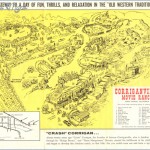
Corriganville Park, At The Eastern End Of Simi Valley, Was An Old Movie Ranch. It Is Named For Ray “Crash” Corrigan, Who Purchased The Ranch In The 1930s. The Area Was The Setting To About A Thousand Movie And Television Shows Between 1937 And 1965, Including The Lone Ranger, Gunsmoke, The Fugitive, Lassie, Mutiny On The Bounty, African Queen, How The West Was Won, And Fort Apache, To Name Just A Few. Old Stone And Concrete Foundations From The Sets Still Remain. The Oak-Shaded Paths Lead Through The 225-Acre Park Past Prominent Sandstone Outcroppings, Cliffs, Caves, A Stream, Jungle Jim Lake, And The Hangin’ Tree, A Towering Oak Used To “Execute” Countless Outlaws.
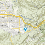
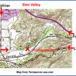
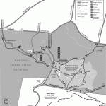
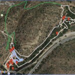
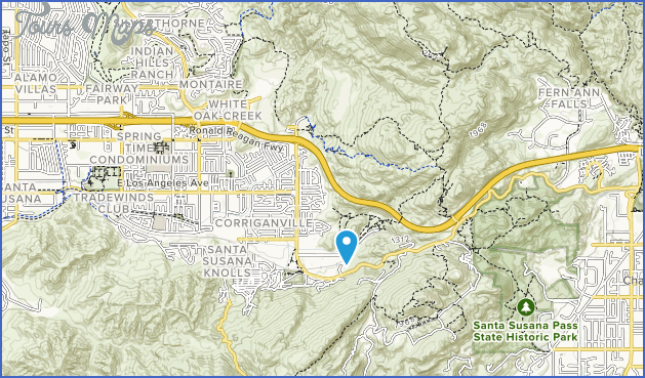
Corriganville Park Map Photo Gallery
To The Trailhead
From Highway 118/Ronald Reagan Freeway In Simi Valley, Exit On Kuehner Drive. Drive 1.1 Mile South To Smith Road And Turn Left. Continue 0.4 Miles Into Corriganville Park And Park On The Left.
The Hike
From The Far East End Of The Parking Lot, Take The Wide Trail Past The Kiosk. The Forested Trail Heads Northeast Up The Draw Past Coast Live Oaks And Sculpted Rock Formations On The Left. Cross A Bridge To A Junction. The Left Fork Crosses A Wooden Bridge, Passes A Pool, And Loops Back For A Shorter Hike. Stay To The Right To The Next Junction. The Right Fork Is A Connector Trail To Rocky Peak Park Via A Concrete Tunnel Under The Freeway. Curve To The Left And Cross The Stream To Another Junction. Both Trails Lead West Back To The Trailhead. The Footpath To The Right Travels Between The Sandstone Cliffs To A Dynamic Overlook And A Junction. The Left Fork Descends To The Old Movie Sets And The Site Of Fort Apache. From The Sets, Cross The Bridge Back To The Parking Lot. I
Hiking Distance: 5-6 Miles Round Trip Hiking Time: 2.5 Hours Configuration: Out-And-Back Elevation Gain: 1,100 Feet Difficulty: Moderate To Strenuous Exposure: Exposed Ridge Dogs: Allowed
Maps: U.S.G.S. Simi Valley East
Rocky Peak Park Is Aptly Named For Dramatic Sandstone Formations, Fractured Boulders, Overhangs, Caves, And Outcroppings. The 4,815-Acre Wilderness Park Is Located In Simi Valley By Santa Susana Pass. The Park Is A Critical Wildlife Habitat Linkage Between The Simi Hills And The Santa Susana Mountains. Rocky Peak Trail Follows A Winding Fire Road On The North Side Of The 118 Freeway To Rocky Peak, Which Lies On The Los Angeles-Ventura County Line. There Are A Series Of Vista Points Along The Route And At The Jagged 2,714-Foot Peak, The Highest Point In The Santa Susan Mountains. The Vista Points Include Top-Of-The-World Views Of The San Fernando Valley, Simi Valley, The Santa Monica Mountains, And The Many Peaks Of The Los Padres National Forest.
To The Trailhead
From Highway 118/Ronald Reagan Freeway In Simi Valley, Exit On Kuehner Drive. Drive 3 Miles South To The Highway 118 East On-Ramp. (Kuehner Drive Becomes Santa Susana Pass Road As It Curves To The East.) Turn Left, Crossing Over The Freeway, And Park 0.1 Mile Ahead At The End Of The Road.
The Hike
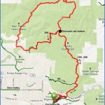
Hike Past The Trailhead Kiosk Up The Winding Fire Road To An Unsigned Trail Split At 0.9 Miles. Stay To The Left On The Main Trail, Hiking Steadily Uphill To A Signed Junction With The Hummingbird Creek Trail On The Left (Hike 151). Proceed Straight Ahead On The Rocky Peak Trail, Which Levels Out. The Winding Trail Offers Alternating Views Of The San Fernando Valley To The East And Simi Valley To The West. At The Base Of The Final Ascent Is A Singular, Large Oak Tree. Begin The Steep Ascent, Gaining 450 Feet In A Half Mile, To The Rocky Peak Cutoff Trail. This Is A Good Turn-Around Spot. However, If You Wish To Hike To The Summit, The Trail Takes Off To The Right Across The Plateau For A Half Mile To Rocky Peak. The Last Section Of The Trail Is A Rock Scramble To The Peak. To Return, Reverse Your Route.
Maybe You Like Them Too
- Top 10 Islands You Can Buy
- Top 10 Underrated Asian Cities 2023
- Top 10 Reasons Upsizing Will Be a Huge Travel Trend
- Top 10 Scuba Diving Destinations
- World’s 10 Best Places To Visit

