Route: Kalo Chorio, Louvaras, Zoopigi, Agios Mamas
Kalo Chorio is known for its commandaria (local sweet wine) and its cooperative winery, established in 1924. The steep-pitched church of Agios Georgios, close to the center of the village, built in 1768 with local stone, is worth visiting. It has recently been restored and includes many interesting portable icons. In a niche on the northern wall is the painting of Agios Georgios. Louvaras has always been a commandaria village, renowned since early days. The traveller can visit Kakomallis, the pine-clad forest which is an extension of Limassol forest. From this mountainous locality the view towards many directions is boundless. Two medieval churches are the treasure of the village: Panagia tis Kyras is a steep-pitched little church with wooden roof. No painting is preserved in this architecturally beautiful building. In the church of Agios Mamas, however, the visitor will have to spend some time. It is built with local stone, while its roof has recently been restored. The beam which runs across the church is beautifully carved and painted. The sanctum as well as the main church are decorated with frescoes of a brilliant Byzantine art. On the upper part of the west door an inscription with the date 1455, when the church was built and painted, is preserved. The donors of the church are shown on the fresco. Three tiers of frescoes are distinguished. The lower tier exhibits Saints who appear in large size. The upper two tiers exhibit smaller frescoes. Among the large sized paintings one can see the fresco of Agios Mamas, seated on a lion. Other paintings are the Crucifixion, the Dormition of the Virgin Mary, the Last Supper and the Washing of the Feet. The fresco of the Betrayal shows the army seizing Christ and not the crowd. Another noteworthy fresco is that of Pistis, Elpis and Agapi (Faith, Hope and Love) with Sofia (Wisdom) close to the left of the west door. On the iconostasis stand only two portable icons, with the rest of them being transported elsewhere or being worn out. In this medieval church of the 15th century, the visitor will not fail to discern the transformation of Byzantine art in Cyprus under the influence of the Italian rennaissance. Zoopigi is renowned for its commandaria as well as for its cooperative wine factory. Apart from the church of Agia Marina, built in the 18th century, which functioned as school till 1930, another church, that of Zoodochos Pigi, stands in the settlement. Zoodochos Pigi is a single-aisled, timber roofed church, most probably originally painted, judging from the remains of frescoes. It was built at the end of the 15th or beginning of the 16th century. Agios Mamas. The picnic site of Agios Mamas, set up at Agios Georgios Finitzou, is furnished with abundant water. A tradition says that the original settlement was that of Finitzia, at the locality where the church of Agios Georgios is currently situated. In the present settlement of Agios Mamas there lived “Arabs”, black in appearance, who might have arrived here during an Arab raid. A resident of Finitzia saw in his sleep Agios Mamas who urged him to build a church at the present locality of the church of Agios Mamas. He was hesitant to proceed to the building of the church, since the village was inhabited by people of a different religion. However, the recurring appearance of the Saint forced him to build the church. Subsequently a plague fell on the village, killing all foreigners. Once the Arabs ceased to be permanent residents of the village, the Christians from Finitzia transferred the icon of Agios Mamas to the new church where they built the village of Agios Mamas.
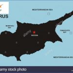
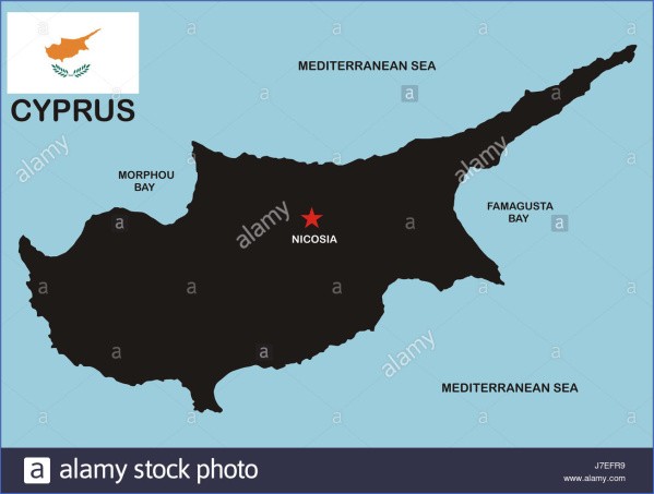
Cyprus Map And Flag Photo Gallery
c) Villages at a small distance from Limassol town
Route: Palodeia, Paramytha, Spitali, Gerasa, Monastery of Panagia
Amirou at Apsiou, Fasoula, Mathikoloni
Palodeia has attracted investors who built country houses around the settlement. West of Palodeia, a few metres from the main road to Troodos, the monastery of Evangelistria hosts a dozen nuns, believers of the old calendar. Paramytha. It appears that the old road from Limassol to Pitsilia passed through Paramytha where an old khan, now restored, lies. A part of the cobbled road is still visible on the landscape of Paramytha. Close by, there is a pottery where visitors can buy artifacts of Lapithos village pottery, well known throughout Cyprus. Besides, in the center of the village a local industry deals with aromatic plants, like wild thyme, sage, origanum, etc. Spitali. The numerous Roman tombs excavated in the village testify its long history. Roman tombstones are located at the entrance to the church of Agia Anna and the cemetery. Even a Roman sarcophagus and a pierced stone are located close by.
Besides, at the village one can see remnants of the overhead railway that carried asbestos from Amiantos to Limassol. Gerasa, situated on the bank of Garyllis, is characterized by stone-built houses of traditional architecture. The route towards Gerasa, particularly along the Garyllis valley, with the slopes of the mountain falling vertically and dressed in rich natural vegetation, is pleasant and impressive.
Cyprus Flag and Description
Panagia Amirou monastery, Apsiou
Monastery of Panagia Amirou at Apsiou. You have to travel at least 2km east of Apsiou before you reach the old monastery of Panagia Amirou. The cells of the old monastery have been destroyed and many other buildings are no more standing. The date the monastery was built and who the founder was are details unknown till now. However, for the name of the church and the monastery there are two interpretations. According to a tradition, a rich man, possibly from the Middle East, was travelling to Europe to meet eminent doctors who could cure the blindness of his daughter. Somewhere close to present-day Amathous his daughter saw a bright light coming from the locality of the monastery of Amirou. The rich man, guided by the villagers, proceeded with his daughter towards the light on the hills. They found the holy well and they washed their face. Immediately the daughter’s sight was restored. The rich man, called Amaril, in gratitude, built the monastery which is called after his name. The second interpretation, according to a different tradition, says that all the area, where the monastery lies, belonged to an aristocratic family from Smyrni called Amirou. It is from this name that the church obtained its name. The 16th century church is single-aisled, vaulted with two entries, west and south. Most probably the north door was closed during some construction works, while the west door is Venetian in style. The gilted iconostasis is of the 17th century, while the doors are dated 1647. The chief interest lies in a few portable icons. Since the end of the 18th century the monastery with its property was rented to stockbreeders who gradually neglected it. The monastery has recently been restored and it has been converted into a functional monastery. Fasoula. On top of Kastros, a conspicuous hill in Fasoula, there stood in ancient times a temple dedicated to Zeus Lavranius. On top of the hill, known as Moutti tou Dkia, inscriptions dedicated to Zeus were found. They belong to the Roman period, a fact testifying that the area was inhabited in those years. In 1992 excavations commenced on top of Kastros to discover the temple of Lavranios Zeus. Another noteworthy monument is the underground tomb where the carved sarcophagus of saints Reginos and Orestis is found. Gunnis considers that the sarcophagus is Byzantine, dates back to the 5th century A.D., and in it Agios Reginos, Archbishop of Cyprus, was buried. In September 1993 part of the bones of Agios Reginos, kept in a Nicosia church, were given to the community in a silver reliquary by the Archbishop of Cyprus. According to a local tradition, by order of the Roman Emperor, Reginos and Orestis were thrown into the sea where they were saved by two dolphins. They finally arrived at Fasoula where they preached Christianity. They were sentenced by pagans, poisoned and finally beheaded. Mathikoloni is a village that belonged to the Grand Commandery. Tradition says that the village was made up of seven quarters with seven churches corresponding to each quarter. Along the stream that dissects the village one encounters a rich riverine natural vegetation as well as two old water- mills.
d) Following the Apesia-Kapileio route
Route: Apesia, Korfi, Limnatis, Kapileio
Limnatis, the village of almond-trees
Most probably Apesia is the ancient Apesos, established many years ago by the inhabitants of Asia Minor. Many tombstones, with Greek inscriptions, lie in the courtyard of the parish church and the elementary school, a real testimony of the village’s ancient history. Cypriots as well as foreigners have built villas on the slopes of the village. Monte Korfi complex on the main road to Apesia lies in the administrative boundaries of the village. Korfi. The old settlement with traditional homes is currently ruined, while the new one is a planned settlement. The landslides of 1969 forced the Government to remove the old village to its present position. Limnatis, situated on the left bank of the homonymous river, is the village of almond trees. The village is very attractive during harvest time. The whole family is in the field either knocking at the ripe almonds to fall or filling plastic sacks with almonds. A centuries-old pistachia in the settlement with a thick trunk still offers its shade to the villagers. Kapileio, well-known as the village of early peaches, stands on a hill with an extensive view towards the forest and the valley of Limnatis. Some old cobbled streets impress, while the church of Agios Georgios lying on a conspicuous site is noteworthy. It is steep-pitched with timber roof and beams inside. A women’s gallery and a gilted iconostasis with some old portable icons are preserved. At a small distance from the village on the bank of Limnatis, close to a water-mill, stands an arched chapel dedicated to Panagia Ampeliotissa of the 15th century, with six niches in the interior and traces of frescoes.
Cyprus Map / Geography of Cyprus / Map of Cyprus
HILLY AREAS WEST AND NORTH-WEST OF LIMASSOL
a) Following the Kouris valley
Route: Alassa, Doros, Laneia, Trimiklini, Kouka
The modern settlement of Alassa was built north of the original, now covered by the Kouris dam. Significant findings have been unearthed at the locality Pano Mantilaris, where a Roman villa of the 5th century A.D. with its complex of baths lay. Besides, rooms with mosaic floors have also been unearthed. Another archaeological site of the Late Bronze Age (1650-1050 B.C.) at Paliotaverna, is still being excavated. Here relics of copper processing and equipment have been found. The foundations of two large buildings with hewn limestone blocks have been unearthed as well. Most probably these buildings belong to a settlement that flourished at the end of the Late Bronze Age. The traveller can rest at a restaurant, in the new village, from where a beautiful view can be enjoyed.
Maybe You Like Them Too
- Top 10 Islands You Can Buy
- Top 10 Underrated Asian Cities 2023
- Top 10 Reasons Upsizing Will Be a Huge Travel Trend
- Top 10 Scuba Diving Destinations
- World’s 10 Best Places To Visit

