County: Finnmark fylke.
Altitude: sea level. Population: 7600.
Postal code: N-9600. Telephone code: 0 84.
RSdhusplassen; tel. 1 21 85.
HOTELS. Grand Rica Hotel, 120 Finnmarksbo Gjestehus, 36 b.: BrassicaLarsens Gjestgiveri, 31 b. YOUTH HOSTEL Two CAMP SITES.
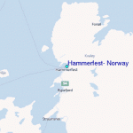
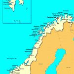
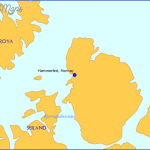
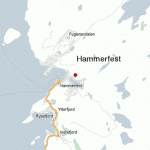
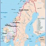
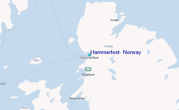
The busy Norwegian port of Hammerfest, the most northerly town in Europe (lat. 7039’48 N, long. 23°40′ E), lies on the W side of the island of Kval0y (area 339 sq. km 130 sq. miles). The sun does not set here between 17 May and 28 July and does not rise from 21 November to 23 January.
Long an important commercial and fishing port because of its sheltered and ice-free harbour, Hammerfest received its municipal charter in 1789. The town was bombarded by the British fleet in 1809, almost totally destroyed by fire in 1890 and razed to the ground by the Germans in October 1944 after the compulsory evacuation of the population. Only the cemetery chapel was left standing after the Second World War, but the people of Hammerfest soon rebuilttheirtown on the narrow strip of land between the Salen hills and the sea. Visitors will be struck by
Hammerfest afterthe war by an Austrian who had been a prisoner of war in Narvik. Farther along, also on the right, is the school (1 961). The , road continues around the bay to the promontory of Fugenes, with an interesting granite column topped by a bronze globe. This is the Meridianst<>tte, erected to commemorate the completion of a joint Norwegian-Swedish-Russian survey (1816-52) to determine the size and shape of the earth. Its southern counterpart was set up at Ismail, 2872 km | (1785 miles) away at the mouth of one of 2. the arms ofthe Danube. The concrete slab m beside it was erected during a further | survey in 1929. From here there is a fine = view of the town and the hills rising immediately behind it.
Hammerfest is the base of Norway’s Arctic fishing fleet. It has a large fish-processing industry and a fishery college. The town also caters for increasing numbers of visitors.
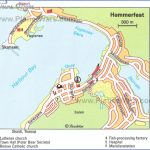
SIGHTS. In the Market Square is the Town Hall (1957), where visitors can become members of the Royal and Ancient Society of Polar Bears upon payment of a single membership fee. This helps finance the building of a museum, and visitors receive a certificate of membership in return for their contribution. In the square is a bust ofthe composer Ole Olsen (1850-1927), a native of Hammerfest. From here Storgate runs N to the berths used by the ships of the Hurtig-rute and by local shipping. To the Wof the market square, in Kirkegata, is the Lutheran Church (1 961), an impressive example of modern architecture. The church, like most of the new churches in the north, has been built to remind one of a Lapp tent. It has no altar; in the tentshaped gable a large and very beautiful stained glass window by Jardar Lunde (1962) has been placed as a focus for worship instead. Concerts are given in the church every evening in summer. Close by stands the little wooden chapel which survived the Second World War.
Strandgata runs NE from the market square, passing on the right the small Catholic Church (1958), mostly built by German volunteers. The cross was carved
SURROUNDINGS. From the market square a footpath leads in 20 minutes to the ridge of hills at the end of the town, Salen (the ”Saddle”: 86 m 282 ft), which can also be reached on a road running W of the town past the little lake of Storvatn (camp site, usually solidly ice-bound until May). From the hill to the W, marked by a stone, there are extensive views of the open sea. On the southern outskirts of the town is the Jansvatn, an open-airswimming pool, and 1 km (f mile) beyond this is the most northerly stretch of woodland in the world. The road continues to Skaidi. To the left is a view of Tyven (419 m (1375 ft): climbed from Hammerfest in 1 hours); from the summit there are views to the E of the barren island with its many lakes, to the S and W of the hills with their snowfields and their glaciers, to the N of the infinite expanse of the Arctic Ocean.
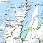
EXCURSION TO THE NORTH CAPE. An attractive alternative to the land route to the North Cape ( 200) is a trip by sea or by a combination of boat and bus. The fast ships of the ”Hurtigrute” leave Hammerfest daily at 5.15 a.m. and reach Honningsvag at 11.30 a.m. From there a bus leaves for the North Cape (1 hour) at 12.45, returning to Honningsvag at 2.45 p.m. A bus leaves Honningsvag for Hammerfest at 5 p.m. arriving at 9.30 p.m. The return boat does not leave Honningsvag until the following morning at 5.45, arriving in Hammerfest at midday.
Timetables and fares, and the possibility of special excursions, should be checked with a tourist information office, travel agency or shipping line. Sturdy footwear and warm clothing are essential, even if the weather on departure from Hammerfest is warm.
There are also charter flights from Hammerfest to the North Cape.
The ‘Troll’s Tongue on the Tysseh0fjell with a view across the Ringedalsvann to the Folgefonn.
Beyond Norheimsund E68 leaves the fjord and traverses the gentler scenery of the Steinsdal. In 2-5 km (1J miles) it comes to the Steinsdalsfoss or Ovsthusfoss (on right), a beautiful waterfall on the Fosselva. It is possible to walk behind the 30 m (100 ft) wall of water. Then a magnificent stretch of road (3 km
2 miles) up the wild gorge (many bends, four tunnels, steep rock walls) of Tokag-jelet. E68 then continues to Bergen (85 km (53 miles): 63).
It is not necessary to leave the Hardanger-fjord at Norheimsund. Other possibilities are to follow the fjord to Mundheim and from there either continue via Eikeland-sosen and Tysse to Bergen (an additional 56 km 35 miles), or via Eikelandsosen to Fusa, from there to Hattvik by ferry and then by road to Bergen (an additional 20 km 12 miles).
From Norheimsund the road runs along the W side of the fjord to the village of Vikey (4 km 2J miles), then another 4 km (2J miles) to the farms of Ystheim and Vangdal (rock carvings of boats and animals). 3 km (2 miles): on ‘ight, the farm of Berge, with a large stand of oaks (a tree rare in Norway). To the right is a view of Vesoldo (1046 m 3432 ft). 2 km (1i miles) farther on lies the village of Torvikbygd, with a car ferry to Jondal (1 5 minutes). 5 km (3 miles) S is the farm of Ljones (at Vikingnes, 1 km (J mile) E, large burial mounds. 8 km (5 miles): Fosse, with beautiful views of Vesoldo to the NE, the Folgefonn across the fjord to the E and the Hardangerjokul to the N. 2 km (1 miles) Strande-barm, on the bay of the same name, with beautiful beaches. There was formerly a flourishing boatbuilding industry in this area, but now only a few craftsmen are still making the local type of boat, the Strandebarmer. The village church dates from 1876. The road then continues via Oma to Mundheim, where it joins Road 13 coming from the S.
Road 13 now turns away from the shore of the fjord and runs NW to Holdhus (12 km (7imiles); alt. 130 m 427 ft), with a chapel (fine interior) which is believed to date from 1726. 6 km (4 miles) beyond this is Eikelandsosen (pop. 600; camp site). Just before the village is the Koldedalsfoss. Here Road 13 bears right to Tysse, while Road 552 runs along the
S side of the Eikelandsfjord to Fusa, from which there is a ferry (20 minutes) to Hattvik. Then via Oseyra and Syftelandto Bergen.
Many islands lie off the shores of the Hardangerfjord. It is well worth visiting one or two of them.
From Kvanndal, at the mouth of the Granvinfjord, there is a ferry across the Utnefjord to Utne (not all boats) and Kinsarvik (Kinsarvik Fjord Hotel, 140 b.), at the mouth ofthe Sorfjord, which is given a particular charm by the contrast between the gentle landscape on the shores of the fjord and the wild and rugged mountain scenery which encloses it. The mild climate favours the growing of fruit, and there are abundant cherry and apple trees, particularly in the lower and middle areas of the fjord. Road 47 runs S for some 40 km (25 miles) along the eastern shore of the fjord. In 10 km (6 miles) it comes to Lofthus (Ullensvang Turisthotell, 250 camp site), one of the most beautiful spots in the Hardanger, with a high school and an experimental fruit-growing farm. To the S is the 13th c. parish church of Ullensvang (restored 1884 and 1958). The road continues along the fjord through attractive country filled with fruit orchards, at its most beautiful when the trees are in blossom (end of May). Above the W side of the fjord rises the great Folgefonn glacier (34 km (21 miles) long, up to 6 km (10 miles) across, highest point 1654 m 5727 ft). 26 km (16 miles):7Vssec9 (pop. 1300; Tyssedal Hotel), at the mouth of the valley of that name (beautiful falls on the Tyssa), has an aluminium factory and a large hydroelectric station which produces power for the region’s industry; chapel (1965).-The road passes through a tunnel 1520 m (1650 yds) long and comes in 6 km (4 miles) to Odda (pop. 1 0,000; Hardanger Hotel, 82 Sorfjord-heimen Pensjonat, 55 b.), a sizeable industrial town at the S end of the Sorfjord. 1 6 km (10 miles) S, on a road which runs past the Sandvinvatnet, is the Latefoss, a mighty waterfall 1 64 m (540 ft) high.
From Odda a narrower road (No. 550) leads N between the Folgefonn glacier and the W shore of the fjord, coming in 29 km (18 miles) to the little village of Aga, with an open-air museum (Agatunet) in the form of a well-preserved peasant settlement of 30-40 buildings clustered around an old courthouse. 16 km (10 miles) farther N is Utne (Utne Hotel, 46 b.), with a fine cruciform church of 1858 containing furnishings from an earlier medieval church; and Hardanger Folke-museum. From Utne there are ferry connections with Kvanndal and Kinsarvik.
From Kinsarvik Road 7 runs NE along the side of the steep-sided Eidfjord, the most easterly branch of the Hardangerfjord. 1 8 km (11 miles): Brimnes, from which there is a ferry service in summer (recommended when Kinsarvik is busy) over the Eidfjord to Bruravik. 11 km (7 miles) beyond this lies the village of Eidfjord (Voringfoss Hotell, 102 b.), majestically located at the S end of the fjord. Above the northern shore of the fjord rises the snow-covered peak of Onen (1621 m 5319 ft).
Hammerfest Norway Map Photo Gallery
Maybe You Like Them Too
- The Best Cities To Visit in The World
- World’s 10 Best Places To Visit
- Coolest Countries in the World to Visit
- Travel to Santorini, Greece
- Map of Barbados – Holiday in Barbados

