JEFFERSON NATIONAL FOREST MAP VIRGINIA
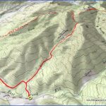
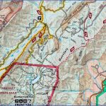
Consisting of a number of separate tracts, Jefferson National Forest sprawls across a large region of the Blue Ridge Mountains in west-central Virginia. It’s an area of many sizable mountains and rocky ridges, with wonderful views.
Of special interest is the 154,000-acre Mount Rogers National Recreation Area, which encloses some of the forest’s finest scenery. Highest point in the state, 5,729-foot Mount Rogers, is located here. Other notable mountains include 5,530-foot White Top Mountain and 5,526-foot Pine Mountain.
There are some balds (grassy-topped mountains) as well as a profusion of streams and waterfallsalong with mixed forests of hardwoods, with spruce and fir at higher elevations, plus dogwood and rhododendron. Among the wildlife are bear, white-tailed deer, and red fox.
The National Forest has a number of designated wilderness areas: the 8,703-acre James River Face
Wilderness, the 8,253-acre Mountain Lake Wilderness, the 6,375-acre Beartown Wilderness, the 5,730-acre Lewis Fork Wilderness, and several smaller wilderness areas.
Activities: Backpacking and hiking are available on more than 900 miles of trails, including over 300 miles of the Appalachian Trail (see entry page 287). Difficulty ranges from easy to strenuous.
Horseback riding is possible on some trails, including the 68-mile Virginia Highlands Horse Trail, the 40-mile Iron Mountain Trail (a previous route of the Appalachian Trail) and the 34-mile Virginia Creeper National Recreation Trail.
I Some trails outside of wilderness areas are open to mountain biking. Cross-country skiing is a winter option at higher elevations. Fishing is also available. Hunting is permitted in season.
Camping Regulations: Camping and campfires are allowed throughout the National Forest, except near public use areas or where otherwise prohibited. No permits are required.
A Virginia law specifies that campfires may be made only from 4 p.m. to midnight each day between March 1 and May 15. Low-impact camping practices are strongly recommended.
For Further Information: Jefferson National Forest, 210 Franklin Road, S.W., Roanoke, VA 24001; (703)982-6270.
JEFFERSON NATIONAL FOREST MAP VIRGINIA Photo Gallery
Maybe You Like Them Too
- Arnold A Town with a Heart
- The Best Cities To Visit in The World
- World’s 10 Best Places To Visit
- Map of New York City – New York City Guide And Statistics
- Map of San Francisco – San Francisco Map Free

