County: Buskerud fylke.
Altitude: 170 m (558 ft). Population: 20,000.
Postal code: N-3600. Telephone code: 03. Turistkontor,
Storgate 36; tel. 73 15 26.
HOTELS. Grand, 166 Gyldenlove, 59 Norge,
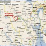
Kongsberg owes its foundation and early prosperity to the nearby silver-mines, which began to be worked in 1624, during the reign of Christian IV, and remained open until 1957. The town the third oldest in Norway after Trondheim and Bergen lies astride the River Ldgen,
Kongsberg from the Funkelia chair-lift which here flows over a series of rapids, in the southern Numedal.
SIGHTS. On the right bank of the river is the Market Square, with a large wooden church (1741-61: fine organ, church plate). To the N of the church stands a monument to Christian IV. In Hyttegate, to the E of the church, is a small Silver-Mine Museum. On the other bank of the river, here spanned by the Nybro, is the Lagdal Museum, with antiquities from the surrounding area. 7 km (4i miles) S of the town are the old Silver-Mines (conducted tours). The Kongensgrube (King’s Mine) at Saggrenda penetrates into the hillside for a distance of 2300 m 1i miles (mine railway).
SURROUNDINGS. Going past the old silver-mines and continuing W on E76, we reach the Heddal; then via Notodden (pop. 9000) to the Heddal stave church (38 km (24 miles): 266).
There is a very attractive trip along the Numedal to Geilo. The valley, which offers particularly fine scenery in its upper reaches, is traversed by the Lagen, coming down from the central Hardangervidda ( 124). Leave Kongsberg on Road 8, going N. Beyond Flesberg (31 km 20 miles) the valley narrows. At Djupdal station (46 km 29 miles) the road crosses the L§gen, here flowing through a deep gorge, and continues past the old church of Rollag and beyond this the Mykstufoss power station.
At Rodberg are the Nore I and II power stations, supplied by two lakes in a side valley, the Paisbufjord and the Tunnhovdfjord. Shortly before Vasstuen the road reaches its highest point (1100 m 3610 ft). To the left is the Sigridfjell (1231 m 4039 ft). After going over two further heights the road comes to Geilo, in the Ustadal (Bardola Hoyfjellshotell, 180 Highland Hotel, 174 Geilo Hotell, 145 Holms, 120 Geilo Hoyfjellspensjonat, 32 youth hostel; camp site), a popular vacation and winter sports resort (several ski-lifts). A chair-lift serves the Geilohoyda (1056 m (3465 ft): restaurant at upper station). To the NW is the Prestholtskarv (1857 m (6093 ft): road to 1350 m-4430 ft).
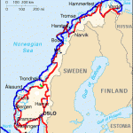
Kongsberg Norway Map Photo Gallery
Maybe You Like Them Too
- The Best Cities To Visit in The World
- World’s 10 Best Places To Visit
- Coolest Countries in the World to Visit
- Travel to Santorini, Greece
- Map of Barbados – Holiday in Barbados

