Relics from the Sanctuary of Aphrodite, Kouklia The Lusignan Manor House. This is a 13th c.A.D building, used as the manor house of the Lusignans, who established sugar-cane plantations in the fertile land between the sea and the present-day settlement. Its history is tied up with adventures. In 1426 A.D. it faced the attack of Mamelukes who caused considerable damage to the building. The Turks later on transformed the original edifice into stables for camels and animals. The south sector was recently restored with impressive stone arches in front of a narrow corridor. The remains of the original chateau lie in the eastern section where a large Gothic chamber with long narrow skylights is found. This chateau is regarded as one of the most beautiful remnants of Frankish architecture in Cyprus. The original square shape of the medieval building is preserved, though changes brought about helped to house the Museum of Kouklia as well as the staff of the archaeological expeditions which still work at Kouklia. From the first floor of the building the visitor can observe the plain where sugarcane was cultivated for almost five centuries, up to the 16th century. Almost all the production of sugar from Pafos and Limassol was exported mainly to Venice. Immediately after the 16th century and particularly after the conquest of Cyprus by the Turks in 1571, sugar-cane was replaced by cotton and silk, while later the area was totally abandoned and deserted. Recent excavations of the Swiss-German Archaeological Expedition unearthed the sugar-cane refinery, west of present-day settlement, at the locality “Stavros”. One of the sugar -mills functioned with the help of animal power, while the other one by running water. The rooms of the factory, where pots were washed and cleaned, were also unearthed. Thousands of conical pots were discovered, though similar pots were also found close to the temple of Aphrodite. It appears that the initial stage of sugar refining was done close to the mills, while more refined procedure was performed at a different spot close to the temple of Aphrodite. (iii) The Museum. In the chambers of the Manor House the visitor can observe rich samples of ceramic, inscriptions in Cyprosyllabic script on marble as well as on limestone, capitals, swords, mosaics, statuettes, clay lamps, clay idols, Mycenean stone instruments and many other findings from the wider area of Palaepafos. (iv) The church of Katholiki is a medieval building which served the Latin community. It dates back to the 12th century, though its western section was restored in the 16th century.
Conical stone serving as cult idol in the Sanctuary of Aprhodite
Currently, the church is long and single-aisled with dome. In essence the visitor sees a cruciform church and an arched sector extending west. Stones from the temple were used for the building of the church, judging from the inscription on some hewn limestone blocks. Most probably none of the original 12th century frescoes are preserved. On the contrary, what the visitor observes are traces of the 16th century paintings. One can discern Pantokrator, on the dome with traces of paintings around, Agios Therapon right of the iconostasis, the rivers Tigris and Euphrates on the west wall depicted as heads with streams of water issuing from the mouths, traces of Agios Georgios, etc. In 1993 the church was restored by the Department of Antiquities. (v) Encleistra. About 3,5km north of the settlement, at the base of a deep valley there is a rock-hewn cave, known as encleistra. It is not ascertained whether this has been the first choice of St Neofytos before choosing his encleistra at Tala (Agios Neofytos monastery). A few frescoes are preserved in the cave. (vi) Pierced stones. Noteworthy is the monument of the two pierced stones, at the locality Styllarka, in the area of the Kouklia chiftlik. Until recently the stones were considered to be associated with the worship of Aphrodite. They were visited by barren women and girls who had lost their lovers. It has recently been proved that they were olive presses. The visitor will be able to observe, on spot, the two stones with the little reservoirs at their base, where olive oil was collected. To the east of Kouklia, in the valley of Chapotami, lies the Secret Valley Golf Club in a fascinating setting attracting golfers from all over Pafos district.
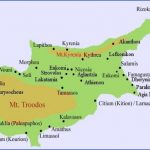
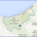
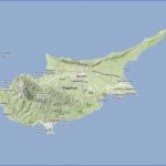
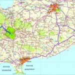
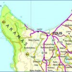
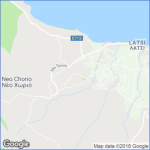
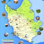
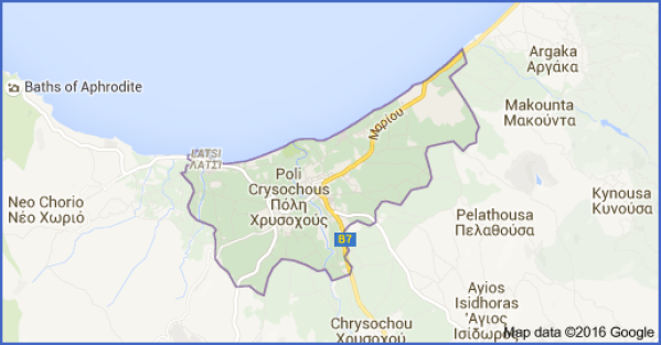
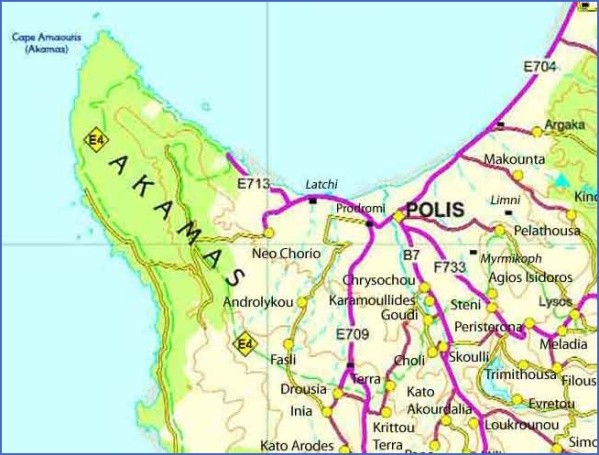
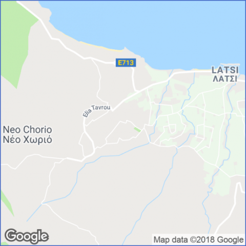
Polis Chrysochous Map: Detailed maps for the city of Polis
EXPLORING THE CHRYSOCHOU AREA
Somewhere in the middle of Chrysochou bay and between the Pafos forest on the right and the Akamas peninsula on the left, lies a small ancient town which was built thousands of years ago. Today it is called Polis, in the Hellenistic and medieval times it was called Arsinoe and in ancient times it was known as Mario. Polis, currently sparsely-populated, remained a large farming village for centuries, whilst its trading activities were rather limited, involving non-agricultural activities with the Limni mine, which has now ceased to operate. Today it is engaged in tourism, offering its almost unlimited sandy and pebbled beaches to the holiday makers. The three churches of Apostolos Andreas, Agios Nikolaos and Agia
Kyriaki, the modern schools of Higher Education, the stadium and hospital, next to the general stores and special shops, and the public services, offer the visitor a picture of a small town. Systematic archaeological excavations have unearthed a 6th-century basilica, near the town’s hospital. Opposite the hospital and a few metres to the right, remains of the Hellenistic period were discovered, while a few metres further east a 5th c.B.C. temple has been found. Undoubtedly we shall learn a lot more, including the line of the ancient wall of the town, as the excavations continue. The discovery of ancient Mario, the town’s relations with the rest of the Greek world and the trade transactions of ancient Mario with Greece will throw light on the history of the town. Perhaps the armour Kinyras gave to Agamemnon was made of copper produced near Mario. Today, to the east of Polis, left of the road to Limni, there is mine waste, an indication that copper was smelted in ancient times. Historians also mention that Mario was conquered in 449 B.C. by Kimon and that the last king of the town was Stasiikos II. Ptolemy demolished and destroyed the town because it was an ally of Antigonos, his opponent. King Stasiikos was killed and his subjects were transferred to Pafos in 312 B.C. Thus, on the foundations of ancient Mario, Arsinoe was later created, after the name of Ptolemy Philadelfos’ sister. With Christianity spreading in Cyprus, Arsinoe acquired a bishopric and, during Frankish times, the seat of the Pafos bishopric was transferred to Arsinoe. Archaeological work at the mosque of Polis, has revealed that the arched Byzantine church of Agios Andronikos, entirely painted with 15th and 16th c paintings, was converted into a mosque immediately after the conquest of Cyprus by the Turks in 1571. The visitor can now observe and admire impressive paintings, on the walls which, had been whitewashed by the Turks.
Central square of Polis
The central square of Polis has been renovated with paved limestone slabs, while the colourful tents outside the cafes, the restaurants and other shops attract tourists and passers-by. Camping site. North of Polis settlement, on forest land, a remarkable camping site has been functioning since 1980. It has a capacity of 250 caravans or tents and it can accommodate up to 750 people. It offers all facilities to the holidaymakers. The beach next to the camping site has a width of about 20 metres and consists of small and large pebbles. The archaeological museum of Polis, comprising rich findings from the area is worth-visiting. The visitor can admire the archaeological wealth of ancient Mario and Arsinoe. Nevertheless the museum is constantly improving, being enriched with new findings from the area. Chrysochou. Chrysochou, a Turkish-Cypriot village, was originally Greek-Cypriot, as one can judge from the church turned into a mosque after the Turkish occupation in the 16th century. Karamoullides. The village existed before the Turkish occupation of Cyprus in 1571, under the name Kalamoulli. Goudi. The settlement consists of a mixture of modern and traditional houses, while a modern olive press serves not only the villagers but also the olive producers of the nearby villages. Choli. The medieval church of Archangelos Michail, is a vaulted, single-aisled building recently restored. The frescoes, however, date from the 15th or the 16th century, even though a great number, probably the most representative of them, are damaged. The frescoes in the northern section of the church refer to the life of the Virgin Mary, with one row depicting Joachim and Anna. In the southern section they depict scenes from the New Testament. The Crucifixion is one of the best preserved frescoes, showing the Virgin and John in deep sorrow next to Crucified Christ. On the Polis-Stroumpi road, just 6km away from Polis, lies Skoulli, all green in natural and cultivated vegetation. The church of Agios Kournoutas does not exist any more, but the place-name is well known. However, the church of Agios Andronikos is well preserved. It is arched with two stone zones inside and an inscription that dates back to 1716, probably the date it was built or restored. Agios Andronikos is the last relic of Kerepin or Tzerapin, the settlement that disappeared during the last century. Currently, Skoulli hosts the Reptiles Museum, which attracts a considerable number of visitors.
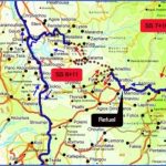
Map of Chrysochou – Michelin Chrysochou Map Photo Gallery
b) Hilly areas west of Chrysochou valley
Route: Kato Akourdaleia, Pano Akourdaleia, Loukrounou, Miliou,
Agioi Anargyroi Monastery, Giolou
Museum of Folk Art, K. Akourdaleia
Kato Akourdaleia. Kato Akourdaleia is a village rich in traditional architecture. In the village’s Museum of Folk Art are housed traditional treasures inherited from previous generations. The church of Agia Paraskevi is of cruciform style with a dome, originally full of frescoes. It maintains its skylights and some worn out frescoes. Part of an icon which can be seen in the church may be quite old. In the village a tradition is preserved about Rigaina and Digenis. Digenis had his home at the locality “Digenies”, while the Queen lived at Tsouvlitzin. When the church of Agia Aikaterini was being built, there was no water and the builders, according to tradition, made mud using milk. Digenis wished to marry Rigaina but she was not interested and, in order to put him off, she asked for something which, according to her, was impossible. She asked him to dig a ditch from his residence so that water could be transferred to her home. Digenis dug the ditch but the Queen, in order to escape him, fled from her home and went to the bay of Chrysochou. Digenis is said to have thrown two rocks at her, which missed their target. These rocks known, as Digenis’ Rocks, are still to be found near the farm of Dkio Potamoi, next to the Baths of Aphrodite. The same story is told in Kritou Tera. Pano Akourdaleia. The houses in P. Akourdaleia are traditional, built with hewn limestone blocks. The damaged church of Panagia Chryseleousa, in the center of the village, dates back to the 16th century. The church was originally full of frescoes but they are currently worn out. An earthen road connects Pano Akourdaleia with Kathikas and the rest of the Laona plateau. The settement of Loukrounou is now deserted. Miliou. Most of the houses are traditional, built with hewn limestone and surrounded by flowered gardens. Apart from the few inhabitants who are farmers, there are two well-established weavers. Some houses have been restored either to be used by the owners themselves or to be rented out. On one of the village slopes lie the remains of the medieval monastery of Agios Fotios. According to tradition, this monastery had 70 monks, while Agioi Anargyroi monastery was its annex. The three-aisled church was destroyed in 1934 along with all its frescoes. The Monastery of Agioi Anargyroi, built in 1649, west of Chrysochou valley, between the villages of Giolou and Miliou, is the center of a spa. It is one of the 79 monasteries mentioned by Kyprianos, most of which were functioning during the Turkish rule. The modern single-aisled, arched church, which has obviously been restored a number of times, maintains the original thick walls and some old, portable icons. The decline and final abandonment of the monastery must have come around the middle or towards the end of the 19th century. The bishop of Pafos, Iakovos Antzoulatos, restored the monastery in 1922 at the expense of the bishopric, adding new rooms. It was then that chemical tests were carried out on its sulphur waters and their therapeutic quality was discovered.
Agioi Anargyroi Monastery, currently Agioi Anargyroi spa
From the early part of the present century, Agioi Anargyroi was either used as a monastery or was hired out and used for therapeutic purposes. Until a few years ago it was used once again by nuns from Greece and Cyprus, but it has now been bought and the nuns’ quarters have been transformed into baths. It is not known how the monastery came to be identified with the names of Agios Cosmas and Damianos, known as Agioi Anargyroi. According to tradition, they were brothers practising as doctors, who did not accept payment from their patients. Perhaps the therapeutic springs next to the monastery and the free treatment given to the patients explains the name it was given. Nevertheless, there is a myth about this monastery, widely spread among the inhabitants of the surrounding villages. According to this tradition, many years ago a number of monks lived in the monastery. One day they argued among themselves and they not only used sticks and stones in their dispute but also eggs from the cellar, because it was during the period of Lent. As a result of the argument, the eggs broke and the water from the springs took the smell of rotten eggs. The tests carried out on the sulphur waters of the springs showed them to be effective for the treatment of bone problems, rheumatism, skin diseases and digestive disorders. Besides, a swimming pool has recently been set up in the garden of the hotel. Giolou. The modern church of Chryseleousa, built in a new architectural style, is a jewel for the village. The old church, which bears the same name, built in the 18th century, contains an icon of the Virgin Mary which was painted in the 17th century. It is said that this icon was originally in the church of Peristerona village but a peasant from Giolou dreamt one night that the neighbouring village was on fire. He managed to save the icon which he brought to Giolou. This huge icon of the Virgin Mary is rain compelling, taken by farmers round the fields in times of drought.
Maybe You Like Them Too
- Top 10 Islands You Can Buy
- Top 10 Underrated Asian Cities 2023
- Top 10 Reasons Upsizing Will Be a Huge Travel Trend
- Top 10 Scuba Diving Destinations
- World’s 10 Best Places To Visit

