c) Hilly areas east of Chrysochou valley
Route: Mirmikofou, Agios Isidoros, Steni, Peristerona, Meladeia, Lysos, Agios Merkourios, Melandra, Zacharia, Filousa,
Tremithousa, Kios, Sarama, Evretou.
Lysos, Cryseleousa church
Tobacco cultivations in the Chrysochou valley
Mirmikofou has been a deserted settlement since the forties. Gunnis refers to a medieval church with mural paintings. Agios Isidoros is an abandoned settlement north-west of Steni. Steni. Though written witnesses of the medieval history of Steni are non-existent, nevertheless one cannot ignore the old monastery of Chrysolakourna, dating back to the 12th century and lying about 3km north of the settlement. Exact details of the date the monastery was built are not known, though in 1821 it was considered a significant monastery. Tsiknopoullos mentions that Chrysolakourna was, at some time, the seat of the Bishop of Pafos. It was abandoned in the 19th century but restored as a three-aisled basilica in 1974 and 1975. There are still a few worn-out frescoes, like St John the Baptist, dating back to the 12th century, as well as Platytera amid the Angels, St. George, prelates, etc. Other noteworthy features are the scattered marble columns and capitals, the arches between the aisles and the impeccable carved limestone with which the church was constructed. Tsiknopoullos, repeated by Kyriazis, mentions a miracle of the Madonna of Chrysolakourna. A few Saracens wanted to usurp the well of the monastery and in order to clean it one of them entered the well but died as he was beaten by an invisible hand. The same fate befell the second one. A third one was drawn to the surface half dead. Peristerona lies on a conspicuous location with an extensive view towards many directions. A few olive-presses and the old portable icons in the church of Agios
Mamas is what the visitor can see. In Peristerona lies the newly-built bishobric of Arsinoe which serves 33 communities in the region. The same building hosts the Byzantine Museum which comprises byzantine treasures from the surrounding area. Meladeia is an abandoned settlement. Lysos is currently being depopulated, with a large number of its inhabitants living abroad. British archaeologist and scholar D. G. Hogarth writes about ancient tombs which probably belonged to miners. Lysos has many churches, the most important of which is that of Panagia (Madonna) Chryseleousa. It is a restored edifice, which originally was probably a Latin church. Two coats of arms, above the north and south doors indicate the medieval age of the church. Jeffery concludes that at least one of the coats of arms belongs to the powerful family of Gourri. The traditional stone-built fountain of the village with its outlets, the village square with the small artificial pool, the cultural center where valuable artifacts of the village are housed, as well as the small park with its flowered garden, are special features of the village. Lysos and particularly the forest area east of Lysos has hosted a number of Cypriot fighters during the Liberation Struggle (1955-59), including the hanged hero, Evagoras Palikaridis. A monument in his honour stands at the locality where he was seized. Agios Merkourios, north-east of Lysos, until recently functioning as a forest station, is currently abandoned. Melandra and Zacharia, south-east of Lysos, are abandoned settlements. Filousa (Chrysochou), south of Lysos, enjoys an extensive view towards the valley of Stavros tis Psokas and the Evretou dam. Tremithousa, west of Filousa, and Istinjo (Kios), east of Filousa, are abandoned settlements. Sarama, in the valley of Stavros tis Psokas and Evretou on the bank of Stavros tis Psokas river are also abandoned.
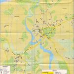
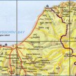
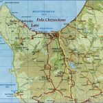
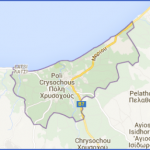
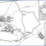
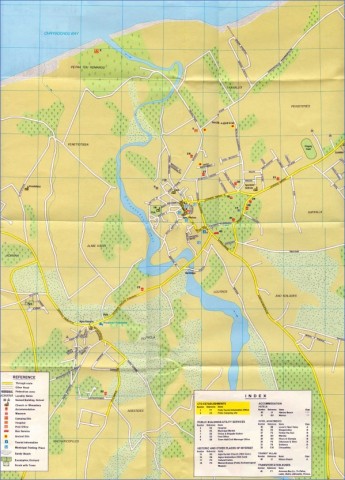
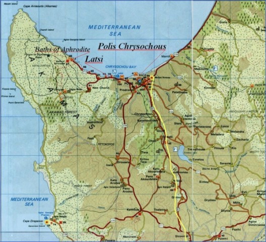
Street Map of Polis | Road Map of Polis Area
d) The eastern coastal plain of Chrysochou
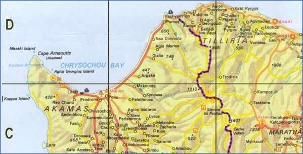
Route: Pelathousa, Makounta, Kinousa, Limni Mines, Argaka,
Gialia, Agia Marina, Nea Dimmata, Pomos, Livadi, Paliampela
Pelathousa lies south-east of Polis, where once extended the Limni mines.
Traditional chair-making, Kinousa
Map of Polis Polis Map Photo Gallery
In the center of the sparsely populated settlement stands the mosque of the village with its tall minaret. The church of Agia Aikaterini, after the conquest of Cyprus by the Turks in 1571, was converted to a mosque. Worth visiting is the church of Panagia (Madonna) Horteri, about three km outside the village. It is a single-aisled, domed, Byzantine building, originally painted. Currently, only traces of the original mural paintings are preserved. North of the church there was probably another aisle. The church of Panagia Horteri belongs, most probably, to the 14th or 15th century. Makounta. The road to Makounta, between Polis and Argaka, passes through the mine-waste of the Limni mines. The old chapel of Agios Georgios, close to the dam, does not exist any more. Instead a modern chapel has been built in the same locality. Kinousa, close to Pafos forest, is known for its two mines of copper pyrites. The Cyprus Sulphur and Copper Company, stationed at Limni, worked the ore from 1951 till 1960. Traditional chair-making is still practised in the village by an artisan. Limni Mines. About 5km east of Polis there are still remains of the once-flourishing Limni mining company, known as Cyprus Sulphur and Copper Company.The ore was exported from the little harbour with its long pier and the surrounding installations. The area between Polis-Limni-Kinousa is covered with scoriae which probably dates back to the Bronze era or to Roman times. Nearby is the site of the ancient Mario mine, where copper was produced and exported. Mario was known in those days for its copper mines. The modern works date back to 1882 and continued uninterrupted until 1920. The production of copper began in 1937 and continued until 1979, when the mine was closed after the reserves were exhausted. Copper was not the only ore which was dug out from Limni. There was also gold, silver and sulphur. Argaka. Despite the fact that there are two villages, known as Kato and Pano Argaka, nevertheless, officially there is only one Argaka, about two km east of the coast. East of the village lies the restored church of Agia Varvara with its carved doors and a few capitals belonging to an old monastery. In July 1821 the abbot of the monastery was taken to Nicosia by the Turks, where he martyred together with other national heroes. Historian N. Kyriazis also notes that Agia Varvara belonged to the Jerusalem Patriarchate and functioned until 1821, having an abbot and two monks. Near the church is the monastery’s holy well, known as Vrysin tou Kalogirou (The Monk’s well), because Abbot Sofronios was known as “The Monk”. On the coastal road after Argaka village the visitor finds Gialia.
Agia Marina dam
The village is divided into Pano and Kato Gialia, even though there is really only one Gialia. Gialia, known for its tasty oranges, extends down the valley, mainly along two parallel roads, north and south of the river to a distance of 3.5km. This is one of the most classical linear-type settlements of Cyprus. British historian R. Gunnis refers to the monastery of Agios Kournoutas, “about two miles east of the village”. As has been suggested, it could have been a Latin building. The Georgian professor Djobadje found remains of the Gialia monastery in 1981, along with evidence that it belonged to Georgian monks who lived in Cyprus. Perhaps the monastery dates back to the 13th century. Agia Marina near the coast is a recent settlement. The original settlement to the east, near the forest, was abandoned. The dam constructed recently and the irrigation of a vast area of land transformed the agricultural economy of the village. Nea Dimmata is a new settlement, created at the beginning of the 1950’s by the British Government so that its inhabitants, mainly stockbreeders and lumbermen, could be transferred from the forest to the west. The land slopes towards the sea, and the coastal formations, particularly the capes and sandy bays, are very impressive. Pomos. The route from Nea Dimmata to cape Pomos is one of the most picturesque coastal routes of Cyprus. The mountains fall vertically to the sea, while their slopes are covered with pine trees. The coastline is laced, while the sea water has a dark-blue colour. Pomos’ fishing harbour is picturesque and allows a number of boats to carry on their fishing activities. East of the village is the arched Chrysopateritissa church, with a raised narthex. According to Gunnis, it dates from the 16th century, although the actual narthex was built in 1816. There is a worn out icon of the Virgin Mary Chrysopateritissa painted in 1524. Also on the north exterior door there is an inscription. Livadi by the river bank of Livadi river, is currently abandoned. The colonial Government, as from 1954, transferred the settlement to Morfou area. Paliampela is an abandoned settlement in Tilliria, on the banks of the Livadi river, east of Pomos.
Maybe You Like Them Too
- Top 10 Islands You Can Buy
- Top 10 Underrated Asian Cities 2023
- Top 10 Reasons Upsizing Will Be a Huge Travel Trend
- Top 10 Scuba Diving Destinations
- World’s 10 Best Places To Visit

