MIQUELON LAKE PROVINCIAL PARK MAP
Directions: Exit Edmonton on Hwy 16 east and take Anthony Henday Drive NW/Hwy 216 south toward Hwy 14 east; continue on Hwy 14 to the Camrose ramp and merge south onto Hwy 21/Range Road 230; turn left at Hwy 623/Township Road 494 and take a slight right at Hwy 833.
Distance: 74.9 km, or about 56 minutes, from Edmonton.
Info: Boat launches may be closed to powerboats when water levels are low, but a hand launch is available for canoes and other small craft. All boats are prohibited from entering certain waterfowl nesting areas and places along the beach. Firewood is sold at the store by the park’s front entrance. 780-672-7308; 780-672-7274; 1-800-427-3582.
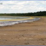
Situated on the southern edge of the Cooking Lake Moraine, Miquelon Lake Provincial Park was once part of a much larger lake that left three isolated basins when the water receded. The park is dominated by white-spruce forests, as well as the trembling aspen and balsam poplar that define the northern portion of Alberta’s aspen parkland belt. Numerous kettle ponds and wetlands mark the park’s 1,299 hectares. Wild rose, saskatoon, raspberry, buffalo berry, pin cherry, and dogwood are just some of the plants that provide habitat for the more than 200 bird species found here.
Shallow and salty, Miquelon Lake is a recognized Important Bird Area and a good place to see species that prefer older woodlandwestern wood-pewees, ovenbirds, yellow warblers, northern orioles, and rose-breasted grosbeaks. Sora, green-winged teals, American coots, and ruddy ducks seek the park’s marsh areas, while great flocks of California and ring-billed gulls nest on Gull Island, colonizing by the thousands. Ducks and shorebirds, including sanderlings and red-necked phalaropes, use the lake during spring and fall migration.
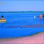
Because the lake’s outlet has not flowed since about 1900, fish cannot travel upstream into the lake, which is too saline to support sport fish. The park’s day-use area has change rooms, firepits, horseshoe pitches, picnic shelters, and flush toilets, as well as an amphitheatre and visitor centre with plant and animal displays. A trail system, with loops ranging in length from 0.6 to 3.7 kilometres, winds through the park’s knob and kettle terrain. Trails provide opportunities for hiking, cycling, and nature exploration. Stop at the visitor centre to find out about the park’s interpretive programs. Summertime visitors can enjoy canoeing, kayaking, hiking, sailing, swimming, and windsurfing. The saline water helps inhibit algae growth, and the lake is often quite clear. Winter visitors can enjoy ice skating on a flooded area and 13 kilometres of groomed cross-country ski trails.
MIQUELON LAKE PROVINCIAL PARK MAP Photo Gallery
Maybe You Like Them Too
- Explore Doncaster, United Kingdom with this detailed map
- Explore Arroyito, Argentina with this Detailed Map
- Explore Belin, Romania with this detailed map
- Explore Almudévar, Spain with this detailed map
- Explore Aguarón, Spain with this detailed map

