GEOGRAPHY
Not surprisingly, given its size, Montana is a state of many distinct regions. In general, residents divide the state into two halves: western Montana, with its rugged mountains and cool rushing rivers, and eastern Montana, known for its plains, canyons, and warm meandering streams.
Within that division are six more regions, largely created by the state’s tourism bureau but nonetheless relevant. Some are the size of small eastern states, and all are composed of subregions worthy of their own names.
Yellowstone country in southwest Montana features the burly mountain ranges and pristine trout streams of travel brochures and famously includes the three percent of Yellowstone National Park that lies in the Treasure State. The Beartooth Highway and Centennial Valley drives in this region are featured in this book.
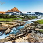
glacier country in northwest Montana tends to include the most densely forested areas of the state, complemented by the jagged peaks and jewel-like lakes of Glacier National Park. This area is traversed by the Going-to-the-Sun Road and Yaak River Country tour.
gold country in western Montana offers forests, broad picturesque valleys, and the remnants of once-flourishing mining and logging economies. The Anaconda-Pintler Scenic Route, the Vigilante Trail, and Big Hole Valley driving routes all wind their way through this area. russell country is largely characterized by undulating prairies rising gently to abrupt meetings with walls of mountains, most strikingly on display at the confluence of the plains and the vast Bob Marshall Wilderness. The Rocky Mountain Front is a highlight of this region.
Missouri river country is Montana’s windswept northeastern corner and features mile after mile of wheat fields, farms, and the Missouri River Breaks. The Hi-Line bisects this part of Montana as well as Russell Country, and the Big Sky Backcountry Byway and the Musselshell route enter this area, too custer country is marked by the wide-open spaces of southeastern Montana, where the term big sky comes to vivid life amid coulees, prairies, sunsets, and Montana’s most famous Indian country. The Warrior Trail covers a corner of Custer Country.
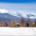
DRIVING IN MONTANA As much as anywhere in America, it’s imperative to be prepared when driving in Montana. In winter, Montanans know to drive with everything they need to spend a night on the side of the road. That includes matches, candles, water, sleeping bags, blankets, boots, gloves, and plenty of warm clothes. With a warming climate, winters aren’t as harsh as the old-timers remember them, but 20 degrees below zero isn’t uncommon. Winds whip across the plains and down mountainsides, creating blinding conditions in a heartbeat. The Rocky Mountain Front, from Browning in the north to Livingston in the south, is renowned for its winter Chinooks, serving up wind speeds of up to 70 mph and scouring the valleys of snow. Even the most beautiful autumn or spring day can turn on a dime. Snow can fall in any month in Montana, and snowstorms in June and September are not aberrations. In 2015, for example, the mountains received a good dusting in late July.
Montana Guide for Tourist Photo Gallery
Maybe You Like Them Too
- The Best Cities To Visit in The World
- World’s 10 Best Places To Visit
- Coolest Countries in the World to Visit
- Travel to Santorini, Greece
- Map of Barbados – Holiday in Barbados

