Columbus (pop. 1,990) sits in pretty pine and cottonwood bottoms along the Yellowstone River, a working-class town along the railroad and interstate dominated by a smelter and refinery. One stop to make is the free Museum of the Beartooths (406-322-4588, May-Sept.), which peeks into the region’s mining and homesteading history. Montana Silversmiths (800-634-4830) has been the manufacturing home of finely crafted jewelry for women, glossy western belt buckles for real and wannabe cowboys, and watches for forty years.
As you leave Columbus on MT 78 and follow the Stillwater River toward the Beartooths, look for some of the region’s prettier barns and an occasional glimpse of colorful flotillas of rafts plying the frothy river during spring and summer. The Stillwater is one of southwest Montana’s favorite whitewater streams because of a relatively lengthy season. Guided full- and half-day raft trips along with fly-fishing excursions the fishing is excellent, too can be arranged with Absarokee River Adventures (800-334-7238), which also rents rafts and inflatable kayaks for do-it-yourselfers. To see the country on a mount, call Wanda at Paintbrush Adventures (406-328-4158) and arrange a one-hour or full-day ride, or a weeklong pack trip into Beartooth country. The Paintbrush hosts also provide guided day hikes and fishing trips, and for a true taste of western life, you can sign up for a working vacation on the ranch.
Twelve miles into the hill country is the cheerful community of Absarokee (pop. 1,150), pronounced ab-SOHR-kee. It’s a cute little town that ought to have more for tourists, but it lost two of its biggest draws when an art gallery and an unusual rug business both closed.
The next stop over a small divide and just off the highway is Roscoe (pop. 14), another leafy oasis this one along East Rosebud Creek. An early postmistress renamed the town after one of her horses. You can’t drive anywhere south of I-90 without eventually seeing a bumper sticker asking Where the hell is Roscoe Montana? a successful marketing campaign driven by the popular Grizzly Bar (406-328-6789). Along the way to Roscoe, look for two historical points: one marking the site of what had been the Crow Nation capital until the U.S. government reneged on a treaty, the other noting a challenging descent on the famed Bozeman Trail. Past Roscoe, MT 78 undulates toward the Beartooths, signaling your arrival in Red Lodge (pop. 2,199).
Save at least a day and perhaps two to explore the museums, galleries, and bountiful boutiques of this energetic foothills town, which is rapidly losing its distinction as the least-discovered gateway to Yellowstone. Once a raucous coal-mining center with more than 20 saloons and nearly as many ethnic neighborhoods, Red Lodge is decidedly tamer but still abuzz. Possibly named for a breakaway band of Crow who erected a red teepee, the town is squeezed between grassy benches along Rock Creek, hard against the broad eastern shoulder of the Beartooths. Even when the Beartooth Highway is closed, Red Lodge remains a popular winter destination for skiing and snowmobiling. The town also stages numerous unique events during its shoulder seasons to bolster a year-round economy.
The main drag is great for hours of people watching and shopping, but carve out time to spin off the beaten byway onto MT 308 and drive over a small but steep divide to Smith Mine No. 3. You can park and walk amid the remnants of the worst coal mine disaster in Montana history (71 killed). Another 7 arid miles east on MT 308 is Bearcreek (pop. 83) and a less somber attraction: the famed Bear Creek Downs pig races at Bear Creek Saloon & Steakhouse (406-446-3481). Yes, pig races. These little piggies go round and round a dirt track, cheered on by bettors, every Thursday through Sunday in the summer. The unconventional entertainment began in 1988 as a way to spark business afer the infamous fires that burned up one-third of Yellowstone took a bite out of tourism
Back in Red Lodge, you might want to grab some essential snacks for the journey to the pass. Stock up on a staggering array of candy including many hard-to-find varieties at the Montana Candy Emporium (406-446-1119), open every day except Christmas. You can also sit a spell, sample local brews at the transformed Red Lodge Ale Brewing Company (406-446-0243), and wait for a panini or baked sandwich for the road. Once literally a hole in the wall of a brewery, the taproom has an updated, yuppified look, but draws the same outstanding drafts.
Shortly afer leaving Red Lodge, US 212 enters a broad U-shaped valley and begins zigging and zagging up the face of a pine-studded granite mountain. Be prepared with a jacket or fleece because the temperatures can drop as much as 30 degrees in the next 20 miles. Up, up, and up the road seems to rise forever. Pines and firs give way to the prehistoric whitebark pine, which is making a last stand in these mountains. Enjoy the trees while you can. Armies of pine bark beetles, thanks to the warming climate that has enabled them to survive once-brutal winters, are killing conifers by the millions in all but the highest elevations most notably the Beartooth. Prolific snows linger into July here and create a unique opportunity for skiers who want to avoid buying a lift ticket at Red Lodge Mountain (406255-6973). Many schuss through the trees to lower portions of the highway, where they hitch a lift back to their car or even higher for more runs.
Just before the East Summit is the impressive Rock Creek Vista Site, with its sweeping views of the canyon far below. The highway has now nearly reached the alpine tundra, almost a mile higher in elevation than Red Lodge. Early visitors are usually treated to a blaze of wildflowers such as columbine and Indian paintbrush, which emerge after the long, harsh winter to make a colorful splash during their brief bloom window. A string of alpine lakes gleam in the sunlight. Pull off the road and hike one of the dozens of Forest Service trails toward glacial lakes and other spectacular scenery in the Absaroka-Beartooth Wilderness. The area looks much the way it did when General Phillip Sheridan made the first documented crossing of the plateau on horseback in 1882. The 14-mile roundtrip Black Canyon Lake hike captures the essence of the mighty Beartooths and can be completed in one day. Crossing the Montana-Wyoming border, a favorite shorter hike is the Beartooth Loop, a National Recreation Trail that includes the oft-photographed Gardner Lake. At the East Summit, a chairlift seems to disappear into the invisible. This is the Twin Lakes Headwall, and skiing camps are conducted here in June and July, after snowmelt allows access but while enough powder remains on the shaded north face to allow top-flight training opportunities for Olympic hopefuls.
After traversing the tundra on the plateau for several miles and beginning a lengthy descent below the West Summit, you’ll eventually arrive at the no-place-like-it Top of the World Store (307-5875368). You are now a little past the midway point to Cooke City. At 9,400 feet in elevation, you’ll find intermittent phone service at the store they ask that you not call for weather conditions and limited electricity, but a world of warmth from the folks who welcome you into their high-elevation harbor. The store was built along Beartooth Lake while the highway was under construction in 1934, then moved to its current site in 1964. If you want to wet a line in a Wyoming lake or stream, Cowboy State licenses are sold here along with gas, snacks, maps, books, souvenirs, and just about anything else an outdoor person needs. Rentals for a wide variety of outdoor activities also are available.
From the Top of the World, the Beartooth Highway’s complexion changes but remains attractive. One of the most photographed sites on the way down to Cooke City is the Index Overlook. It’s an unobstructed view into the North Absaroka Wilderness and of the pointy 11,708-foot Pilot Peak and its sister mountain, the 10,709-foot Index Peak, both carved by glaciers. A short distance later is Clay Butte Lookout, one of the few fire lookouts easily accessible from a paved highway. It’s a 2-mile drive or hike to the lookout, which has marvelous panoramic views and interpretive information about the scars of the 1988 fires that nearly left Cooke City in ashes. After the junction of WY 296, the road follows the meandering Clarks Fork of the Yellowstone River, an angler’s paradise. The highway soon crosses back into Montana and descends gently through towering pine and spruce into Cooke City (pop. 140), the end of the road coming from the other direction in winter. Like Red Lodge, Cooke City had its genesis as a mining town; unlike Red Lodge, its economy is narrow Yellowstone visitors in summer, snowmobilers and wolf watchers in winter. The lodging and dining befits such uniformity. The Cooke City Store (406-838-2234), built in 1886, still has some of its original hardware and is worth a stop for ice cream, souvenirs, and history. For more charm but fewer lodging and dining opportunities, continue along Soda Butte Creek toward the park’s northeast entrance another 3 miles to Silver Gate (pop. 15), where year-round non-motorized peace is the antithesis of its motor-friendly neighbor. On the way, look for the inconspicuous sign on the right for Hartman Gallery (406-838-2296), an extension of Dan and Cindy Hartman’s house in a conifer thicket. You can view or purchase paintings of stunning landscapes and/or wildlife and may catch a glimpse of a resident pine marten, if you’re lucky.
Silver Gate also has its roots in mining and has an equally breathtaking Absaroka backdrop, but the similarities stop there. The entire population, a dozen or so year-rounders, has made a conscientious effort to be the quiet alternative to neighboring Cooke City, with an emphasis on sustainable, human-powered recreation. Also here is the stately and reputedly haunted Range Rider Lodge, once one of the two largest freestanding log structures in the nation (behind Old Faithful Inn in Yellowstone National Park). The former bordello rooms upstairs are available for large group bookings, and the lodge frequently hosts musical events and other activities during the high season. For your hiking, skiing, and climbing needs, the Silvertip Mountain Center (800-863-0807) gears its retail and rental inventory to the season. Stop the Car Trading Post (406-838-2130) is a year-round place to stock up on convenience items and made-in-Montana gifts.
Silver Gate and Cooke City are along Soda Butte Creek, which meanders through some of the best grizzly bear habitat in America. Locals have grown accustomed to living with bears in their midst and take all the proper precautions. Whenever in grizzly country, it’s mandatory to bring bear spray, make noise, store food properly, and travel in parties of at least four if possible.
From Silver Gate, it’s a mere mile to the park. You can continue your journey by taking the only year-round road in Yellowstone through the Lamar Valley. But that’s a trip described in our Great Destinations: Yellowstone and Grand Teton National Parks and Jackson Hole from Countryman Press.
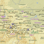
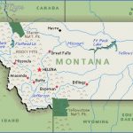
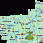
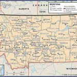
MONTANA MAP WITH CITIES AND TOWNS Photo Gallery
Maybe You Like Them Too
- The Best Cities To Visit in The World
- World’s 10 Best Places To Visit
- Coolest Countries in the World to Visit
- Travel to Santorini, Greece
- Map of Barbados – Holiday in Barbados

