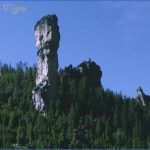
This National Forest is comprised of three tracts in central Oregon, with a fourth tract which consists of 111,379-acre Crooked River National Grassland (see entry page 243). It’s an area of mountains, steep cliffs, canyons, rolling hills, and high desert.
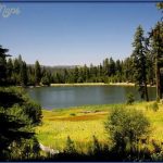
Top elevation is 7,163-foot Snow Mountain. There are small lakes and streams, meadows and grasslands, areas of sagebrush-juniper, and forests of ponderosa pine and fir, including some old-growth stands. Elk, antelope, mule deer, wild horse, and cougar are among the wildlife.
This National Forest has three designated wilderness areas: the 17,400-acre Mill Creek Wilderness, the 13,400-acre Black Canyon Wilderness, and the 5,400-acre Bridge Creek Wilderness.
Activities: There are currently 86 miles of trails for hiking and backpacking. Difficulty varies from easy to strenuous. Horseback riding is allowed on most trails, as is mountain biking except in wilderness areas. Cross-country skiing is possible here in the winter. Hunting and fishing are permitted in season.
Camping Regulations: Camping and campfires are allowed throughout the National Forest, except near public use areas or where otherwise prohibited. No permits are necessary.
For Further Information: Ochoco National Forest, P.O. Box 490, Prineville, OR 97754; (503)447-6247.
FREMONT NATIONAL FOREST OREGON
1,196,000 acres. Located in the eastern Cascades of south-central Oregon, with lands along the California border, Fremont National Forest consists of high desert with mountains and ridges, volcanic domes, rock formations and pinnacles, canyons and steep cliffs.
Elevations range from 4,100 feet to over 8,000 feet. There are meadows, small lakes, streams, a few rivers, and a single designated wilderness area, the 22,823-acre Gearhart Mountain Wilderness. Forests are of ponderosa pine, white fir, and aspen. Wildlife includes elk, antelope, mule deer, and mountain lion.
Activities: About 77 miles of trails are available for backpacking and hiking. Difficulty varies from easy to strenuous. Horseback riding is allowed, as is mountain biking on trails outside of the wilderness area.
Both cross-country skiing and snowshoeing are possible with sufficient snowfall in the winter. Fishing is available along the streams, rivers, and lakes. Hunting is permitted in season.
Camping Regulations: Camping is allowed throughout the National Forest, as are campfires, except near public recreation areas or where otherwise prohibited. No permits are required.
For Further Information: Fremont National Forest, 524 North G Street, Lakeview, OR 97630; (503)947-2151.
HART MOUNTAIN NATIONAL ANTELOPE REFUGE OREGON
275,000 acres. Situated in south-central Oregon, this National Antelope Refuge encompasses an area which includes 8,065-foot Hart Mountain, along with steep rocky cliffs and bluffs, ridges, and deep canyon gorges.
There are also hilly grasslands and brushlands, with a number of creeks and lakes, even though the region is mostly arid. Among the wildlife are pronghorn antelope, mule deer, bighorn sheep, coyote, bobcat, and golden eagle.
Activities: Hiking and backpacking are allowed throughout the refuge. There are no established trails, so travel must be cross-country. Horseback riding is also possible, and Nordic skiing is a winter option. Fishing is limited to two creeks. Hunting is permitted in season.
Camping Regulations: A free permit is required in order to camp in the backcountry. Campfires are generally allowed, but are subject to being banned when fire danger is high. Parts of the refuge may be closed to entry at certain times of year.
For Further Information: Hart Mountain National Antelope Refuge, P.O. Box 111, Lakeview, OR 97630; (503)947-3315.
CROOKED RIVER NATIONAL GRASSLAND OREGON
111,379 acres. Located in the high desert of central Oregon and administered by Ochoco National Forest, Crooked River National Grassland is on a plateau with some steep 600-foot canyons, buttes, and rolling hills.
Included are both the Deschutes and Crooked Rivers, along with some streams and several reservoirs. Vegetation consists of grasslands with sagebrush and juniper. Among the wildlife are antelope and mule deer.
Activities: The National Grassland is open to hiking and backpacking as well as horseback riding, but there are no established trails. Most travel must be cross-country. Hunting and fishing are permitted in season.
Camping Regulations: Camping is allowed throughout the Grassland, as are campfires, except where posted otherwise. No permits are required. Visitors are asked to camp at least 100 feet from water sources.
For Further Information: Crooked River National Grassland, P.O. Box 687, 155 North Court, Prineville, OR 97754; (503)447-9641.
BLM LANDS IN OREGON
There are 15,700,000 acres of BLM (Bureau of Land Management) or public domain lands in the state, consisting of a great many separate tractsespecially in southcentral, east, and southeast Oregon. Included are a large number of Wilderness Study Areas, under consideration for wilderness status.
Locations in the western part of the state are generally forested, with some stands of old-growth trees, and a number of major rivers and streams with waterfalls. Most of the remaining lands are arid areas of high desert, with rugged mountains and steep canyons, buttes, and rock formations.
Access to some BLM areas is difficult, roads may not be in good condition, and facilities are generally few or nonexistent. Brochures and other printed information are available for only a small number of tracts.
Activities: Backpacking, hiking, horseback riding, and mountain biking are allowed on these lands. Among the relatively few established trails are short sections of the Pacific Crest Trail (see entry page 244) and the 40-mile Rogue River Trail. Most travel on BLM lands must be cross-country.
White-water rafting, kayaking, and canoeing are available on several of the rivers. Cross-country skiing is also possible at high elevations. Hunting and fishing are permitted in season.
Camping Regulations: Camping is allowed freely on BLM lands, as are campfires, except where posted otherwise. Limited restrictions apply in a few areas. No permits are required.
For Further Information: Bureau of Land Management, 1300 NE 44th Avenue, P.O. Box 2965, Portland, OR 97208; (503)280-7002.
STATE FORESTS IN OREGON
Oregon has a number of state forests, several of which are sizable. The three largest are 364,000-acre Tillamook State Forest, 92,000-acre Elliott State Forest, and 47,721-acre Santiam State Forest. These lands are used primarily for tree-harvesting. Some of the areas include rugged terrain.
Activities: The state forests are open to recreational use such as hunting and fishing, and also offer some limited opportunities for hiking, backpacking, and horseback riding. Tillamook State Forest has 25 miles of trails, far more than the other forests. Most have few or no established trails.
Camping Regulations: Primitive camping is generally allowed in the state forests, except where posted otherwise. Campfires should only be built at designated campsites.
For Further Information: Oregon Department of Forestry, 2600 State Street, Salem, OR 97310; (503)378-2560.
In addition, Ecola State Park in the northwest corner of Oregon has a single designated primitive
camping area along the Oregon Coast Trail, two miles from a parking area. For more information contact Ecola State Park, c/o Fort Stevens State Park, Hammond, OR 97121; (503)861-3170.
Also, Oswald West State Park in northwest Oregon has a walk-in campground which is one-third mile by trail from a parking area. For information contact Oswald West State Park, c/o Nehalem Bay State Park, 8300 R Third Street Necarney, Nehalem, OR 97131.
OCHOCO NATIONAL FOREST OREGON Photo Gallery
Maybe You Like Them Too
- Arnold A Town with a Heart
- The Best Cities To Visit in The World
- World’s 10 Best Places To Visit
- Map of New York City – New York City Guide And Statistics
- Map of San Francisco – San Francisco Map Free

