Province
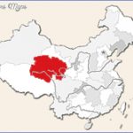
Area: 720,OOOsq.km/277,920sq. miles Population: 4,540,000. Capital: Xining
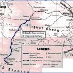
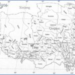
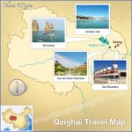
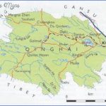
Qinghai lies in the north-west of China between 89°35′ and 103°03’E and Situation 31°40′ and 39°19’N.
The province was named after the Qinghaihu Lake, (Koko Nor in Mongolian). After Tibet it is the least populated province in China.
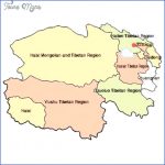
The population, concentrated mainly in the eastern region, consists chiefly of ethnic minorities; Tibetans, Mongolians, Kasachen and Hui. Each minority lives in its own autonomous district.
The Qinghai-Tibet Plateau; over 400m/1312ft high, covers the territory. Topography
The 220,000sq.km/84,920sq. mile basin Qaidam Pendi lies on this plateau reaching heights of 26003000m/8530-9843ft. It is part ofthe Kulunshan mountain range, which has average heights of 5000-6000m/16,405-19,686ft, and ofthe Bayan Har Shan.
In the province is the source of the rivers Huanghe, Lancangjiang (Mekong) and Changjiang. High mountain steppes and deserts dominate the area, only 2% of which consists of forests.
The climate is typically continental; low average yearly temperatures, Climate great changes in temperature, seldom, but concentrated, downpours and long periods of sunshine.
Originally the region was chiefly inhabited by Tibetans and Mongolian History nomads. From the 3rd c. b.c. Chinese influence was felt here, becoming more pronounced from the 6th c. onwards. Later Qinghai was included in the places which came under Tibetan and Tangut control, until it finally became completely Chinese. Trade and Industry mainly consists of the manufacture of agricultural products tex- Industry tiles and food. From the rich natural resources oil, uranium and coal are mined; salt is extracted from the salt water lakes.
Of great importance is livestock farming (yak, sheep, camels, and horses). In the river valleys near Xining and on the southern edge of the Qaidam Pend basin arable farming includes barley, oats, maize, millet, and sweet potatoes.
Places to visit Tourism in this province is still very underdeveloped except in the capital
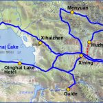
Xining (see entry); its mosques and the nearby salt-water lake, Quinghai Hu, attract a number of visitors.
Qinhuangdao
The city’s port plays an important role in Chinesp trade. The city itself is separated into three districts about 15km/9 miles apart: Beidaihe in the west, Qinhuangdao in the centre and Shanhaiguan in the east.
The Shanhaiguan is the most important pass in the east ofthe Great Wall. The fortress, originally constructed in 1381 – the present structure dating from 1639 – is situated in the centre of Shanhaiguan, It has four gates protected by towers. There are 68 embrasures in the wall for archery purposes.
Hanging on the east gate roof ledge is a large wooden tablet bearing the inscription: “First gate on earth” (Tianxia diyiguan). It was engraved by one ofthe graduates ofthe imperial examinations.
Sights Shanhaiguan Fortress
The extension ofthe citadel leading to the sea is known as the Head ofthe Old Dragon and forms the eastern end of the Great Wall.
Qinghai Map Photo Gallery
Maybe You Like Them Too
- The Best Cities To Visit in The World
- World’s 10 Best Places To Visit
- Coolest Countries in the World to Visit
- Travel to Santorini, Greece
- Map of Barbados – Holiday in Barbados

