Rocky Peak Park
Hiking Distance: 4.6 Miles Round Trip Hiking Time: 2 Hours Configuration: Out-And-Back Elevation Gain: 1,000 Feet Difficulty: Moderate To Strenuous Exposure: Open Hillside Dogs: Allowed
Maps: U.S.G.S. Simi Valley East
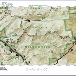
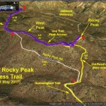
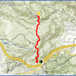
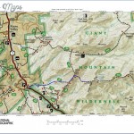
Rocky Peak Trail Map Photo Gallery
Rocky Peak Park, In The Santa Susana Mountains, Straddles The Los Angeles- Ventura County Line At The Eastern End Of Simi Valley. A Network Of Hiking Trails Weaves Through The 4,815-Acre Park That Is Home To Deep Oak-Lined Canyons, Trickling Streams, And Massive, Sculpted Sandstone Formations With A Moonscape Appearance. The Hummingbird Creek Trail, At The Base Of Rocky Peak, Crosses Hummingbird Creek And Climbs Up A Narrow Canyon Through Open Chaparral To The Rocky Peak Trail (A Fire Road), Passing Stacks Of Giant Sandstone Boulders, Sculpted Caves, And Dramatic Rock Outcroppings.
To The Trailhead
From Highway 118/Ronald Reagan Freeway In Simi Valley, Exit On Kuehner Drive. Drive 0.3 Miles North To The Signed Trailhead On The Right. Park In One Of The Pullouts Alongside The Road. If Full, Additional Parking Is Available Just North Of The Freeway.
The Hike
From The Trailhead Kiosk, Head Downhill. The Trail Soon U-Turns Southeast Into The Canyon To A Defunct Rock Dam From 1917 And Hummingbird Creek. Proceed Past The Dam Into An Oak Woodland And Meadow. Once Past The Meadow, The Trail Crosses Hummingbird Creek And Begins The Ascent Up The Mountain Through Chaparral. Switchbacks Lead Up To Sandstone Caves And Rock Formations. After The Rocks And Caves, The Trail Levels Out Before The Second Ascent. Switch Backs Make The Climb Easier As It Heads Up The Canyon. At The Head Of The Canyon, The Trail Levels Out And Passes More Rock Formations. The Trail Ends At A Junction With The Rocky Peak Trail. Return To The Trailhead By Retracing Your Steps.
To Hike Farther, The Rocky Peak Trail Continues 1.7 Miles North To The Summit Of Rocky Peak Hike 150.
Maybe You Like Them Too
- Top 10 Islands You Can Buy
- Top 10 Underrated Asian Cities 2023
- Top 10 Reasons Upsizing Will Be a Huge Travel Trend
- Top 10 Scuba Diving Destinations
- World’s 10 Best Places To Visit

