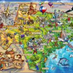
Texas Map Tourist Attractions
BIG BEND RANCH STATE NATURAL AREA
Located along the Big Bend of the Rio Grande, in southwest Texas, this huge State Natural Area has small mountains and mesas, deep canyons and caves, volcanic rocks, and other rugged Chihuahuan Desert scenery.
Vegetation includes grasslands along with yucca, cactus, and agave, and also some stands of trees. Among the wildlife here are mule deer, mountain lion, javelina, and golden eagle.
Activities: Backpacking and hiking are possible on about 30 miles of trails, including the 19-mile Rancherias Loop Trail. White-water rafting is available by permit on the Rio Grande, and fishing is also allowed along the river.
Camping Regulations: A permit is required in order to camp here, and visitors must specify an itinerary. Some established campsites are located along the trails.
It’s also possible to camp elsewhere, except for a few areas which are off-limits to camping. Sites must be at least 300 feet from water sources and historic structures. Avoid drainages.
Campsites along the Rio Grande should be well above the high water mark. Campfires are not permitted, so a stove must be brought if one wishes to cook. Pets are prohibited.
For Further Information: Big Bend Ranch State Natural Area, P.O. Box 1180, Presidio, TX 79845.
Texas Map Tourist Attractions Photo Gallery
Maybe You Like Them Too
- Arnold A Town with a Heart
- The Best Cities To Visit in The World
- World’s 10 Best Places To Visit
- Map of New York City – New York City Guide And Statistics
- Map of San Francisco – San Francisco Map Free

