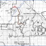
TOIYABE NATIONAL FOREST MAP CALIFORNIA
At 3,856,000 acres, Toiyabe National Forest is the largest National Forest in the United States outside of Alaska. While most of the lands are in Nevada, over
630,000 acres are located in the Sierras of east-central California.
Terrain is mountainous, with elevations as high as 10,000 feet. Parts of the Carson-Iceberg Wilderness, the Mokelumne Wilderness, and the Hoover Wilderness are found here.
Camping is allowed freely in the region, except where posted otherwise. A fire permit is required to use a stove or build a campfire. Wilderness permits must be obtained to camp in designated wilderness areas. See the Toiyabe National Forest listing in the Nevada chapter for more information.
TOIYABE NATIONAL FOREST MAP CALIFORNIA Photo Gallery
Maybe You Like Them Too
- Arnold A Town with a Heart
- The Best Cities To Visit in The World
- World’s 10 Best Places To Visit
- Map of New York City – New York City Guide And Statistics
- Map of San Francisco – San Francisco Map Free

