Topanga State Park
Pacific Palisades Trailhead
Hiking Distance: 4 Miles Round Trip Hiking Time: 2 Hours Configuration: Out-And-Back Elevation Gain: 800 Feet Difficulty: Moderate Exposure: Forested And Exposed Ridge Dogs: Not Allowed
Maps: U.S.G.S. Topanga Topanga State Park Map Tom Harrison Maps: Topanga State Park Trail Map
Santa Ynez Canyon Runs North And South From The Heart Of Topanga State Park Beneath Eagle Rock And Temescal Peak To The Pacific Highlands. The Lush Stream-Fed Canyon And Natural Sanctuary Is Filled With Oaks, Willows, Sycamores, Bay Laurels, And Towering Sandstone Formations.
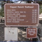
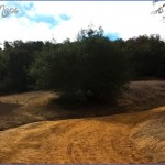
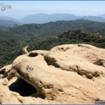
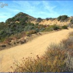
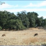
Trippet Ranch Area of Topanga State Park Trail Photo Gallery
This Hike Follows The Canyon Floor With Numerous Stream Crossings, Then Climbs The Canyon Wall To Spectacular Vistas Across The Santa Monica Mountains. The Trail Ends At Trippet Ranch By A Tree-Shaded Picnic Area And Pond At The Park’S Headquarters.
To The Trailhead
From Santa Monica, Drive 3 Miles Northbound On The Pacific Coast Highway/Highway 1 To Sunset Boulevard. Turn Right And Drive 0.4 Miles To Palisades Drive. Turn Left And Continue 2.4 Miles To Vereda De La Montura On The Left. Turn Left And Park At The End Of The Road 0.1 Mile Ahead.
The Hike
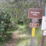
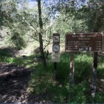
Pass The Trailhead Gate And Descend Steps To Santa Ynez Creek. Follow The East Bank Of The Creek Under The Shade Of Sycamore And Oak Trees. Cross Stepping Stones Over A Side Stream And Continue Up Canyon. Cross The Seasonal Creek Four Consecutive Times Under A Canopy Of Sycamores While Passing Sandstone Boulders With Caves. After The Fourth Crossing Is A Trail Split At Quarry Canyon, Named For An Abandoned Limestone Quarry. Stay To The Left, Crossing To The West Side Of The Creek And A Posted Trail Split At A Half Mile.
The Right Fork Leads 0.8 Miles To Santa Ynez Falls (Hike 82).
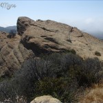
Stay To The Left And Wind Through The Lush Riparian Habitat, Following The Ephemeral Stream. Cross To The North Side Of The Stream And Head Up Canyon. Ascend The Hillside To The Exposed, Chaparral-Covered Slopes With Dense Stands Of Ceanothus, Chamise, Sumac, And Toyon. From The Hillside Are 360- Degree Views Of The Mountainous Backcountry Follow The Slab-Rock Path On The Ridge Between Two Canyons Feeding Santa Ynez Creek. Continue Gaining Altitude On The Ridge, With A View Of Temescal Peak At The Head Of The Canyon To The Right. Pass A Posted Trail On The Left That Cuts Across To The East Topanga Fire Road. Walk Straight Ahead 150 Yards To A Junction With The Eagle Springs Fire Road At 2 Miles. The Left Fork Leads To Trippet Ranch And A Picnic Area. The Right Fork Leads To Eagle Rock And Hub Junction (Hike 79).
Elevation Gain: 600 Feet Difficulty: Easy To Moderate Exposure: Exposed Dogs: Allowed
Maps: U.S.G.S. Conoga Park Topanga State Park Map Tom Harrison Maps: Topanga State Park Trail Map
Caballero Canyon Runs Into The North Border Of Topanga State Park From Marvin Braude Mulholland Gateway Park. The Grassy Hillside Park With Picnic Sites Lies Adjacent To Tarzana In The San Fernando Valley. From The North Slope Of The Santa Monica Mountains, This Loop Trail Connects With An Unpaved Section Of Mulholland Drive (Commonly Referred To As Dirt Mulholland). The Hike Follows The Ridge And Returns Down Caballero Canyon Through Sycamore And Willow Groves Along A Seasonal Streambed.
The Trailhead Is A Popular Link To Dirt Mulholland And Is A Key Entry Point Into The Northern Part Of Topanga State Park.
To The Trailhead
From The Ventura Freeway/Highway 101 In Tarzana, Exit On Reseda Boulevard. Drive 3.4 Miles South Into Marvin Braude Mulholland Gateway Park, And Park At The End Of The Road. Inside The Park Gate Is A White Line Painted Across The Road. Parking Is Free North Of The White Line, Located 0.2 Miles Away From The Trailhead. A Parking Fee Is Required South Of The White Line.
The Hike
From The South End Of Reseda Boulevard, Take The Gated Tarzana Fire Road, An Unpaved Fire Road, Up The Hill Into Topanga State Park. Pass A Second Vehicle Gate, Reaching Dirt Mulholland At 0.2 Miles On A U-Bend In The Road. Bear Left On The Wide Road, And Follow The Ridge Across The Head Of Caballero
Canyon, Curving South Then East. From The Ridge Are Southern Views Into Temescal And Rustic Canyons And Northern Views Into Caballero Canyon. At 0.7 Miles, Pass The Bent Arrow Trail, A Connector Trail To The Temescal Ridge Fire Road, And Continue Along The Ridge. Just Before The Road Curves Left Around A Prominent Hill Known As Farmer Ridge, Watch For The Caballero Canyon Trail On The Left At 1.1 Miles.
Bear Left And Descend Down The East Flank Of The Canyon. Wind Downhill To The Canyon Floor Dotted With Sycamore Trees And Coastal Sage Scrub. Head North, Parallel To An Intermittent Stream, And Meander Through The Canyon To Reseda Boulevard At The Old Caballero Canyon Trailhead. Bear Left And Follow Landscaped Reseda Boulevard Above Caballero Canyon For 1.2 Miles, Back To The Trailhead.
Maybe You Like Them Too
- Top 10 Islands You Can Buy
- Top 10 Underrated Asian Cities 2023
- Top 10 Reasons Upsizing Will Be a Huge Travel Trend
- Top 10 Scuba Diving Destinations
- World’s 10 Best Places To Visit

