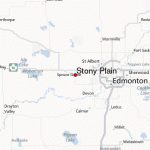
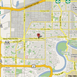
STONY PLAIN MAP EDMONTON
Directions: Exit Edmonton from either Hwy 16 or 16A west, and take the Stony Plain exit onto Hwy 779 (Range Road 10), which becomes 48th Street.
Distance: 36 km west, or 43 minutes, from Edmonton.
Info: 780-963-2151; www.stonyplain.com.
In the early 1700s a small band of Stoney Natives from the Dakotas came to the foothills east of the Rocky Mountains, between the Bow and Athabasca Rivers. Because of the Stoney and the fertile plains where they camped, the region west of Fort Edmonton became known as the Stoney plains.
John L. McDonald moved to the area more than 100 years ago and built a house near a creek flowing from Dog Lake. A bend in the creek looked like the rear end of a dog, and hence the Cree called it atim ozwe sipimeaning dog creek or dog rump creek.
The area around the town came to be known as Stoney, but the town was called Dog Rump Creek. The community changed its name to Stony Plain in 1892 after J. L. McDonald applied to open a post office. He dropped the e from Stoney in the hope that it would stop people from thinking the area was covered in stones. However, in 1858, James Hector of the Palliser Expedition noted the town deserved its name for the plain was covered with boulders, which are generally rare in this region.
In 1906 the railway from Edmonton passed more than 1.5 kilometres from Stony Plain, and community leaders decided to move the town closer to the tracks. They rolled the buildings on logs to the spot where the town is todaya task that required 20 teams of horses.
Stony Plain became a tent city of railway workers; indeed, its first bank opened in a tent. In 1907 Israel Umbach was sworn in as sheriff, and a year later Stony Plain became a town. Umbach is remembered for chaining himself to a locomotive on the railway tracks to force the CPR to pay its outstanding taxes.
Stony Plain is an agricultural community with a population that has grown to more than 15,000 people. You can experience much of Stony Plain’s charm by strolling through downtown, which is adorned with a heritage theme comprising old-fashioned lampposts and park benches, as well as colourful flowering baskets in the summer. Dubbed the Town with the Painted Past, Stony Plain has been called the wall-art capital of Albertathe result of its Outdoor Gallery that appears on the outside walls of many buildings and increases in size annually. So far, 32 larger-than-life murals and a sculpture showcase the community’s history. Both local and nationally known artists have illustrated Stony Plain’s colourful past with artwork that depicts the town’s multiculturalism, early pioneers, and landmarks. You can pick up a brochure to guide you through the town’s Outdoor Gallery at the tourist information centre and many main-street shops. The Multicultural Heritage Centre arranges a variety of guided tours.
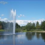
You will find abundant green spaces, including the ornamental garden Shikaoi Park, named after Stony Plain’s sister community in Hokkaido, Japan. The Many Faces, One Heart mural in the park pays tribute to the town’s multiculturalism More than 25 kilometres of trails, with wooden bridges, crisscross the beautiful Whispering Waters Creek that flows through town. Trails lead to a public BMX bike track, skateboard park, and picnic area with cookstoves and firewood, as well as two gazebos.
If you enjoy home-baked, handcrafted, and home-grown goods, visit the two farmers’ markets in Stony Plain. Vendors at the Heritage Farmers Market sell their goods at Heritage Park Pavilion (5100-41st Street) from mid-April to mid-October on Saturdays from 9:00 a.m. to 1:00 p.m. The Stony Plain Farmers’ Market is held on Saturdays from April through December at the downtown Stony Plain Community Centre (500851 st Avenue), from 9:00 a.m. to 1:00 p.m.
Annual events include Farmers’ Days and Kinsmen Rodeo (June); Canada Day festivities (July); the Great White North Triathlon (July); the Blueberry Bluegrass and Country Music Festival (August); the Cowboy Music, Poetry, and Art Gathering (September); and the Harvest Festival (September).
STONY PLAIN MAP EDMONTON Photo Gallery
Maybe You Like Them Too
- Explore Doncaster, United Kingdom with this detailed map
- Explore Arroyito, Argentina with this Detailed Map
- Explore Belin, Romania with this detailed map
- Explore Almudévar, Spain with this detailed map
- Explore Aguarón, Spain with this detailed map

