On the DN 1 (E 60) between Comarnic and Campina, Breaza is one of the best-rated health resorts in Romania. It is said that the area, situated in the Sub-Carpathians of Prahova, enjoys the greatest number of sunny days a year in all Romania. Breaza air, rich in ozone and negative ions, has been compared to that of Davos in the Swiss Alps. Breaza is home to Romania’s oldest golf club – Lac de Verde.
The long journey of the Olt River (615km) begins in the Hasmasu Mare Massif. In the region of Northern Oltenia, the Olt River, which the Dacians called the Alutus, traverses spectacular landscapes.
The Olt Pass (DN 7) pierces, for a distance of fifty-eight kilometres, the narrowest section of the Meridional Carpathians. The pass has three distinct sections: the 16km Cozia Pass, which divides the Cozia Massif from the Capatanii Mountains; Caineni-Gura Lotrului (25km), in the sector of the Lovistea Depression; and the Turnu Rosu Pass (17km), which runs between the principal summits of the Fagaras and Lotrului Mountains. The Olt Pass has, over the ages, represented the easiest route whereby to cross the Meridional Carpathians. The natural beauties of the pass are complemented by remarkable man-made achievements, such as the Cozia Dam and Reservoir, the road suspended on pylons over the Olt, and the numerous tunnels bored through the mountains.
By the waters of the Olt, standing in silent witness to the past, lie the ruins of the seven forts that were built as a line of defences, the Limes Alutanus, by the conquering Romans: Pons Vetus (Caineni), Praetorium (Racovita), Autela (Bivolari), Castra Traiana (Sanbotin), Buridava (Stolniceni), Pons Aluti (lonestii Govorei), Rusidava (Dragasani).
Other historic remains can be found near the Danube. Of the bridge over the Danube built by Apollodoros of Damascus at the orders of the Emperor Trajan in 103-5 AD, near the town of Turnu Severin, nothing has remained except the stone bases, on each bank of the river. However, there is also archaeological evidence of even more ancient visitors to these lands: it seems that as early as the 3rd and 2nd centuries BC merchant ships from the Isle of Rhodes sailed up the Danube as far as the Iron Gates and traded with the aristocracy of the Dacian tribes of Oltenia. At Runcu and Baia de Fier, amphorae from Rhodes have been discovered, proving that wine and olive oil were traded as far away as the foothills of the Sub-Carpathian Mountains of Oltenia.
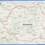
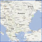
Romania Map Google Photo Gallery
The Olt Valley Arutela Castrum The castrum at Turnu Rosu Spring crocuses The north of Oltenia isflanked by the rocky heights of the Cozia Massif. The 17,000-hectares Cozia National Park is known for the wealth of its ecosystems. Here we encounter particularly picturesque forms of relief: jagged crests, pinnacles, caves, and almost anthropomorphic rock formations (the Sphinx of Cozia, the Shepherd, the Haidouk, the Pharoah).There are also spectacular cataracts: the Tncuietori Waterfall, where the Bulzu Stream drops for a height of fifteen metres, and the twenty-metre high Gardului Waterfall on the Urzica Stream. Wonderful views are offered by the Bulzului, Zavodului, Patestilor and Cetatii peaks. At the top of the Bulzului summit, we discover a Muntenia and Oltenia Cozia Mountain glade, named the Gardens of Bulzului, which is covered in a carpet of edelweiss (Leontopodium alpinum).
The Cozia Massif has the advantage of being easy to access, as the walking routes are relatively short, and is especially picturesque. The massif can be reached through the Olt Valley via four equidistant points of access between the Turnu railway station and the bridge across the Olt in the town of Calimanesti. The Cozia chalet, situated at an altitude of 1,600m, is ideal for hikers.
Maybe You Like Them Too
- Romania Road Map Online
- Best Pre-Wedding Photoshoot Ideas
- Romania Map Of Counties
- Romania Map Google Earth
- Romania Map In World Map

