COYOTE LAKE NATURAL AREA MAP EDMONTON
Directions: Exit Edmonton on Hwy 2 south. Turn west on Hwy 39 towards Calmar.
Continue west when the road becomes Hwy 622, then turns into Township Road 500. Turn south onto Range Road 44 and follow to parking lot.
Distance: 100 km southwest, or 1 hour, 26 minutes, from Edmonton, and 45 km east, or 40 minutes, from Drayton Valley.
Info: 1-877-262-1253; www.natureconservancy.ca.
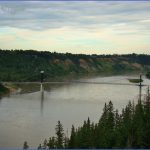
Coyote Lake is a rich biological area in a dry mixed-wood boreal forest and parkland transition zone. The natural area is home to more than 22 mammal species, 154 types of birds9 of which are at risk and 266 different plants, including rare and uncommon orchids. Coyote Lake provides important feeding habitat for great blue herons, resting sites for numerous migrating waterfowl, and nesting habitat for the red-necked grebe, common loon, and ring-necked duck. The absence of insecticide spraying in recent years has allowed bird populations to increase dramatically.
The 130-hectare nature sanctuary and 194-hectare conservation area are situated on land donated to the Nature Conservancy of Canada in 1996. The nature sanctuary is open for daytime visits and selfguided hikes. Interpretive walks are available to groups who book ahead. Group walks and guided
COYOTE LAKE NATURAL AREA MAP EDMONTON Photo Gallery
Maybe You Like Them Too
- Explore Doncaster, United Kingdom with this detailed map
- Explore Arroyito, Argentina with this Detailed Map
- Explore Belin, Romania with this detailed map
- Explore Almudévar, Spain with this detailed map
- Explore Aguarón, Spain with this detailed map

