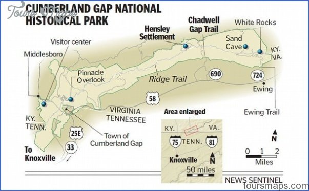
CUMBERLAND GAP NATIONAL HISTORICAL PARK MAP VIRGINIA
This scenic park centers around historic Cumberland Gap, an important early gateway through the Appalachians. While based in Kentucky, it includes lands in the southwest corner of Virginia as well as in Tennessee.
Terrain here is rugged, with fine views from rocky outcrops. There are caves, creeks, and forests of oak-hickory, with some conifers. Deer and fox are among the wildlife.
Activities: About 50 miles of trails are available for hiking and backpacking, including the 21-mile Ridge Trail, which follows along the KentuckyVirginia border. Difficulty ranges from easy to strenuous. Horses are allowed on many trails.
Camping Regulations: Camping is restricted to five designated backcountry camping areas in this National Historical Park. One area is a horse camp. Two of the camping areas are in the Virginia portion of the park. A backcountry camping permit is required, and must be obtained from the visitor center.
For Further Information: Cumberland Gap National Historical Park, P.O. Box 1848, Mid-dlesboro, KY 40965; (606)248-2817.
CUMBERLAND GAP NATIONAL HISTORICAL PARK MAP VIRGINIA Photo Gallery
Maybe You Like Them Too
- Arnold A Town with a Heart
- The Best Cities To Visit in The World
- World’s 10 Best Places To Visit
- Map of New York City – New York City Guide And Statistics
- Map of San Francisco – San Francisco Map Free


