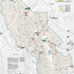
DEATH VALLEY NATIONAL MONUMENT MAP CALIFORNIA
2,048,851 acres. Located in south-central California, next to the Nevada border, this enormous National Monument includes famous Death Valley, which has the lowest elevation in the United States: 282 feet at Badwater Basin.
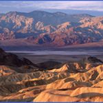
Death Valley is known for extreme temperatures in the summer. In addition to the desert valley, however, there are lofty rugged peaks herehighest of which is 11,049-foot Telescope Peakalong with deep canyons, craters, and sand dunes.
Stands of pine and juniper are found at higher elevations, plus some bristlecone pine. Mule deer, bighorn sheep, mountain lion, and coyote are among the Monument’s wildlife.
Activities: There are about 50 miles of trails for backpacking and hiking. Difficulty varies from easy to strenuous. Most trails are primitive and unmaintained. Cross-country travel is feasible throughout much of the Monument.
Climbing and mountaineering are also possible. Climbers should check in at a ranger station before and after the activity. Horseback riding is not recommended here, and hunting is forbidden.
Camping Regulations: Camping is allowed in most areas of the National Monument, except where otherwise prohibited. Camping is not permitted within one-quarter mile of any water source, one mile of a road, or within five miles of a campground.
A permit is not required, but it’s suggested that campers fill out a Backcountry Registration Form at a ranger station or visitor center. Pets are not allowed in the backcountry.
Campfires are also prohibited. A stove must be brought if one wishes to cook. Water in the region is very scarce, and it must generally be carried in. Because of the extreme heat, visits between May and October are not recommended.
For Further Information: Death Valley National Monument, Death Valley, CA 92328; (619)786-2331.
DEATH VALLEY NATIONAL MONUMENT MAP CALIFORNIA Photo Gallery
Maybe You Like Them Too
- Arnold A Town with a Heart
- The Best Cities To Visit in The World
- World’s 10 Best Places To Visit
- Map of New York City – New York City Guide And Statistics
- Map of San Francisco – San Francisco Map Free

