Counties; Oppland fylke, Sogn og Fjordane fylke. Altitude: 2468 m (8098 ft).
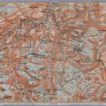
The ‘Jotunheim, the largest of the few Alpine-type regions on the Norwegian high plateau, extends from the Sognefjord in the W to the Gudbrandsdal in the NE. Its name (Home of Giants) was coined by Norwegian students, referring to the frost and ice giants of the Edda. Most of the mountains in the Jotunheim riseto heights of no more than 1800-2000 m (6000-6500 ft), but the region also includes the highest peaks in Scandinavia, Galdopig (2469 m 8098 ft) and Glittertind (2452 m 8045 ft). The valleys, with a few exceptions, lie above the tree-line and are notably barren. Magnificent views of rocky crags and fields of ice add up to a memorable experience of natural beauty.
The Jotunheim is best reached from the Lillehammer-Trondheim road (E6), branching off at Otta into Road 15, which runs W to the Nordfjord ( 197). Following this road up the Ottadal, we come to Vagamo, with the church of Vaga (first mentioned in 1270; font, 1050), and continue along the S side of the Vagavatn via Randen to Lom (stave Church), where we take Road 55, which runs through the Beverdal in the direction of the Sognefjord (239). To the SE extends the Jotunheim, which can be explored on foot from a number of bases in the valley.
At Galdesanda road branches off to the left and climbs steeply (21 bends, with extensive views) to the Juvvashytta (14 km 9 miles). This mountain hut, in a rugged and treeless region, is the highest point in Norway reachable by car (1817 m 5963 ft).
From the Juvvashytta, Galdhopig, the highest mountain in Scandinavia (2469 m 8098 ft), can be climbed in 4 hours (guide required). From the summit there are superb views: to the E, beyond the Visdal, towers Glittertind (2452 m 8045 ft), with its massive crown of snow.
Sognefjell (Jotunheim)
Beyond Galdesand, Road 55 continues along the Lelrdal, passing the splendidly situated hotel Jotunheimen Fjellstue (1 25 b.). It then ascends the Breiseterdal, through magnificent mountain scenery, to the Sognefjell, a pass used since time immemorial (1440 m 4725 ft). To the left is an impressive glacier, the Smor-stabbre. Beyond the pass, the road descends past a number of mountain lakes and a magnificent viewpoint at Oscarshaug to the Turtagre hotel. This is a good base for walks and climbs in the Hurrungane (Horunger), the finest mountain group in the Jotunheim.
A particularly rewarding climb in the Hurrungane is to the Skagastolsbotn, with the Skagastesbre glacier and the Skagastolstinder behind it. This ascent takes about 3 hours; if a climb of the Store Skagatolstind (2404 m (7888 ft): strenuous) is included, an additional 4 hours should be allowed. To the E of Turtagro is Fanarak (2075 m 6808 ft), which can be climbed in 4-5 hours, and to the NW Klypen3si (1145 m (3757 ft: 2ihours). For all these climbs a guide is required.
Gjendesheim climbers’ hostel (Jotunheim)
From Turtagro the road winds its way downhill to Hauge, on the Lusterfjord ( 239).
In the southern part of the Jotunheim there are many beautiful lakes. From Randen, on the S side of the Vagavatn, Road 51 passes the Lemonsj’0 and below Rindehevda (155 m 509 ft), a fine view. It continues up the Sjodal, passing a series of small lakes, to Maurvangen. A little way W is Lake Gjende. Bygdin, beyond the Valdresflya plateau, much of which is covered with bog, is situated between Lake Bygdin (on the right) and the Vinstervatn (on the left).
On Lake Bygdin, motorboats ply between Bygdin and the Eidsbugaren Hey-fjellshotel (HoyfjelI Museum). From there a road (3-5 km 2 miles) which affords panoramic views leads up to the Tyinhol-men Hotel, on the N side of Lake Tyin (area 35 sq. km (13-2 sq. miles); motorboat trips), the shores of which are uninhabited. In a commanding setting on the S side of the lake stands the Tyin Heyfjellshotel.
Jotunheim Norway Map Photo Gallery
Maybe You Like Them Too
- The Best Cities To Visit in The World
- World’s 10 Best Places To Visit
- Coolest Countries in the World to Visit
- Travel to Santorini, Greece
- Map of Barbados – Holiday in Barbados

