Germasogeia dam
Germasogeia, a growing settlement, in spite of the dam, completed in 1968, cannot support the current population. The residents of the village commute to Limassol and the city exercises an important influence. The Germasogeia Dam has a capacity of approximately 13,5 million tonnes of water and is about 50 metres high. The spillway, a necessary feature of every single dam, to be seen on the left of the dam, as one approaches it from the village, is truly impressive. Akrounta. Built on the banks of a tributary of Germasogeia river, it remained for many years unknown to travellers.
However, the dam of Germasogeia as well as the land consolidation implemented in the village early in the 1970’s made the village well known to Cypriots and foreigners alike. Foinikaria. The revolutionary changes in the landscape, brought about by the Germasogeia dam and the implementation of land consolidation, attracted new residents and amateur fishermen to the village. Foinikaria, like many other Cypriot villages, is tied up with Rigaina, the Frankish queen of Cyprus. Rigas, the king, who was jealous of her abundant water and gardens, proposed a generous payment on the condition that she would allow him to transport water to his tower. However, for the transportation of water the mountain, close by, had to be pierced. Soon, when the king “opened” a hole in the mountain, the queen, as always, broke her promise. The place-name to-day, known as “Hollow of the Frank” or “Hollow of the King”, reminds us of the numerous stories, legends and agreements of Rigaina and the King. Rigaina and Rigas, these two medieval heroes, are the corresponding names of Aphrodite and Adonis of the ancient Cypriot history. Mouttagiaka was a Turkish Cypriot village up until 1975. Today, the residents of the village comprise displaced persons living in distinct neighbourhoods.
Route: Armenochori, Amathous.
Armenochori. Situated on the summit of a hill, Armenochori is visible from long distances. Its name discloses links with the tiny minority of Armenians living in Cyprus. It is, however, not certain when the Armenians first appeared in the village. The village belonged to the Grand Commandery whose headquarters were at Kolossi.
Amathous, one of the ancient kingdoms of Cyprus, is now a vast area of ruins, and is not easily recognizable as an important ancient city, without referring to historical sources and findings of the ongoing archaeological excavations. It is not known exactly when Amathous was founded, since its Eteocypriot character has not been disputed. Both Scyllax and Theopompos mention indigenous inhabitants, while Amathous’ local character is attributed through testimonies up to 310 B.C. What is definite is that Amathous developed into a city early on and continued to flourish until the Byzantine years. Strabo, Claudius Ptolemy, Pliny, Jerokles (6th century), Georgios Cyprius (7th century) and Constantinos Porfyrogennitos (10th century), all refer to Amathous as a city. The hill, which still dominates the environs, through the passage of time developed into a place of worship for Aphrodite, according to Catulus, or, a joint place of worship for Adonis and Aphrodite, according to Pausanias. Author Stephanos Byzantios refers specifically to Adonis-Osiris, while the worship of Zeus and Hera seems to have been equally significant in Amathous. It would appear that the Temple of Aphrodite, unearthed, to a great extent, by the archaeological spade, is quite old and was still in use during the 4th century A.D. Economic background. In order to discover what the economic foundations, or rather what were the occupations of the residents of the city, which has been described as small in size but densely populated, the researcher has to delve into ancient sources. Ovid mentions the “rich in metals Amathous”.
There can be no doubt that he is referring to the Kalavasos mines, northeast of Amathous. Agriculture was another economic activity, since the population had to be fed. A Ptolemaic inscription found at Amathous, dating back to the mid-2nd century B.C., is particularly enlightening. This is an edict by Ariston, high priest of the Temple of Aphrodite in Amathous, in which he proclaims that the city should support the agricultural population, since it can be surmised from the contents of the inscription that the year had been particularly hard to agriculture, possibly because of drought. Furthermore, according to Strabo, Hipponax praises the wheat produced in Amathous. The presence of a harbour and the large Greek and Eastern Mediterranean amphorae, further document the trade that Amathous enjoyed with neighbouring peoples.
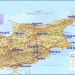
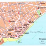
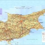
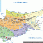
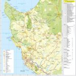
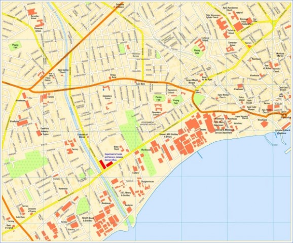
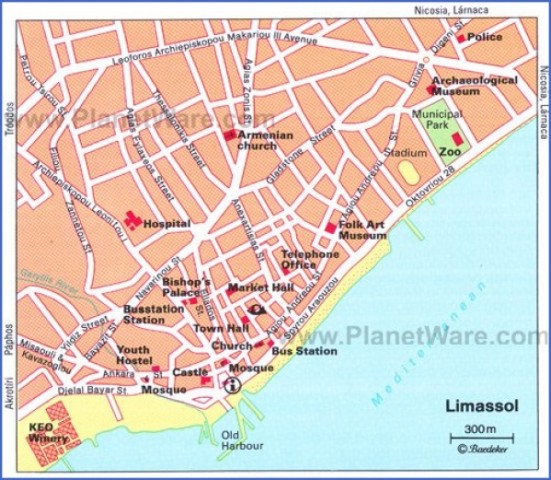
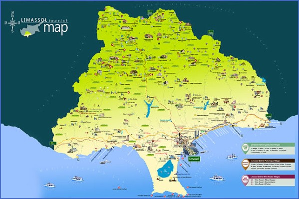
Limassol Map: Detailed maps for the city of Limassol Photo Gallery
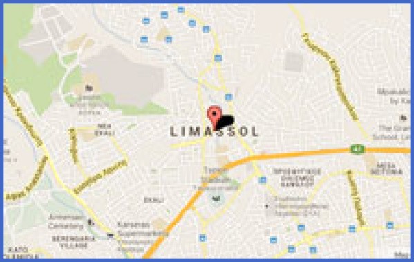
Map of Limassol, Lemesos – road map, satellite view and street view
Gigantic vase unearthed in Amathous (engraving)
The Basilica of Amathous
The archaeological excavations at the site, carried out by both French and Cypriot teams, focus on the Acropolis and the Temple of Aphrodite, on the supposed palace, the city walls, the ancient forum, the ancient harbour, the basilica and the two necropoles, east and west of the city. The Temple of Aphrodite, whose reconstruction continues, according to the experts dates back to the 1st century B.C. and belongs to the Roman period. However, previous constructions have been unearthed. Even though it has not yet been ascertained whether the Acropolis featured a palace, despite the fact that excavations continue to this day, references mention the “site of the supposed palace of Amathous”. Research as regards the presence of city walls has brought to light a series of successive fortifications, while, closer to the sea, a section of the walls and a Classical or Archaic tower has been incorporated into sizeable walls, dating back to the Hellenistic period. The western gates to the city have also been revealed. The excavations in the forum have brought to light columns, capitals, arcades, sewers, spacious yards, inscriptions, baths and cisterns. It would appear that this was a public space, since any indication towards private use is absent. The ancient harbour of Amathous, as revealed by underwater archaeology, was probably built in the 4th century B.C., during the Ptolemaic period in Cyprus. It seems that the harbour was in use for only a short period. It soon silted up, from the sediment carried down from the slopes of the Acropolis. The harbour featured three piers and a basin of considerable size. It was built with large stones from the quarries in the area, since a crane was used for its construction. The entry to the harbour, in its southeastern corner, formed a narrow channel, permitting the passage of large ships. It is worth mentioning that Pseudo-scylax mentions a “deserted port” during the mid-4th century B.C. It is also said that the Amathous harbour is one of the best-preserved ancient ports, and serious thought is being given to its reconstruction and modification into a site of interest as regards tourism. To the east and west of Amathous one encounters the two necropoles, where hundreds of large and small graves, some robbed, some intact, have been discovered. Most of the graves are carved out of the solid rock. Recent excavations concerning the walls of the city have disclosed the western gate by the sea, some additional towers and more details of the wall structure. Though today Amathous, from the beach to the high Acropolis, is a desolate area, many of its valuable artefacts are exhibited in the Cypriot museums, as well as in the British Museum, the New York Metropolitan Museum, in Constantinople, in the Louvre and elsewhere. Worth mentioning is the gigantic jar now exhibited in the Louvre. Even the finely carved limestone blocks which were used for the construction of many of the buildings of Amathous were, according to reports, either transported to Egypt or used, as was the case with other archaeological sites, by residents of neighbouring villages for the construction of their own homes. Since the 4th century A.D.,Amathous became a Bishopric and it continued as such well into the Byzantine period. The huge growth of the city and the fame of its kingdom, not only in Cyprus but also in the then known world, may be the main reason for which Cyprus was called “Amathousia”, as noted by Filanides and Stephanos Byzantios.
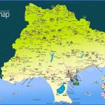
Online Map of Limassol – street map and satellite map
Amathous around ancient agora
b) Travelling along the Limassol-Nicosia Highway
Route: Agios Tychonas, Parekklisia, Pyrgos, Moni, Monagroulli
Church of Timios Stavros, Parekklisia
Agios Tychonas. One can hardly find, in the modern settlement, the church of Agios Tychonas, second bishop of Amathous. The only village church is the vaulted church of Agios Nikolaos that still hosts some of the old icons of the last century. It is a single-aisled church with thick walls and an especially low belfry. Cesnola writes that he found, in the premises of Agios Nikolaos, a limestone relief, three feet and two inches high and twenty-two inches wide, depicting a young woman holding a pigeon in her left hand. It is said that this relief was removed, years ago, from the Amathous acropolis. Parekklisia. The modern church of the village, dedicated to Archangelos Michail, is built on the foundations of an old church that probably dates back to the 17th century. However, it is the church of Timios Stavros that impresses, with its dome and cruciform style. The interior of the dome as well as the sanctum are covered with frescoes, while the iconostasis is gilted. According to Gunnis, the church belongs to the 12th or 13th century and is definitely of Byzantine origin. Around the settlement and next to the village cemetery stands a small chapel, recently restored, dedicated to the Virgin Mary the Neroforousa. It used to be covered with frescoes, but today nothing remains of the old church, apart from a 16th century icon. Recent excavations by the French School of Athens have revealed the presence of a neolithic settlement at “Skyllourokampos”, whose pottery resembles that of Sotira. The settlement’s architecture, as reported, is unique. Its stone findings are numerous, while the presence of obsidian witnesses commercial relations with neighbouring countries. A horse-breeding farm and the Country Club have recently been set up at Parekklisia. A riding school is also functioning for those interested in horse riding. Pyrgos. The church of Virgin Mary of Chrysopyrgotissa, has a gilted iconostasis and was originally completely covered with frescoes of the 16th century. Only those in the sanctum have survived, whereas traces of frescoes can be seen in the main church. On the river bed of Pyrgos, stand the ruins of a watermill of unknown age, which functioned until the first decades of the 20th century. It is an unusual building because it communicated with two large cisterns from where the water was channeled towards the water-mill. Cypriot folklorist and writer N.Klerides cites a legend known to all inhabitants of Pyrgos concerning the Rigaina tower at the village. According to tradition, an underground tunnel starting from the floor of the tower reached Amathous. A gold carriage, used by the royal couple for their trips to Amathous and back, was hidden in this tunnel. When the King and Queen left for Egypt one day, the gold carriage remained in the tunnel and it is still there. Moni. The name of the village implies a monastery which most probably stood by the present cemetery and was dedicated to the Holy Belt. The church, also dedicated to the Holy Belt, is worthy of note and features bas-reliefs around the doorways and windows, as well as a gilted iconostasis and many reliefs in its interior. Monagroulli, is very near the Moni cement factory and power plant, as well as close to Limassol, the second largest urban center of Cyprus. Both Moni and Limassol serve as employment centers for the residents of the village, while at the same time they enable them to stay in Monagroulli. Most probably the village’s name is connected with the nearby monastery of Agios Georgios Alamanos.
Route: Agios Georgios Alamanos Monastery, Pentakomo, Governor’s Beach
The monastery of Agios Georgios Alamanos standing majestically, like an ancient castle, is found south west of Pentakomo. Two Byzantine rhythm chapels, those of Agioi Pantes and Agios Nektarios, the main church in the middle of the complex and the nuns’ cells on the ground as well as the first floor of the tall buildings which surround the church, are what catch the eye of the visitor. In this commune, and under the supervision and succour of the Mother Superior, each nun has her own particular duties. The history of the monastery of Agios Georgios Alamanos is lost in the depths of time. According to Machairas, one of the 300 Alaman saints who reached Cyprus, came to this remote and tranquil spot to exercise his monastic life. It is not certain whether a monastery was founded here during the Frankish period, later to be disestablished during the Ottoman occupation of Cyprus. What is certain is that in 1880 Paisius re-established this location as a worshipping site. Paisius constructed the first monastic cells and repaired the decrepit church, which, together, formed the nucleus of the contemporary monastery. Monastic life, however, did not continue uninterrupted since, for a number of reasons, Paisius was compelled to abandon the monastery. In 1949, the then Bishop of Kitium and later Makarios III, Archbishop of Cyprus, reorganised the monastery and, with his support, led to the settling there of about 13 nuns from the monastery of Agios Antonios, near Deryneia. Thanks to the diligence, zeal and faith of these first nuns, the monastery was transformed in no time. The number of cells was increased, the number of visitors multiplied, and contributions led to the establishment of many modern amenities.
Maybe You Like Them Too
- Top 10 Islands You Can Buy
- Top 10 Underrated Asian Cities 2023
- Top 10 Reasons Upsizing Will Be a Huge Travel Trend
- Top 10 Scuba Diving Destinations
- World’s 10 Best Places To Visit


