Capital of the autonomous region of Guangxi
Altitude: 80-100m/260-330ft. Area: 68sq.km/26sq. miles Population: 525,000 (conurbation 866,000)
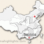
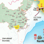
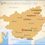
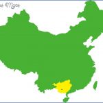
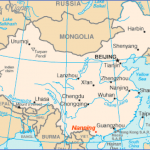
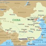
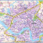
Nanning lies at 108°16’E and 22°49’N in the south of the autonomous region of Guangxi, on the banks of the Yongjiang. It is connected with other major cities by air and rail.
Nanning is a lively industrial city which enjoys a climate where everything is green and in blossom all the year round. The most important agricultural products are rice and sugar-cane, while thanks to the favourable climatic conditions it is possible to harvest subtropical fruits such as mangoes and lychees.
The Longship Festival, which takes place at the beginning of June (on the 5th day ofthe 5th month according to the lunar calendar) attracts countless visitors every year who come to see the longship races which are conducted with dedicated zeal on the Yongjiang.
The city, which was already the political centre and military stronghold of south-west China over 1600 years ago, received its present name during the Yuan period (1271-1368). In 1912 Nanning became the capital ofthe province of Guangxi and in the 1950s was declared the seat of government ofthe Zhuang national autonomous region of Guangxi. In 1952 a minorities institute was founded here.
The Museum ofthe Autonomous Region of Guangxi is near the city centre and has a floor area of 12,900sq.m/139,000sq.ft. It was built in 1954 and extended in 1978.
It provides an introduction to the history ofthe various different nationalities in Guangxi. The exhibits include 320 old bronze drums, made by ethnic minority groups in the region.
The People’s Parkin the north-east of the city is one ofthe most picturesque places in Nanning. 200 rare types of tree and flower are to be found in this very popular park.
South Lake extends over an area of 93ha/230 acres in the south-east ofthe city. Of special interest are an orchid garden and a bonsai exhibition.
On the east shore of the lake there is an excellent restaurant offering delicious fish dishes.
In the nearby Botanical Garden over 1900 different medicinal herbs are cultivated.
Yiling Yan Grotto is located on top of a hill29km/18milestothe north ofthe city (accessible by bus). Popular tradition has it that about 1500 years ago a Taoist hermit lived here. The people used to take refuge in the cave when faced with adversity. In the 1100m/1200yd long dripstone cave the visitor will see stalagmites and stalactites of every conceivable shape, while neon illuminations provide fantastic lighting effects.
The 1 km/Vi mile long lake, Waters ofthe Soul, lies 43km/27 miles north of Nanning in the district of Wuming. It is fed by springs which are always clear. The water temperature is 18-22°C/64-72°F all the year round. The shores ofthe lake are lined with bathing pools, pavilions, kiosks and other facilities.
Nantong lies at 120°51’E and 32°02’N, in the south-east ofthe province of Jiangsu, on the northern bank of the estuary of the Changjiang. It can be reached by river-boat from Shanghai in six hours, while there are connections by both bus and water with the provincial capital Nanjing.
Although Nantong can boast a history stretching back a thousand years, it remained until the 1950s a quiet backwater with only a few thousand inhabitants. Today, however, it has become an important industrial centre in the province of Jiangsu.
The Temple of Heavenly Rest in the town centre dates from the second half of the 9th c. Most of the buildings were, however, rebuilt in 1430.
Documents are stored here which are of particular interest for specialists in Chinese architecture ofthe Ming period (1368-1644).
The importance of this museum, which was founded in 1905 in the east of the town, lies in the fact that it is the earliest modern museum in China. Its exhibits include numerous archaeological finds from Nantong and the surrounding area.
Towering up about 10km/6 miles south of the town on the north bank ofthe Changjiang is the 107m/351ft high Wolf Mountain.
The summit of Wolf Mountain is dominated by the 15th c. Pagoda Holding up the Clouds, a square five-storeyed building made of wood and tiles.
On the north-east slope of the mountain there is an old inscription, left on a rock in 937 by the then prefect ofthe district, Yao Cun.
Nanning Map Photo Gallery
Maybe You Like Them Too
- The Best Cities To Visit in The World
- World’s 10 Best Places To Visit
- Coolest Countries in the World to Visit
- Travel to Santorini, Greece
- Map of Barbados – Holiday in Barbados

