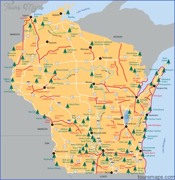
NORTH COUNTRY TRAIL MAP WISCONSIN
This important new National Scenic Trail will eventually be 3,200 miles long, stretching from New York to North Dakota. The Wisconsin section, which crosses the northwest corner of the state, will extend about 155 miles.
Some 60 miles of the trail fall within Chequa-megon National Forest, and it also traverses state park and forest lands. For about 40 miles it parallels the St. Croix National Scenic Riverway. Difficulty ranges from easy to moderate.
Camping Regulations: On state lands camping is normally restricted to designated sites, and a camping fee is sometimes required. In the National Forest one may camp almost anywhere along the trail, and campfires are allowed, with the exception of posted areas. Legal campsites are not currently available for some segments of the trail, including those on private lands.
For Further Information: North Country Trail Association, P.O. Box 311, White Cloud, MI 49349.
WISCONSIN CAMPING RESOURCES
ORGANIZATIONS WHICH OFFER WILDERNESS
CAMPING TRIPS
American Youth Hostels, Wisconsin Council, 2224 West Wisconsin Avenue, Milwaukee, WI 53233; (414)933-1155. This AYH council schedules several canoe-camping trips each year.
INFORMATION ABOUT STATE PARK AND FOREST
CAMPGROUNDS
Wisconsin Department of Natural Resources, Bureau of Parks and Recreation, P.O. Box 7921, Madison, WI 53707; (608)266-2181.
STATE HIGHWAY MAP AND TRAVEL INFORMATION
Wisconsin Tourist Information Center, 123 West Washington Avenue, P.O. Box 7606, Madison, WI 53707; (608)266-2161/ (800)432- TRIP (out of state)/ (800)372-2737 (in state).
NORTH COUNTRY TRAIL MAP WISCONSIN Photo Gallery
Maybe You Like Them Too
- Arnold A Town with a Heart
- The Best Cities To Visit in The World
- World’s 10 Best Places To Visit
- Map of New York City – New York City Guide And Statistics
- Map of San Francisco – San Francisco Map Free