SOUTH OF EDMONTON MAP EDMONTON
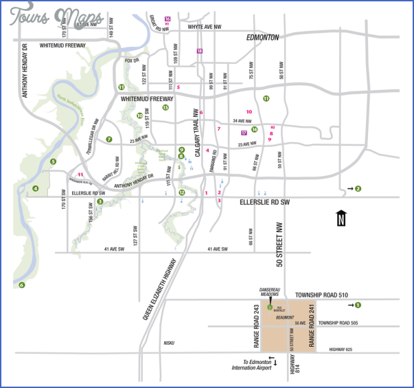
Predominantly parkland, the area south of Edmonton includes sites in and around Devon, Leduc, Wetaskiwin, Camrose, Viking, Tofield, Lacombe, Red Deer, and Innisfail. The Oilfield Loop includes the history-altering Leduc Oil Well No. 1 and the Leduc #1 Energy Discovery Centre.
The town of Devon, established to accommodate the needs of the oil boom after the drilling of Imperial Oil’s Discovery Well, offers numerous recreational opportunities in the North Saskatchewan River valley, including one of the world’s top 10 waterskiing facilities.
Millet, which promotes itself as Alberta’s prettiest little town, has numerous gardens and historical buildings that make it well worth a visit on the way to Wetaskiwin. Well known for the Reynolds-Alberta Museum and Canada’s Aviation Hall of Fame, Wetaskiwin is also home to an intriguing legend that explains the origin of the town’s name. (Read more about it on page 128.)
Camrose, known as the Rose City, lies in the gently rolling agricultural parkland east of Wetaskiwin. A city of history and beauty, Camrose has numerous historical buildings and Alberta’s Littlest Airporta unique model-airplane and race-car facility.
Birding opportunities abound throughout the region. Miquelon Lake Provincial Park has been a designated bird sanctuary since the 1920s, and Beaverhill Lake provides feeding and resting habitat for more than 50,000 birds each year. A natural protected area, Beaverhill Lake offers a good example of a parkland pothole lake ecosystem in its natural state. Farther east again (this time toward a town named for its pirating ancestors), Viking boasts both hockey fame and historic petroglyphs, carved into a grouping of quartzite boulders at least 1,000 years ago.
To the south, Lacombe has numerous sites and attractions, including Alberta’s most intact Edwardian main street. You can also visit Michener House Museum, where former governor general Roland Michener was born. From here, the highway leads to Red Deer, Alberta’s third-largest city and a place where planning a day trip will mean picking and choosing what to see with each visit. You might enjoy the Sports Hall of Fame, a ghost tour, numerous outdoor opportunities, or a visit to the Norwegian Laft Hus to discover distinctive Norwegian-Canadian culture. The next stop is Innisfail, where Anthony Henday first saw the Rocky Mountains. If you time it carefully, you might see a police dog training demonstration. Innisfail is also home to the only stopping house preserved from the days of stagecoach travel between Calgary and Edmonton.
Highway 2 between Edmonton and Calgary was named the Queen Elizabeth II Highway on May 23, 2005. Locally, this 260-kilometre section of highway is referred to as the Queen-E, QEW, or Q-E. It is the longest continuous roadway in Canada to be named after a monarch, and the only road to be named after Queen Elizabeth II, as Ontario’s Queen Elizabeth Way is named after the Queen Mother. The Queen personally unveiled the first new road sign.
SIMPLE SUMMER FAMILY DAY TRIP Total driving time: about 3 hours and 40 minutes Make the Reynolds-Alberta Museum and Canada’s Aviation Hall of Fame in
Wetaskiwin your first stop on a jaunt south of Edmonton. Enjoy lunch at Huckleberry’s Cafe (3840-56th Street), then head toward Camrose, stopping to
stretch and see the swans and Viking longship at Mirror Lake Park . If you’re in the area on a weekend, there’s a good chance of seeing model aircraft operators as they fly planes and race cars at Alberta’s Littlest Airport . The action will be even better if you time your visit with one of their major events. Now drive to Miquelon Lake Provincial Park , and plan to explore nature and enjoy a picnic supper before heading back to Edmonton.
SOUTH OF EDMONTON MAP EDMONTON Photo Gallery
Maybe You Like Them Too
- Explore Doncaster, United Kingdom with this detailed map
- Explore Arroyito, Argentina with this Detailed Map
- Explore Belin, Romania with this detailed map
- Explore Almudévar, Spain with this detailed map
- Explore Aguarón, Spain with this detailed map

