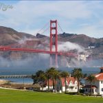
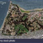
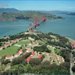
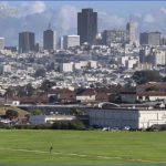
What’s Best: Overlooking the Pacific and San Francisco Bay, the entire Presidio is a National Historic Landmark of nearly 1,500 acres. You’ll find buildings of at least nine different architectural styles that reveal a diverse history dating from the late 1700s all set amid trees ranging from garden palms to forests of cypress, eucalyptus, and pine.
Parking: At Main Post. From the Golden Gate Bridge, pass through the far-right toll booth and turn right immediately past the bridge office building, on Merchant Rd. Then turn right immediately again, following the road under the bridge roadway to the parking lot on the east side. Keep right to stop sign at Lincoln Ave. Turn left on Lincoln, follow for about 1 ml. and veer right on Sheridan; cross Taylor Road and turn left on Montgomery you’ll now be in a large parking lot. From Highway 1 south, which is 19th Ave, continue to north side of Golden Gate Park and turn right on California St. Go about .75 ml. on California, just past 2nd Ave. and turn left on Arguello Blvd. Follow through the Arguello Gate to the Presidio, and then all the way down to Sheridan; jog left on Sheridan and then right on Montgomery St. Agency: Golden Gate National Recreation Area
Ecology Trail from Main Post to Inspiration Point (1.5 ml.); Bay Hike: Area Ridge Trail to: San Francisco National Cemetery (1.25 ml.), or Fort Winfield Scott Parade Ground (3 ml.); Mountain Lake Park to
Rob Hill via Juan Bautista de Anza Trail (3 ml.)
Prior to becoming part of the National Park Service’s GGNRA in 1994, the Presidio had been a military garrison for 220 years under the flags of three different nations. First, in 1776, Spanish troops constructed an adobe quadrangle that became the northernmost outpost of their empire, then called Alta (upper) California. In 1821, the Mexican flag flew here, when the newly independent republic annexed Alta California as part of its territory. In 1846, American forces landed during the war with Mexico, and, as a result of treaty in 1848, the Stars and Stripes were raised. The garrison was the staging area for U.S. troops bound for the Philippines in 1898, during the Spanish American War, and many of the brick barracks were built during that period. Today, since many of the buildings are no longer needed for military personnel, a whopping 6-million square feet of spread-out office space is being leased through private-public partnership to nonprofit groups and other park-friendly organizations, under the stewardship of the Presidio Trust. The Trust is charged with making sure the park is financially self-sufficient.
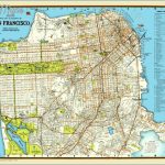
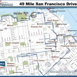
THE PRESIDIO MAP SAN FRANCISCO Photo Gallery
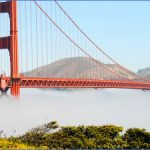
Ft. Point during construction of the Golden Gate Bridge. Photo collection of Golden Gate National Recreation Area, National Park
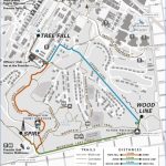
For the Ecology Trail from Main Post to Inspiration Point, walk directly away from the visitors center across the former Parade Ground, veering right across Pershing Square to Moraga Street. Go to Funston Street you’ll see the old Officers Quarters, built in 1862, in a line along Funston. From the corner of Moraga and Funston, join the Ecology Trail, which heads up, climbing over 200 feet, through eucalyptus and cypress forest to the recently renovated Inspiration Point. Near the top of the trail, stairs lead up to the point from the trail. From the point are views of the bay toward Crissy Field and Alcatraz. Note: The point is accessible by car at Arguello Gate.
For both Bay Area Ridge Trail hikes, begin at the Presidio Golf Course parking, just inside the Arguello Gate. Drive winding Arguello up from Moraga Avenue near the visitors center. The Ridge Trail was begun some 30 years ago as the brainchild of conservationist William Mott. Begin the hikes by heading north, entering a tunnel of towering cypress and eucalyptus trees. In about .5-mile you come out to Washington Boulevard just before you do, note a spur road to your left that gives you an option of scaling Presidio Hill. Then go left on Washington, following BART signs.
For the San Francisco National Cemetery, veer to the right on Nauman Road just past a crosswalk that takes the BART path to the other side. Pass a few 1940s-circa officers’ family homes and go right on a trail marked by upright pipes. This short spur trail leads to a view from the uppermost portion of the cemetery grounds. This glimpse is bound to cause a patriotic beat of the heart even among cynics, especially on holidays when flags are flying over the sea of headstones dating from the late 1800s.
To continue to the Fort Winfield Scott Parade Grounds, stay on Washington, following BART signs to Compton. Head up Compton, turning right on the dirt trail. You walk up through dense eucalyptus forest, passing a picnic area and popping back out to pavement at Harrison Street. Walk down Harrison and turn right on Hitchcock Street part of the San Juan de Bautista Trail. Then look for a left-jog of the trail, which leads via Greenough Avenue to the parade grounds. The grounds are surrounded by Fort Scott barracks, which date from 1910. Leave the parade ground at the south end, going uphill on Upton Avenue before going left on Kobbe Avenue. At the bottom, cross busy Park Boulevard to a short trail that leads up to the San Francisco National Cemetery. You’ll need to step over a two-foot high wall. Keep to your right, going steeply uphill through the cemetery. At its southern corner, go out a spur trail and then go left at the first street this takes you out to Washington Street, where you retrace your steps to the Arguello Gate.
Maybe You Like Them Too
- Arnold A Town with a Heart
- Map of New York City – New York City Guide And Statistics
- Map of San Francisco – San Francisco Map Free
- Coolest Countries in the World to Visit
- The 10 Best American National Parks to Visit

