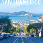
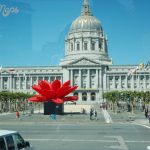
San Francisco skyline, Conservatory of Flowers, Golden Gate Park Market Street
In 1849, the Mother Lode was struck about 150 miles east in the Sierra Nevada foothills, followed 11 years later by the Comstock Lode just over the crest; combined, these strikes are by far the largest deposits of gold and silver ever dug out of the earth. The Mexicans were swept aside by a strong-arm treaty, as California became a state. By 1870, Yerba Buena was San Francisco, with a population of 150,000, with people coming literally as fast as humanly possible, the largest voluntary migration in history, over land on wagons and around the Horn on ships. By 1890, with railways firmly established, the population doubled to 300,000, at a time when Los Angeles residents numbered about 10,000. In 50 years, the city had gone from virtually zero to the nation’s eighth largest.
The precious metals made millionaires of many among them, engineer Adolph Sutro and the railroad’s Big Four of Charles Crocker, Leland Stanford, Mark Hopkins and Collis Huntington. Smitten as they were by fine scenery and a Mediterranean climate not to mention an infusion of money by the boatload the new millionaires and a host of civic leaders laid the groundwork that made San Francisco one of the world’s most desirable places a development only delayed by the horrific quake of 1906. Today, American travelers consistently rank San Francisco with Paris and Rome as top destinations.
All hike and walk distances are ROUND TRIP except as noted for shuttles.
Please contact Agency to obtain current rules and regulations. See Resource Links for all telephone numbers. See also special Doggie Trails and Trailblazer Kids sections.
Travel in San Francisco Photo Gallery
THE CITY
What’s Best: Three urban treks along the streets and waterfront of downtown San Francisco, taking in the landmarks and curiosities that make this one of the most beloved cities in the world.
Parking: Walks begin at the Ferry Building, located on The Embarcadero at Market Street. Ferries: Golden Gate Ferry from Larkspur or Sausalito; Blue & Gold Fleet from Tiburon, Vallejo, Alameda, Oakland; Red & White Fleet from Richmond. Note: In front of the Ferry Building between the deco Millennium Light Towers is a streetcar terminal. For cable car rides, head up Market two blocks to California Street. Agency: San Francisco Park Department
Walk: Downtown (2.5 ml.); North Beach (3 ml.); SoMa (South of Market) (3.5 ml.)
San Francisco known locally as The City ranks at the top, or near it, among surveyed travelers asked for their wish list of worldwide vacation destinations. The Downtown walk takes you through the heart of the financial district, into Chinatown, up to Nob Hill hotels and then down to the hubbub of Union Square, with its designer fashion stores. The North Beach walk goes along The Embarcadero waterfront, over historic Telegraph Hill, featuring bay views, down into bohemian North Beach, followed by a walk through Chinatown on the homestretch. The SoMa walk goes south on The Embarcadero to the Giants’ new ball park, then through the gritty-arty neighborhoods comparable to New York’s SoHo, and winds up at the Museum of Modern Art and Yerba Buena Gardens, featuring outdoor art, hip shops and restaurants.
The Ferry Building, which opened in 1898, is known for its 240-foot clock tower that survived the earthquake. Waiting for a departure has become a joy since the opening of the San Francisco Ferry Plaza with its gourmet food, gift shops and Bay Bridge views. For the Downtown walk cross The Embarcadero in front of the Ferry Building and veer right into Justin Herman Plaza. You’ll see cubist Vaillancourt Fountain to your right. To your left midway in the plaza, enter the Embarcadero Center, a three-level shopping complex that stretches from the plaza four blocks up to Battery Street. Maritime Plaza, a greenbelt, parallels the center to your right, connected by above-street walkways. Continue through Embarcadero Center and descend stairs, coming out at the corner of Battery and Sacramento streets. Head up Sacramento, passing the columns of the old Federal Reserve Bank, and then turn right on narrow Leidesdorff Street, which leads to the Transamerica Pyramid.
In the Transamerica plaza, you’ll find Redwood Park, a favorite among office workers taking respite among the large trees and fountain. In front of the Pyramid, go right on white-collar Montgomery Street and turn left on Washington. Here you’ll see a plaque marking the headquarters of the Pony Express, begun in 1861. Continue up Washington to Portsmouth Square, a gathering place for the city’s thriving Chinese neighborhoods and the site where John Montgomery planted the flag and claimed the area as part of the United States in 1846. Meander to your left through the square, and cross
Kearny Street, and head up Clay. After a block you reach Grant Avenue, the heart of Chinatown. Turn left, or south, on Grant. Wander around on side streets to get the full multi-sensory impact. Near the south end of Chinatown, at Grant Avenue and California, is Old Saint Mary’s, the first cathedral built in California, in 1853.
Maybe You Like Them Too
- Arnold A Town with a Heart
- Map of New York City – New York City Guide And Statistics
- Map of San Francisco – San Francisco Map Free
- Coolest Countries in the World to Visit
- The 10 Best American National Parks to Visit

